ABOUT THE PARK:Appalachian Trail Pennsylvania - The Appalachian Trail Conservancy
DIRECTIONS:GPS Coordinates 40.86067, -75.29255
 |
| Wind Gap Parking |
HIKE DISTANCE: 14.3 miles
THE HIKE:
 |
| The Appalachian Trail comes in from the south through the parking lot and continues up steps from about the mid point of the parking lot. |
 |
| The trail ascends steeply at time but once at the top, other than minor ups and downs, that is the bulk of the ascent. |
 |
| There were some partial views along the way but it was hazy early in the morning so we'd check back at the end of the hike on our way down. |
 |
| The trail levels out at the top and then follows the ridge. |
 |
| The trail surface alternates between semi-rocky ... |
 |
| ... very rocky ... |
 |
| ... and smooth but it is mostly rocky. |
 |
| Crossing the private Blue Mountain Water Company road. According to my ancient 1998 Appalachian Trail Guide, there should be a view here but there is not. We went a few steps in either direction and the best I could find was ... |
 |
| ... a short distance to the left. |
 |
| When I hiked Wolf Rocks from the opposite direction back in 2012 this bypass trail did not exist so I was not aware it was there. I decided to go on to Wolf Rocks then loop back around on the bypass trail. |
 |
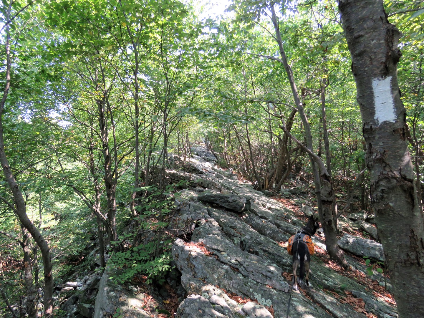
| The rocks start getting bigger and soon it's all boulders. |
 |
| Hiking along Wolf Rocks. |
 |
| I had not seen any of the spotted lanternflies in the woods but on my, were they enjoying the Wolf Rocks views. They were everywhere on the cliffs. |
 |
| After a scramble down from Wolf Rocks, continuing north on the AT, it's a short distance to the other end of the bypass trail where we turned left. |
 |
| This was the most pleasant, smooth and easy going part of the hike. It was a welcome change after all of those rocks. |
 |
| The bypass trail starts to become a bit more rocky right before joining back up with the AT. |
 |
| At the AT we turned right to head back... |
 |
| ... over all those rocks. |
 |
| Picking up some litter along the way. |
 |
| At the water company road Brodie wanted to turn right. I think he had about had it with all the rocks, too. That would have been a nice, smooth descent back to the parking lot but unfortunately it is not allowed as it goes into posted water company property. |
 |
| Some better partial views on the descent. |
 |
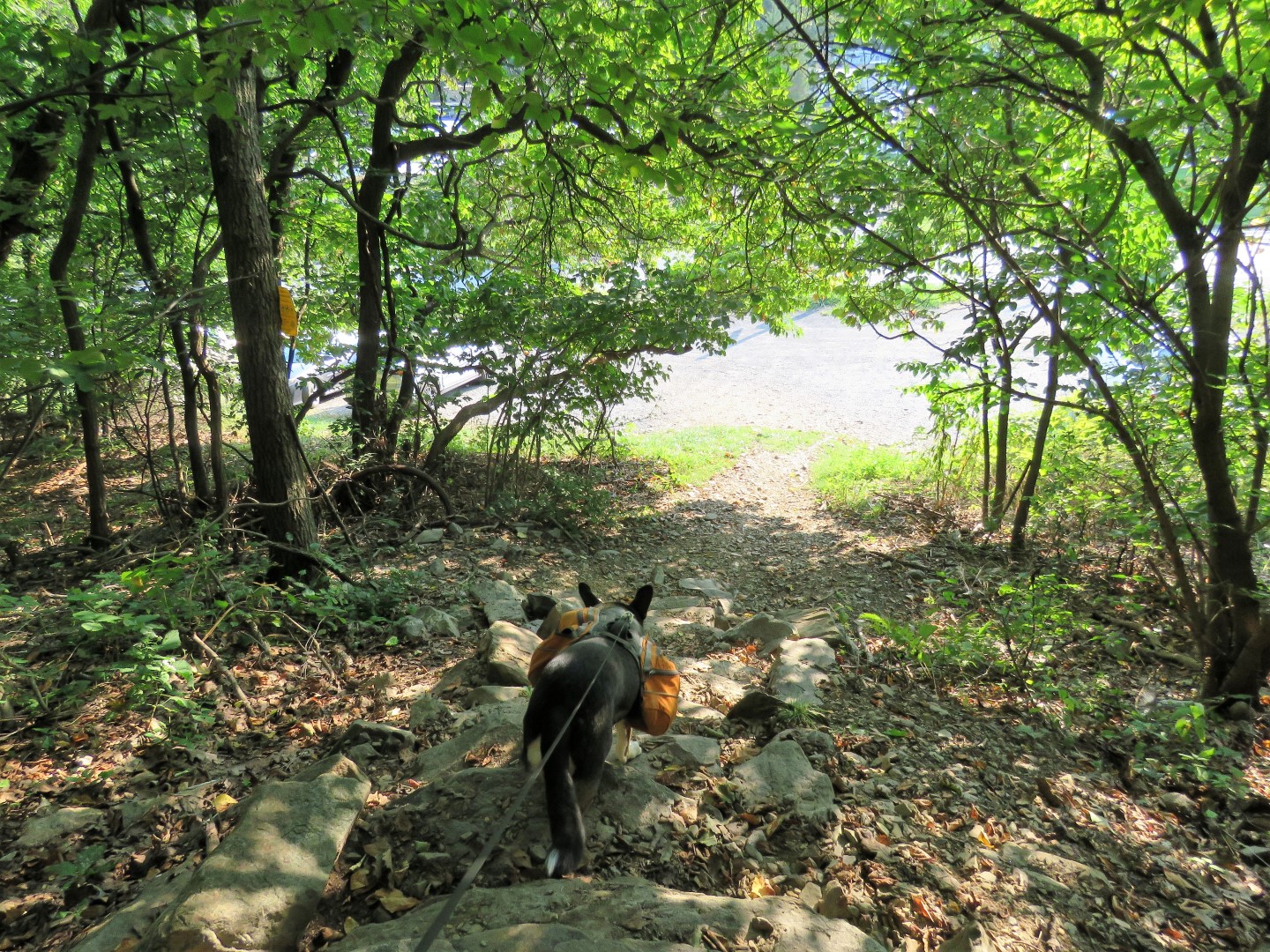
| Coming back out at the parking lot. |


Hi Daniela -- Been a while since I commented; although, I've been following your adventure *religiously* over the past few months (since you hiked in "my" area in South Jersey.) Absolutely _gorgeous_ pix, as always! Looks like you can *never* go wrong on the AT, especially when you get the "views" from high atop a mountain! While the sections of the trail include the "rocky" hikes, bring 'em on! Hopefully you'll do some more of the AT in the weeks to come, what with all the soon-to-be vivid Fall (leaf) colors! Brodie is a REAL trooper too! I will _have_ to make an effort to get my dog (Penny) on some good Fall hikes in the coming weeks as well...I already mapped out a good hike in Bass River State Forest earlier this year...I think she will love the Fall colors, along with the beaches along Lake Absegami!
ReplyDeleteAs always, I cannot wait to see your next adventure...again, with Fall approaching. Happy Hiking!!
Jim
Well stay tuned! Heading to the Adirondacks for the first time. Where I am going the current foliage report says "Color change is underway with vigor and intensity, with as much as 35-40% leaf transition featuring fantastic hues of rhubarb, cerise, maize, saffron, russet, and tangerine." The mountain forecast says the highs will be in the 40's, in the 30's early in the morning. BRRRRRR. Dusting off the fall hiking wardrobe.
Delete