ABOUT THE PARK:
Wye Island NRMA - Maryland Department of Natural Resources
DIRECTIONS:
GPS Coordinates 38.88824, -76.14426
 |
| Large parking lot on Lodge Lane. |
TRAIL MAP:
Wye Island Trail Map - Maryland Department of Natural Resources
Wye Island Trail Guide
HIKE DISTANCE: 13.2 miles
THE HIKE:
 |
| From the parking lot, walk back out to pick up the yellow trail just the other side of those trees on the right. |
 |
| The Yellow Trail |
 |
| Granary Creek |
 |
| Crossing Wye Island Road to continue with yellow on the other side. |
 |
| A massive blow down completely across the trail. |
 |
| We had to bushwhack through thorny stuff to get up on the trunk. |
 |
| I then had to convince Brody to walk along the truck to avoid stepping on more thorns. |
 |
| He did it! |
 |
| A successful blow down navigation. |
 |
| Coming out on Wye Island Road at the end of yellow. |
 |
| At this point the pavement stops and Wye Island Road becomes a multi-use road. |
 |
| When the road turns left, the green trail starts straight ahead. |
 |
| Entering the green trail. |
 |
| To the left a waterfowl blind. |
 |
| But nobody is home, at least not at this end. |
 |
| Continuing on I could see something in the water to the left at the far end ... |
 |
| ... but I couldn't get very close before ... |
 |
| ... everyone took off. |
 |
| When green meets up with blue, an unmarked trail to the right ... |
 |
| ... follows a series of bridges and boardwalks ... |
 |
| ... to Grapevine Cove. |
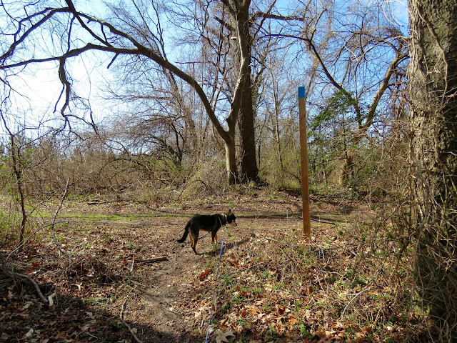 |
| Coming back off of that unmarked trail, things get kind of confusing. Trails are well-marked with posts but the problem is the posts are at intersections and don't indicate which way to go so we went out and back in a couple of different directions until I got us going in the right direction. |
 |
| Fast forward to the Holly Tree Trail, a continuation of the green trail. |
 |
| And here we are at the 275+ year old holly tree. |
 |
| Snacks under the holly tree. |
 |
| Spring is arriving in Maryland. |
 |
| House shopping for spring nesting? |
 |
| The end of the green at Wye Island Road. |
 |
| It's a short walk on the road to the orange Osage Trail on the right. |
 |
| I believe these are Tundra Swans (they had straight necks unlike the mute swans we normally see) perhaps passing through on their migration to summer breeding grounds in the arctic. |
 |
| Bigwood Cove |
 |
| Coming up on a picnic table ... |
 |
| ... at a Wye River overlook. |
 |
| I have been able to manage Brodie's car sickness by only giving him a few tablespoons of wet food before we leave in the morning to get a little something in his stomach. On a full day trip like this one, he needs to have lunch. It's not his normal diet but it's packable and works well for hikes. |
 |
| Wye River |
 |
| Heading back through a hedgerow of gnarly old trees. |
 |
| The orange trail ends at Wye Island Road where we turn right ... |
 |
| ... and continue on for about 3/4 of a mile. |
 |
| It's not a bad walk unless a car goes by too fast and leaves you inhaling a cloud of dust. Ugh. Fortunately there weren't many cars and others drove by more slowly. |
 |
| Hanging a right on the red West Corner Trail. The red trail is actually three trails in one. This is the first. |
 |
| An overlook at Wye River. |
 |
| I have never been so happy to see dandelions! Could this winter actually be coming to an end? |
 |
| The West Corner Trail comes out on the road to the Ferry Point Trail parking lot. |
 |
| Second of the three red trails. |
 |
| Right on the Jack-in-the-Pulpit Trail, the third of the red trails. |
 |
| Another Wye River overlook. |
 |
| Things are really turning green over on this part of the island. |
 |
| Back on the Ferry Point Trail a right to ... |
 |
| ... a picnic table on the Wye River. |
 |
| Lots of ducks in the Wye River. |
 |
| Returning on the Ferry Point Trail. |
 |
| To the left is the West Corner Trail where we came out but I decided to stay with the road walk since that trail had been pretty wet in spots. |
 |
| Those swans that we saw before? |
 |
| At the end, another parking lot and private property to the right. |
 |
| We turn left. |
 |
| A turkey vulture earlier and now a black vulture. |
 |
| This was a bald eagle that flew right over us but I couldn't hone in on him fast enough for a better picture. |
 |
| Just beyond where we came off of the orange Osage Trail on the left ... |
 |
| ... no sign but a white post where we turned on to the white Dividing Creek Trail. |
 |
| Coming up on some activity in the water ... (a Great Blue Heron was flying off to the right somewhere in the distance) |
 |
| ... but most of them promptly took off before we could get too close. |
 |
| A handful held out a bit longer before joining the others in the sky. |
 |
| Coming up on Dividing Creek. |
 |
| I was thinking there would be no balloons on this hike when I found this little scrap of one. Couldn't quite count that but I packed it out anyway. |
 |
| The Dividing Creek Trail did not actually have any views of Dividing Creek so we bushwhacked over to get a look. |
 |
| Then on this very last stretch right before the parking lot straight ahead ... |
 |
| Over to the right, yes indeed, a balloon! In a mess of thorns. Since it was so close I put Brodie in the car then went to extract it without getting sliced up on thorns. Success! The ribbon did not fare so well. I got it all but it was shredded to pieces from the thorns. |
 |
| Dog tired after 13.2 miles of hiking. |
 |
| Balloon #28 of the year. |


