

Cook Forest State Park - Pennsylvania DCNR
DIRECTIONS:
GPS Coordinates 41.346304, -79.218453
 |
| Longfellow Trailhead Parking |
TRAIL MAP:
Cook Forest State Park Map - Pennsylvania DCNR
Cook Forest - Clear Creek Map - Purple Lizard Maps
HIKE DISTANCE: 9.6 miles
THE HIKE:
Travel Day 1 hike on my semi-annual trip from New Jersey to Missouri.
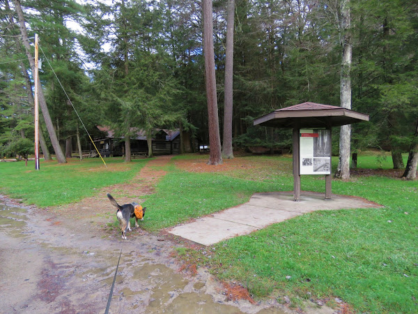 |
| From the parking lot, heading towards the Log Cabin Environmental Learning Center ... |
 |
| ... where the Longfellow Trail begins. |
 |
| Memorial Fountain |
 |
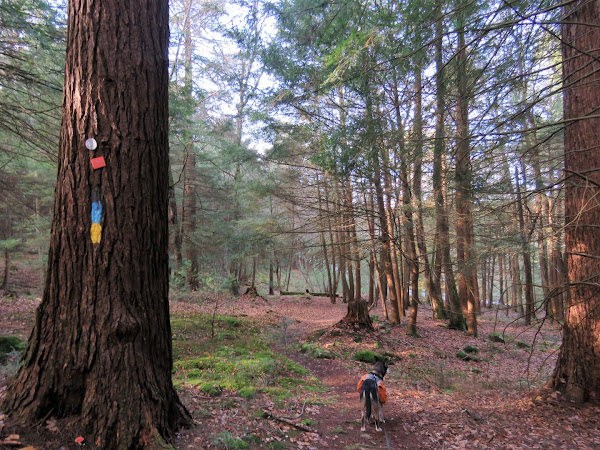
| All of the trails are blazed yellow. Yellow and blue means the North Country Trail follows the same path. |
 |
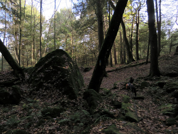
| Forest Cathedral Natural Area |


 |
| Ancient Forest Trail |

 |
| It looked like most of the ancient trees were no more. |


 |
| The Purple Lizard map denotes points of interest with a lizard so we headed left on the Joyce Kilmer Trail a short distance to check this one out. |


 |
| It's an American chestnut snag. |


 |
| Coming off of the Indian Trail at the cabins ... |

 |
| ... and continuing past the park office. |
 |
| A left on Route 36 a short distance then crossing over just before the guardrail ... |
 |
| ... to the Seneca Trail. |
 |
| Where we had just been in the Forest Cathedral is the most popular area of the park but this side of Route 36 tuned out to be my favorite part. |
 |
| The Clarion River on the left. |


 |
| Heading towards ... |
 |
| Seneca Point |
 |
| Next to the fire tower. |

 |
| I am deathly afraid of heights and have only made it up three flights of steps on a fire tower before then had to scoot down on my rear. But this one seemed more doable for me because the sides had fencing from the handrail down to the step treads. Just that little bit made it mentally "safer". Yes, I know it is all in my head. Brodie was tethered and I gave it a shot. |
 |
| I was hanging on for dear life and white knuckling all the way up. |
 |
| I kept going higher and higher, well past 3 flights. |
 |
| I didn't realize how close to the top I was but at above tree level I figured I had better not push my luck. |

 |
| Heading back down. |
 |
| Turns out I was only two flights from the top but the box at the top isn't open anyway. Just as I was untethering Brodie other people came and went up. Thank goodness I had made it down first because others flying by me on the steps would have been really bad. |
 |
| On to the River Trail. |

 |
| This little guy had better get to hibernating. It was in the 40's. |

 |
| At the bottom, the River Trail follows along the Clarion River. |

 |
| The River Trail turns left uphill but we would be going that way later. First straight for a while to another point of interest. |
 |
| The river views were better along this section. |
 |
| Except for these gas lines but they were confined to a small area. |

 |
| Henry Run Sawmill Dam - our turn around point. |

 |
| Now taking the River Trail up. The topography on the map makes it look very steep but ... |
 |
| ... it's a wide woods road all the way up and only gets as steep as woods roads get. |
 |
| At the top, a jog on the Fire Tower Road ... |
 |
| ... to continue on the River Trail. |
 |
| Here there are orange markers on the trees. |


 |
| Working our way along the Tom's Run Trail on the final stretch, the trail crosses Tom's Run on bridges a few times. |

 |
| Uh oh. This was not expected and we were so close to finishing. |
 |
| On our way to retrace and find another way, I came across what appeared to be an old trail and tried that. |
 |
| Someone on the left was not expecting to see us here. |

 |
| It was indeed an old trail that still had a little footbridge. |
 |
| It led us right back to the Longfellow Trail where the entrance was blocked off by logs. Seems they should have reinstated the defunct trail with the bridge closure. |
 |
| Retracing from the beginning of the hike. |

 |
| It was around 5 PM and were were the only ones left. |
 |
| On to the motel in Youngstown, OH for some R&R. |