ABOUT THE PARKS:
Poetry Trail in Greenway Meadows - World Literature Today
Greenway Meadows Poetry Trail - Beautiful Walkable Princeton
Johnson Woodland Preserve - Open Green Map
Stony Brook Trail - Beautiful Walkable Princeton
Johnson Education Center - D&R Greenway Land Trust
DIRECTIONS:
GPS Coordinates 40.34528, -74.68190
 |
| Greenway Meadows Parking (parking lot farthest west on the map) |
TRAIL MAP:
Greenway Meadows/Stony Brook - New Jersey Trails Association
HIKE DISTANCE: 5.9 miles
THE HIKE:
 |
| From the parking lot, a paved path with the mowed path of the Scott and Hella McVay Poetry Trail a few steps ahead on the right. |
 |
| There are poems all along this trail. I'm sure it is just me but I don't get poetry and never have so none of it made any sense to me. |
 |
| This mockingbird sat perfectly still on the top of a bush surveying the meadows. |
 |
| And wondering why I kept taking his picture. Well, it's not often a bird sits still for that long. |
 |
| At a T-intersection of mowed paths, a right turn leads to the Johnson Education Center. |
 |
| I cut through and veered left which turned out to be wrong. I should have veered right. |
 |
| So I crossed Rosendale Road, turned right and walked a short distance on the paved path to... |
 |
| ... this drive which is where I should have come out because the trail into Johnson Woodland Preserve is... |
 |
| ... directly across Rosendale Road from that drive. |
 |
| The yellow trail into Johnson Woodland Preserve. |
 |
| At the intersection we turned right on red. |
 |
| Although the woods appear to be choked by invasives, the path is mowed clear. |
 |
| Uh oh. Not wheelchair friendly at all. |
 |
| Fortunately there was a way around across the grassy area then down a service road then left on ... |
 |
| ... the paved Trolley Line. |
 |
| When the paved trail veers left towards Johnson Park School, the footpath continues straight. |
 |
| These steps were doable. |
 |
| Uh oh. This was a pretty big blow down and it was HEAVY but Shawnee waited patiently... |
 |
| ... while I did some trail maintenance and managed to clear the way. |
 |
| After this bridge and a few stone steps up ... |
 |
| Stony Brook |
 |
| Looking back the way we came at an old bridge I had passed earlier, |
 |
| I did not know it at the time because it's impossible to see coming in this direction, the trail actually continues beyond the picnic table and downed tree. I thought I was crossing Rosendale Road to the left but turns out it was actually the entrance road to Johnson Woods School. |
 |
| The fact that it was still marked red should have clued me in but it wasn't until I ran into the yellow trail we had come in on that I realized I missed the unmarked trail that should have continued along Stony Brook. |
 |
| Backtracked and found the trail on the other side of that picnic table. |
 |
| Then right before Rosendale Road the trail fizzled out and all I could see was a steep climb up to the road no matter which way we went. |
 |
| Managed to drag the wheelchair up the embankment, turned right on Rosendale then crossed over following the left arrow to... |
 |
| The paved path that runs parallel to the path we should have been on that I still could not see. |
 |
| A short distance ahead where a paved path leaves left to a parking lot, turn right before the post up ahead on the right ... |
 |
| ... with the map holder that had no maps, and a footpath leads right to ... |
 |
| ... the Stony Brook Trail. |
 |
| We started running into some rugged terrain where the wheelchair tipped over twice. |
 |
| We managed to get up these steps but it was not easy. |
 |
| Sometimes I had to take her out of the wheelchair and move her along then go back and get the wheelchair. |
 |
| Completely not doable but there was no water in the creek and we were able to go around this bridge and the next one. |
 |
| Then the trail smoothed out but I had already been thinking of alternatives to retracing along this trail. Don't get me wrong, the trail is perfectly fine as long as you are not a dog in a wheelchair. |
 |
| Coming up on a nice long bridge over Stony Brook. |
 |
| Ducks in Stony Brook. |
 |
| The trail straight ahead goes to Hun School, more on that later, but for now right across the bridge. |
 |
| Crossing another shorter bridge. |
 |
| This trail follows along a golf course all the way to ... |
 |
| ... Route 206 just up ahead. The plan was to possibly turn left on Route 206 and walk to the residential streets which would lead back to Greenway Meadows. |
 |
| Obviously that was not going to happen with no place to walk along Route 206 |
 |
| Heading back. |
 |
| After crossing over the long bridge, we turned right towards Hun School in hopes I could get over to the residential street that way. |
 |
| I did not see any signs saying I could not go this way or that dogs were not allowed so I hoped for the best and forged on. |
 |
| The red-tailed hawk did not seem to mind. |
 |
| The trail comes out on to school athletic fields where I followed the path left ... |
 |
| ... then right behind bleachers when it became paved. |
 |
| I was horrified to see all of the steps at the end but oh yes, a handicapped ramp! |
 |
| That got us up to the parking lot then out to the residential streets where we took Edgerstoune Road all the way to the end where ... |
 |
| ... it turns into the paved path back to Greenway Meadows. |
 |
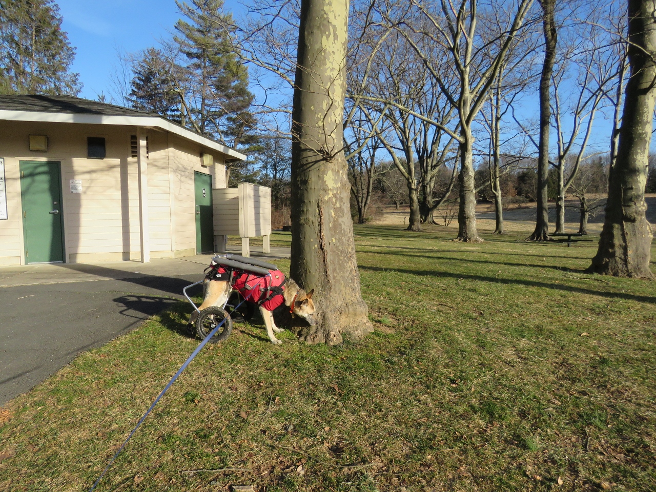
| Coming up on Johnson Education Center. |
 |
| The indoor restrooms were closed but according to Shawnee the outdoor dog restroom was open. |
 |
| Keeping right on the paved path then right to complete the poetry trail loop. |
 |
| The trail goes uphill to views over the meadows. |
 |
| Same mockingbird, different bush? It was the same general area where I saw the one at the beginning of the hike and this one also was sitting perfectly still perched on top of the bush. |
 |
| Finishing the poetry loop back to the parking lot. |