ABOUT THE PARK:Ricketts Glen State Park - Pennsylvania Department of Conservation and Natural Resources
DIRECTIONS:GPS coordinates 41.30035, -76.27089
 |
| Glens Lot Trailhead Parking |
HIKE DISTANCE: 10.4 miles
THE HIKE:
Having hiked here just two weeks before on my way to Missouri, it reminded me that I had always wanted to hike the Old Bulldozer Road Trail and that Ricketts Glen State Park was the same distance away as the Catskills, so back I went on a peak foliage day. The main attraction is the Falls Trail and as expected, that was packed with people. I had to use that for the last 3 miles of the hike. But for the first 7.4 miles I ran into one local man early on who hikes the Old Bulldozer Road Trail often and saw a couple in the distance heading coming off of a trail I was going to be turning on. That was it. So beautiful and peaceful with nobody else around.
 |
| About the midway point of the parking lot is an access for the Old Bulldozer Road Trail. |
 |
| It climbs steadily. |
 |
| Blazed red denoting a multi-use trail, not a trail color. |
 |
| Arriving at the steepest part. |
 |
| It's steeper than it looks but it's all woods road, no scrambles. Just the kind of sustained steep that makes your heart pound in your ears. |
 |
| At the top! Elevation gain of 856 ft. in 1.2 miles. There would be more ups and downs throughout the hike but this was the toughest part, |
 |
| It was acutally 1.3 miles form Route 118. |
 |
| Taking a side trail to an overlook. |
 |
| Yellow blazes meaning foot traffic only. |
 |
| Valley View |
 |
| The yellow blazes continue on so I followed them only to find they abruptly stop at the park boundary at a private property sign. |
 |
| Heading back. |
 |
| Coming off of the side trail, turning right to continue on the Old Bulldozer Road Trail. |
 |
| Caterpillar of the hickory tussock moth. |
 |
| Looking back on the way we had come in on the Old Bulldozer Road Trail to see the signs, now making a sharp right on the Mountain Springs Trail. |
 |
| Left on the Little Cherry Run Trail. |
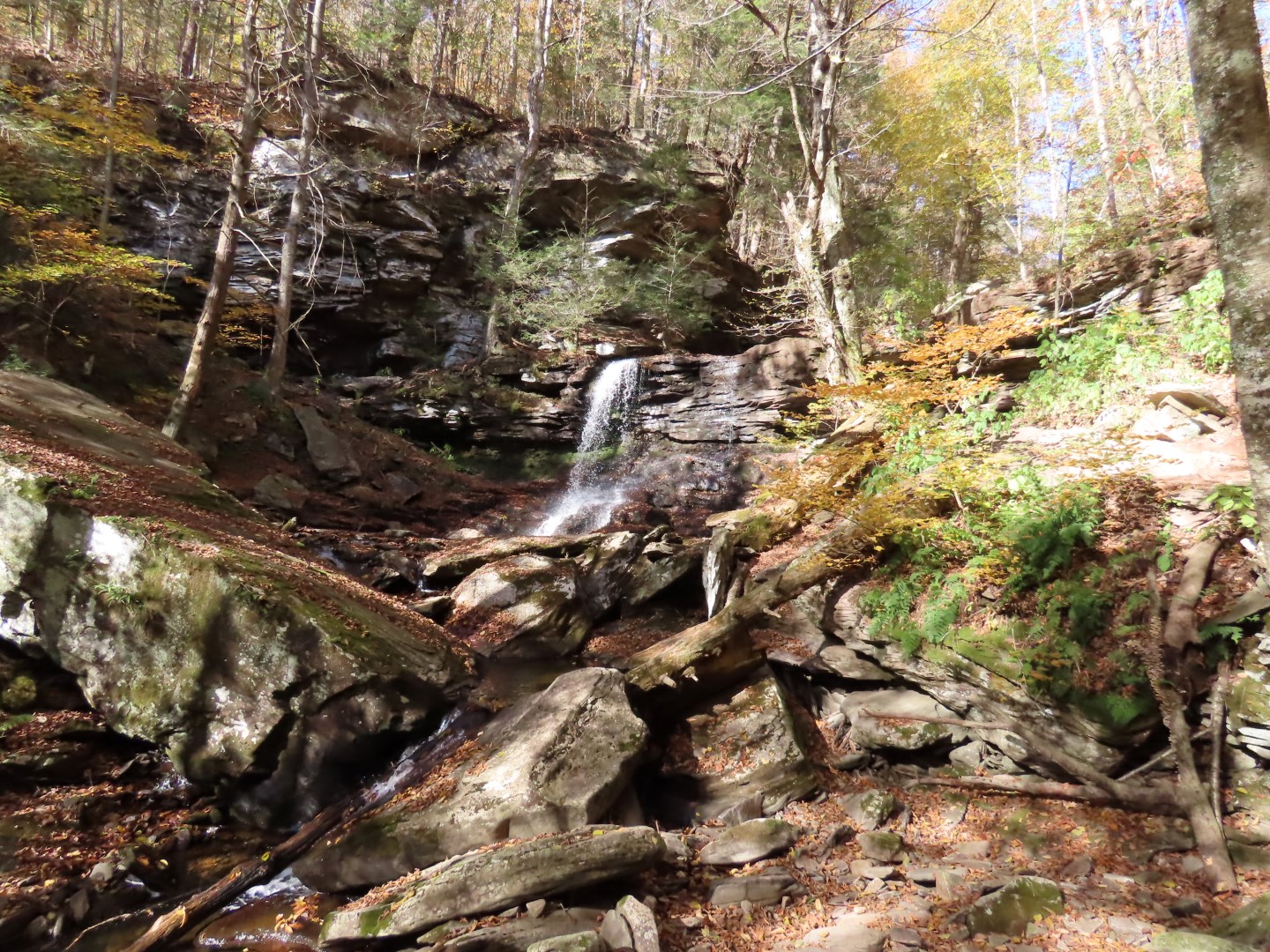
 |
| The Little Cherry Run Trail is beautiful with rock formations on the left and waterfalls and cascades on the right. |
 |
| The trail becomes a well-marked footpath through the woods. |
 |
| Left on the Cherry Run Trail in the direction of the park office. |
 |
| At the Lake Leigh dam is where peace and tranquility ended and the crowds began. |
 |
| Taking the Falls Trail all the way back to the parking lot on Route 118. |
 |
| Passing by the bench were we took a family photo two weeks before. |
 |
| Two weeks ago we had come up this part of the trail. Now we were going down and oh my, was it crazy steep going down on wet steps. I was being extra cautious after the 13 stitches incident a month ago. |
 |
| We took the lower trail which was far less difficult than what we had hiked on the Falls Trail this far. With all of the non-hiker tourists around, yes, it would have been difficult for them and I could hear them all on the upper trail. But for hikers, the lower trail would be considered moderate. |
 |
| Merging back with the upper trail, it's all smooth and flat the rest of the way. |