ABOUT THE PARK:
American Legion and Peoples State Forests - Connecticut DEEP
DIRECTIONS:
GPS Coordinates 41.942530, -73007598
 |
| Parking across from trail head along East River Road. |
TRAIL MAP:
American Legion and Peoples State Forests Trail Map - Connecticut DEEP
HIKE DISTANCE: 7 miles
Hiked together with:
American Legion State Forest - Henry Buck Trail - 2 miles
American Legion State Forest - Turkey Vulture Ledges Trail - .8 miles
THE HIKE:
I was hesitant to start on the Falls Cut Off Trail because I had read things like: Hardest trail in Connecticut, not for those afraid of heights, 90% grade... Other than my fear of heights I was worried about getting Brodie up rock scrambles. He is not a fan and keeps wanting to go back down. But thought I would give it a try and I am glad I did. Despite what I read, it is not that bad. I only had to help Brodie up once.
 |
| Eastern Phoebe at the Farmington River |
 |
| Crossing East River Road to the trail head. |
 |
| The sign pertains to the trail we would be returning on. |
 |
| Just a short distance in, left on the blue/red Falls Cut Off Trail. |
 |
| It starts off smooth enough ... |
 |
| ... then suddenly becomes rocky. |
 |
| Going up. |
 |
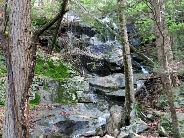
| There are a lot of steps built in with rock slabs. The trail goes up right next to the falls, sometimes the falls are flowing down the trail. |
 |
| Looking back down the trail. |
 |
| Crossing the falls. |
 |
| Nearing the top of the falls. |
 |
| At the top, we turned left on the blue/yellow Jessie Gerard Trail. |
 |
| Black and White Warbler |
 |
| Still a little bit of climbing ... |
 |
| ... to an overlook to the south. |
 |
| Farmington River down below. |
 |
| Across the Farmington River I can see the old bridge abutments where the Henry Buck Trail is that we would be hiking later. |
 |
| Continuing on through gorgeous forests. |
 |
| Coming up on another ... |
 |
| ... overlook to the north. |
 |
| At the Jessie Gerard Trail sign, right on the park road a short distance to ... |
 |
| ... left on the Charles Pack Trail which is also blue/yellow. |
 |
| At the stop sign at the park road I did not see any turn blazes but it is a left turn over the bridge then a right just the other side of the bridge. |
 |
| Looking back at the bridge we just crossed over. |
 |
| Just before this bridge over Beaver Brook, right at the post to ... |
 |
| ... the green Pond Trail. |
 |
| It's a short distance to a nice overlook at the pond. |
 |
| Heading back and crossing the bridge. |
 |
| At this post, a left on the blue/orange Agnes Bowen Trail. |
 |
| Right on the blue Robert Ross Trail. |
 |
| Back at the Jessie Gerard Trail, left to switchback down steeply. |
 |
| Almost at the bottom, the Lighthouse Village Cemetery. |
 |
| Unmarked field stones that designate graves. |
 |
| Back at the parking lot for lunch and a break before heading across the Farmington River to the American Legion State Forest. |
 |
| But before leaving, a short path from the parking area down to Farmington River. |


