

ABOUT THE PARKS:
Wharton Canal Walk - Canal Society of New Jersey
Irondale Mountain Trails - Borough of Wharton
DIRECTIONS:
GPS Coordinates 40.90218, -74.58820
 |
| HUGE parking lot - I parked right at the entrance since I would be finishing from the left. Parking goes as far as you can see down this picture except for the cars ahead - that is a house. Yes, a house smack in the middle of the parking lot. |
TRAIL MAPS:
Wharton Canal Walk - Canal Society of New Jersey
Irondale Mountain Trails - Borough of Wharton
HIKE DISTANCE: 4 miles
Hiked together with Hedden County Park, an 8 minute drive away.
THE HIKE:


 |
| The Morris Canal on the left, Rockaway River on the right. |


 |
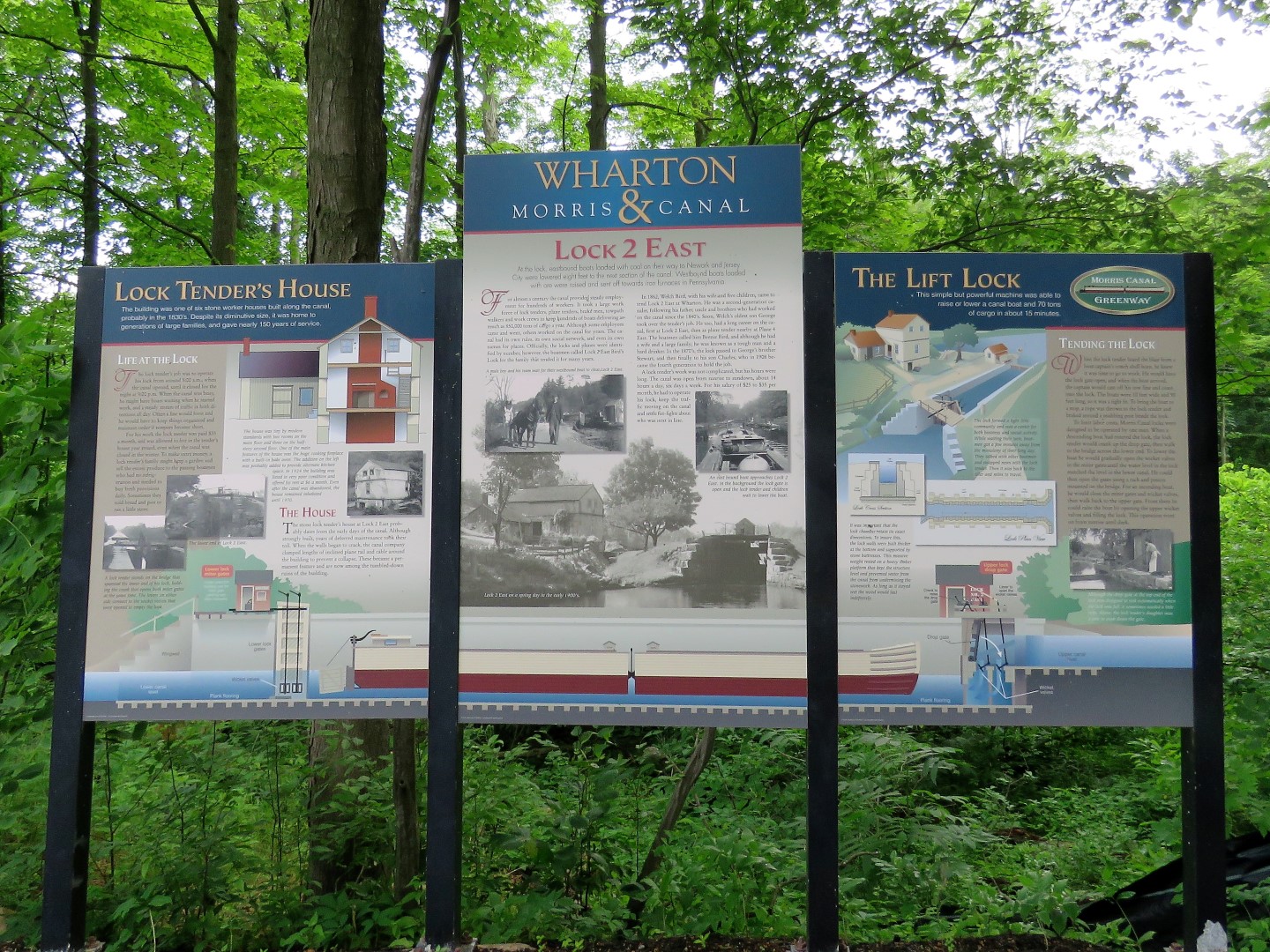
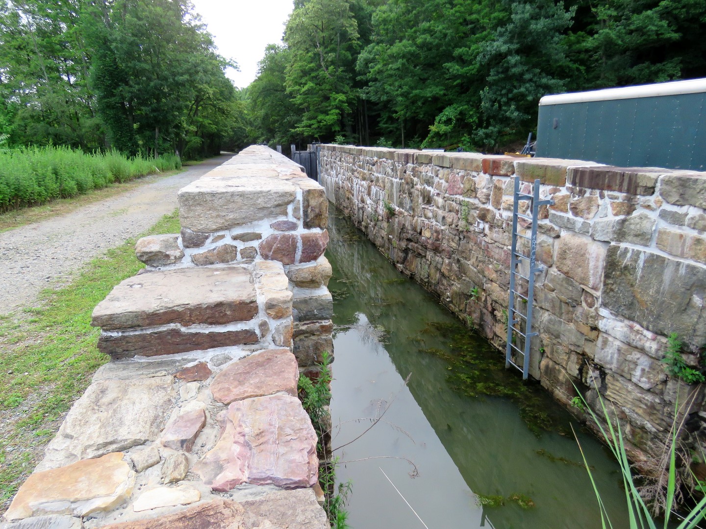
| Coming up on Lock 2. |

 |
| There was construction going on at Lock 2 and the trail that would connect to the upper level was not accessible as it was all fenced off. We were going to return to that point to get to the upper level but I thought there might be another way so on we went. |


 |
| Wetlands along the trail. |
 |
| At the end this goes uphill and you can either go left or right. We went right first. |

 |
| Looking back at the way we came. |

 |
| W followed this as far as we could and it eventually fizzled out into overgrowth. |
 |
| So we headed back. |
 |
| Lovely views of a junkyard along the way. |
 |
| We had come up from the left, now keeping straight to see if we could loop around to the upper level. |

 |
| OK, so does this no trespassing sign mean do not enter at all or stay left and do not leave the path? I decided to proceed based on the latter but not at all sure if that was OK. |
 |
| The trail continues ... |
 |
| ... then comes out at a sign not too far along. |
 |
| Turning around to read the sign. Well, again, does this mean just don't leave the trail? |
 |
| Going back through the power cut that we had crossed below earlier. |
 |
| Lock 2 at the edge of the power cut. |
 |
| From up here it looks like the lock tender's house is being rebuilt. |
 |
| This would be the path coming up from Lock 2 which is currently not accessible. |
 |
| Now on the upper level which is the former route of the Central Railroad of New Jersey - High Bridge Branch. |
 |
| There are still old railroad ties around. |
 |
| The three geese we had passed earlier down in the canal. |
 |
| The kiosk where the Irondale Mountain Trails are accessed. |

 |
| We kept to the right looping around and capturing all of the trails. |


 |
| There were multiple mine pits along this trail which turned out to be test pits according to the sign farther along. |


 |
| The Ridge Trail goes left here but we turned right ... |
 |
| ... towards the power cut for a look. |

 |
| There is a pretty nice power cut view up here. |
 |
| We went through the power cut for a bit ... |
 |
| ... then headed back. |

 |
| The yellow Ridge Trail forks and right goes a short distance to this overlook. More like a seasonal overlook, nothing to see with leaves on the trees. |
 |
| Right on the blue-blazed Lower Mine Trail ... |
 |
| ... is an actual mine. |


 |
| This trail comes out at the Birch Street parking lot. |

 |
| Heading back on blue. |


 |
| We both had a freak out moment when he got stuck in my hair. |
 |
| Meeting back up with where we had started on red. |
 |
| Right on the rail bed ... |
 |
| ... back to where we parked. |