ABOUT THE PARK:
Beartown State Forest - Mass.gov
Daily parking fees Memorial Day to Labor Day:
MA resident $8
Non-MA resident $15
DIRECTIONS:
GPS Coordinates 42.202799, -73.288781
 |
| Beartown State Forest Parking Lot |
TRAIL MAP:
Beartown State Forest Trail Map - Mass.gov
HIKE DISTANCE: 13.6 miles
THE HIKE:
 |
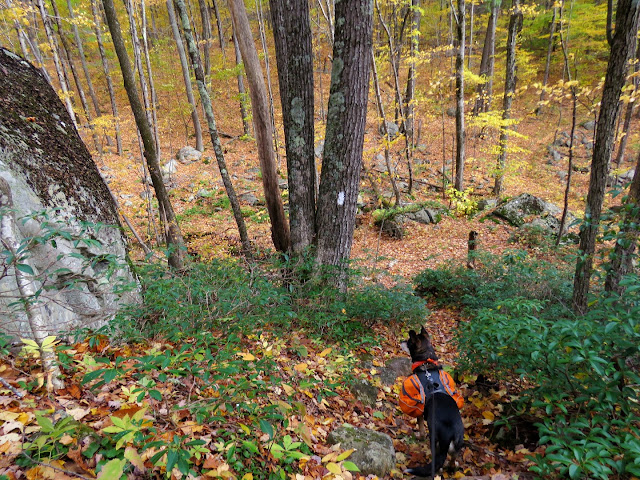
| Facing Benedict Pond from the parking lot, the Pond Loop Trail starts to the right at the kiosk. Blue blazes indicate hiker/bridle/mountain bike trail although I saw no horses (or evidence thereof) or mountain bikes on this hike. |
 |
| Even though 50-60 mph winds had knocked a lot of the foliage down a few days prior, there was still fantastic color all around. |
 |
| Benedict Pond from the Pond Loop Trail. |
 |
| Benedict Pond |
 |
| Turning north on the Appalachian Trail ... |
 |
| ... which follows along with the Pond Loop Trail for a bit. |
 |
| Benedict Pond from the far end. |
 |
| After this bridge ... |
 |
| ... the Pond Loop Trail continues straight while the Appalachian Trail leaves right to ... |
 |
| ... The Ledges. |
 |
| It's a rocky climb up but never any scrambles. |
 |
| Views from The Ledges |
 |
| Continuing on the AT, we ran into no other hikers the rest of the hike. The two couples we encountered were hiking to The Ledges and back. |
 |
| Wilcox South Shelter |
 |
| Crossing the outlet of ... |
 |
| a pond on the left. |
 |
| At Beartown Mountain Road, the AT turns right, we turned left. |
 |
| Beartown Mountain Road |
 |
| This is the Sky Peak Trail to the right, there are no signs to the left but left is where we needed to go. |
 |
| Sky Peak Trail |
 |
| We turned right following this trail to the Airplane Trail. Unfortunately, trails blazed with orange triangles are open to ATVs and dirt bikes. Fortunately, we did not encounter any in this area but these multi-use trails are needed to connect back to non-motorized use trails. |
 |
| On the Airplane Trail. |
 |
| Left on the Turkey Trail. |
 |
| Right on Mt. Wilcox Trail but there is no sign with the name, just the post on the right what indicates it is a ski/bridle trail. |
 |
| It was about at this point where the map indicates a cemetery on the left (which I could not find) that it started to rain so I broke out the rain gear and not a minute too soon. Although the forecast said it wasn't supposed to rain until after 4 PM, it was 2PM and we had three hours of hiking in the rain ahead of us. For as much as Brodie refuses to go outside in the rain, he didn't complain. |
 |
| A left on Benedict Pond Road heading towards the Beartown Mountain Trail. |
 |
| Benedict Pond Road |
 |
| Right on Beartown Mountain Trail. |
 |
| At the Wildcat Trail, a multi-use trail, Brodie heard something coming from the left. |
 |
| The only dirt bike we saw all day. We needed to turn right briefly on the Wildcat Trail to continue on the Bear Mountain Trail leaving to the left but not after inhaling a couple lungfuls of exhaust. Ugh. That stuff lingers forever. |
 |
| There are very few blazes along the Beartown Mountain Trail but even as a footpath covered with leaves it was easy enough to follow. |
 |
| Yay! A shelter! |
 |
| We stopped to get out of the rain for a few minutes. Amazingly, by the time we got going again, the rain had stopped. This is where the forecast said at 5PM there would be 100% chance of rain. |
 |
| From the shelter we took the Wildcat Trail steeply uphill ... |
 |
| ... to a right on the Lookout Trail, not expecting much of a view with all the rain. |
 |
| Much to my surprise, there was a fantastic view. |
 |
| The rain made for some low clouds that you would not see otherwise. |
 |
| It didn't show up well in the picture but the hump in the distance on the horizon where the clouds break up, I believe that is Mount Greylock. |
 |
| At the end of the Lookout Trail, a right on the paved park road. |
 |
| At the bend curve in the road, the Beartown Mountain Trail comes in from the right. You almost have to turn completely around to the left to see the left turn ... |
 |
| ... for the trail to the pond. |
 |
| It was starting to get dark fast with sunset around 6PM. |
 |
| Benedict Pond on the left. |
 |
| Benedict Pond |
 |
| Benedict Pond Dam |
 |
| Crossing the dam. The park buildings already had lights on, that is how dark it was. The pictures have been lightened considerably. The trail continues in front of that building back into the woods but because it was so dark, we turned right just before that building then left ... |
 |
| ... for a very short road walk to the parking lot. |
 |
| Last car in the parking lot. By the time I changed clothes and pulled out for the 3 1/2 hour drive home, it was pitch black. |


