
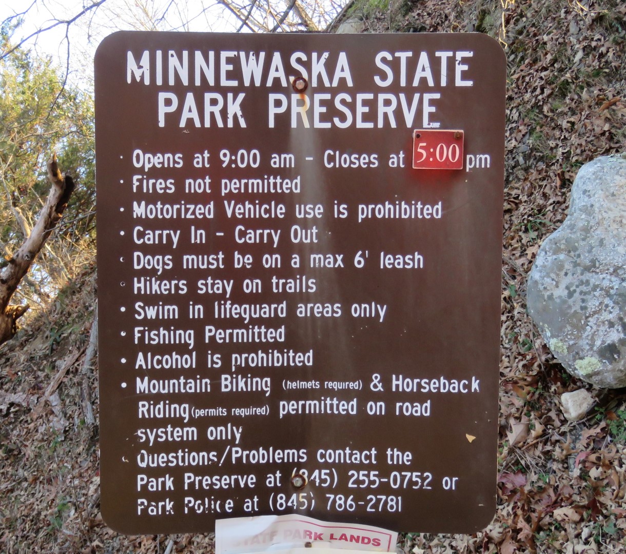
Minnewaska State Park Preserve - New York State Parks
Awosting Preserve - Gardiner Gazette
While there is a $10 fee to enter the park at the main entrance, there is no fee to park at the Awosting Preserve section.
DIRECTIONS:
GPS Coordinates 41.67620, -74.26370
 |
| Awosting Preserve Parking |
TRAIL MAP:
Shawangunk Trails Map 104 - NYNJ Trail Conference
HIKE DISTANCE: 13.8 miles
THE HIKE:
 |
| Starting at the gate in the parking lot. |


 |
| There are sometimes distinct trails that cut off the switchbacks. |

 |
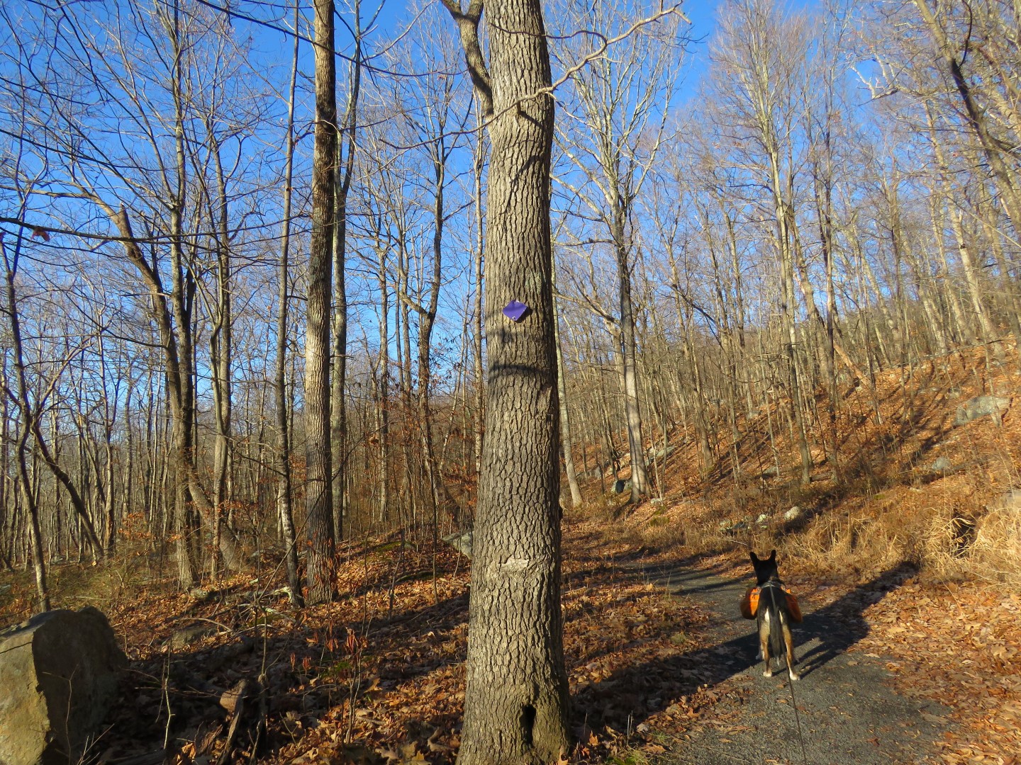
| Turning right at the Y on the purple Awosting Reserve Loop. |


 |
| The ridge on the right would be our destination. |
 |
| Right on an unmarked but easy to follow trail that is not on the map. |

 |
| There are even some logs placed to cross the creek. |
 |
| The only time I had trouble finding the trail was in this shale pit because there are mountain bike trails going every which way. Turns out it's down into the pit keeping to the left then turning left on ... |
 |
| ... a wider woods road that is shown as a partial dashed red line on the map. |
 |
| This intersects with the lilac Scenic Trail and the Shawangunk Ridge Trail where we turned right ... |
 |
| ... rock hopped over a creek then began the rock scramble up. |


 |
| Almost at the top the views start. |
 |
| High Point Monument in New Jersey in the far distance. |
 |
| There were several patches of snow off trail at this higher elevation. It is noticeably colder and much windier up here. |
 |
| Lilac/SRT turns right on ... |
 |
| ... the Hamilton Point Carriage Road ... |
 |
| ... then leaves to the left where it climbs straight up to Carriage Point where we would be later but via the carriage roads. I had come down from Carriage Point on the SRT many years ago and can't say I want to repeat that, at least not with a dog. |
 |
| So continuing on the Hamilton Point Carriage Road. |
 |
| Views are abundant. |


 |
| Gertrude's Nose ... |
 |
| ... which is hugely popular and was busy every time I zoomed in along the way. |


 |
| We would be heading back via Castle Point Carriage Road which is up a level to the left. |

 |
| Left on a connector trail ... |

 |
| .. to left on Castle Point Carriage Road. |
 |
| Views are even better from this higher level. |
 |
| Patterson's Pellet across the way, also always a busy place. |


 |
| Coming up on Castle Point where the SRT drops straight down off the cliff. |
 |
| Lake Awosting from Castle Point |
 |
| Continuing on the carriage road... |
 |
| ... to views of the Catskills. |

 |
| A friendly porcupine was munching on pine needles only 10 feet off the trail and could have cared less that I was taking his picture. He was high enough that Brodie did not notice him, thank goodness. |
 |
| The carriage road loops down and around back to ... |
 |
| ... the Hamilton Point intersection where we had started the loop. |
 |
| Now continuing on the carriage road passing by where we had come in from lilac/SRT. |
 |
| I needed to turn left on the Wolf Jaw Trail but I had gone too far. |
 |
| Backtracking back uphill I found it but it but it looked more like a herd path. |
 |
| A short distance in it does open up and you can see the crushed shale surface at times so it seems to be a now defunct old carriage road. |
 |
| But it is nice and quiet with nobody else around and passes very pretty sections. |
 |
| Wolf Jaw |

 |
| Crossing over lilac/SRT ... |
 |
| ... and now retracing on the unmarked footpath... |

 |
| ... to left on the Awosting Reserve Loop. |


