ABOUT THE PARK:
(wording adapted from Audubon.org)
Sparta Mountain Greenway extends along the westernmost ridge of the New Jersey Highlands.
It includes:
PERMIT REQUIRED FOR HIKING THE PEQUANNOCK WATERSHED PORTION.
See THIS hike for permit details.
Highlands Trail Guide - NYNJ Trail Conference
DIRECTIONS:
GPS Coordinates 41.073056, -74.521770
 |
| Pull out parking for 5-6 cars. Not sure if parking here requires a permit but it is located in the Pequannock Watershed. The lot is not numbered on the map like the permit required lots are. However, 1.2 miles of this hike on the Highlands Trail does require the watershed hiking permit. |
TRAIL MAP:
Jersey Highlands Trails Map 126 - NYNJ Trail Conference
HIKE DISTANCE: 12.5 miles (Out and back on Highlands Trail only would be about 4.5 miles each way from the parking area to Ridge Road.
THE HIKE:
 |
| From the parking lot turn right on Holland Mountain Road. |
 |
| In .2 miles, at the end of the second guardrail section, the Highlands Trail crosses over Holland Mountain Road. |
 |
| We turned left just after the guardrail heading south on the Highlands Trail. |
 |
| When the Highlands Trail turned left, I went to see what was over to the right but the cemetery is cordoned off with ugly orange plastic fencing so we respectfully stayed out. |
 |
| Crossing Rock Lodge Road |
 |
| Balloon #25 of the year. |
 |
| Turning right on Rock Lodge Road ... |
 |
| Rock Lodge Road pavement ends at a parking pullout which is shown as a parking option on the map but is currently occupied by heavy machinery. |
 |
| The signs say "restricted area" but being a Sunday, the heavy machinery is not in operation so we continued on. Apparently there has been some controversial logging going on for a few years. |
 |
| Things start to look a little better farther in. |
 |
| Then not so much. The teal Highlands Trail blazes were pretty much obliterated through this area. I saw several chopped down trees sporting blazes. Sigh. |
 |
| But it does get better after the logging area. |
 |
| Balloon #26 of the year. |
 |
| The trail starts to become less woods road and more trail. |
 |
| Coming up on Ryker Lake. |
 |
| I wanted to pick up that discarded newspaper as well as the many plastic water bottles and beer cans along the way but it's just too risky given the level of disease transmission at this time so I had to lave all of the litter where it was. |
 |
| The Ryker Lake parking lot getting busy at 10 AM. |
 |
| Ryker Lake |
 |
| Yellow Warbler |
 |
| Some Audubon trail markers join in with Highlands Trail blazes. |
 |
| A bridge over Russia Brook shortly before ... |
 |
| ... coming out across from Kean Skylands with parking for a few cars on the right to access the Mount Paul trails. This was our turn around point. |
 |
| Heading back. |
 |
| Where the Highlands Trail veered right, I noticed a faint trail veering left so we went to explore that. |
 |
| Brodie suddenly alerted and something scurried in the leaves. |
 |
| Holy moly was this a HUGE snapping turtle! He was all about social distancing so after zooming in from afar for a photo, we left him to his turtle business. |
 |
| This wasn't much of a trail, very overgrown and unmaintained with a random Audubon trail marker. |
 |
| We were able to follow the path and it put us back out on the Highlands Trail. |
 |
| Somewhere in the vicinity of this old map is where a woods road should have left to the right into Russia Brook Sanctuary for a loop I wanted to do on the way back. Dan and Laura Balogh had hiked this loop back in 2013. But it was not to be found so we continued retracing. |
 |
| Heading back into the logging part, this sign says road is closed to unauthorized vehicles. Much different than the restricted area signs I saw at the other end. So which is it? |
 |
| Some of this logging to restore forest habitat looks like it was just left a jumbled mess. |
 |
| Ovenbird |
 |
| We turned left off of the Highland Trail to hike a woods road loop through Sparta Mountain WMA. It was rutted and muddy in parts, presumably from the logging trucks, but it got better. |
 |
| Veery |
 |
| Old stone walls along the way. |
 |
| Going through an area of new growth. |
 |
| Back at the Highlands Trail, left for a short distance. |
 |
| Right on the woods road into Russia Brook Sanctuary - this is where I had planned on coming back out onto the Highlands Trail had I been able to find the way in at southern end.. Giving it a shot from this end to see how far I can get.. |
 |
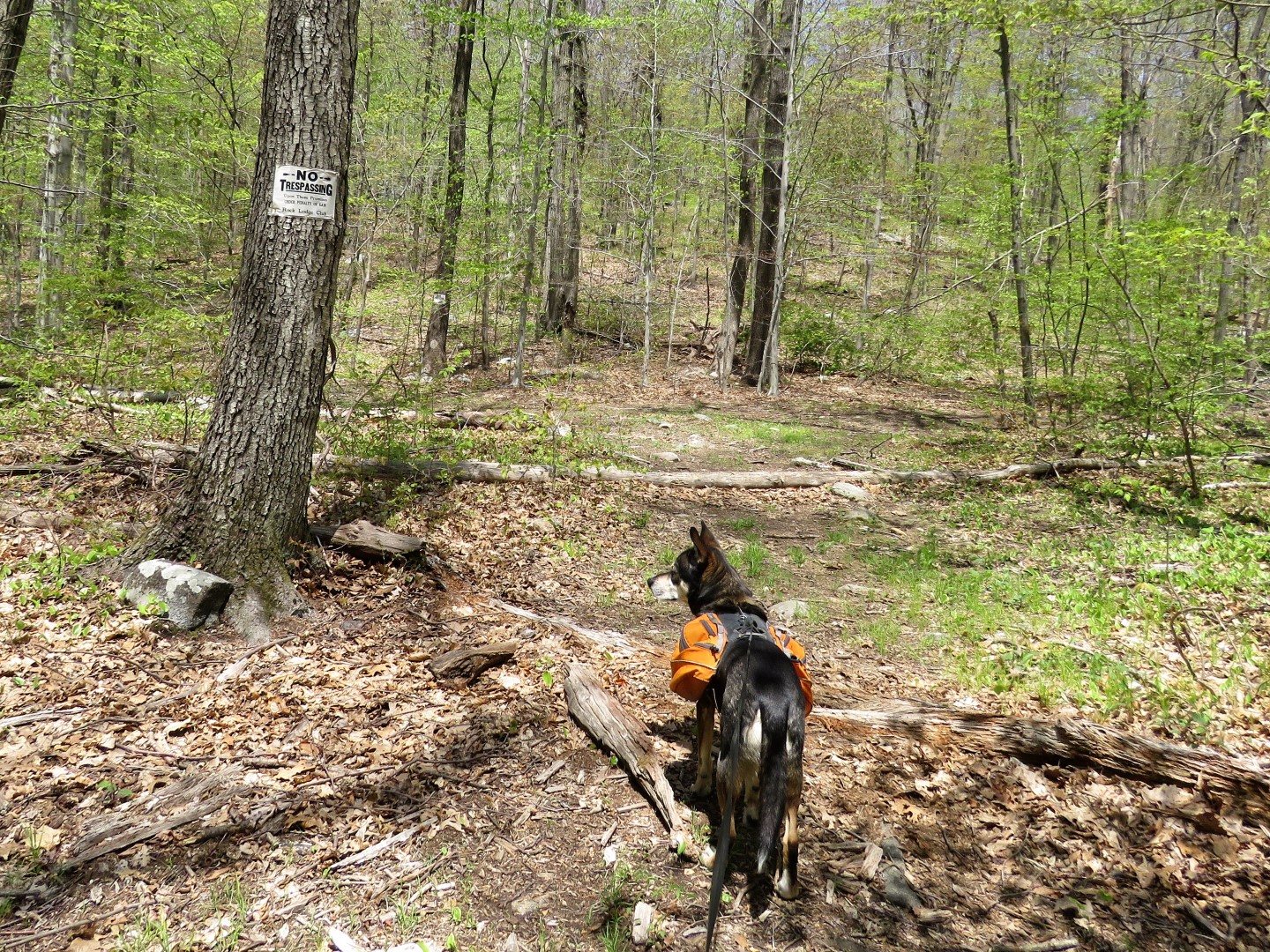
| To the left is private property which leads to a nudist camp, Rock Lodge Club. |
 |
| I noticed a faint woods road to the right of the private property signs so went that way to see how far I could get. |
 |
| I was just thinking we would have to turn back soon as this woods road was sometimes hard to follow... |
 |
| ... when lo and behold, after crossing two small creeks we found ourselves on a very nicely maintained footpath. |
 |
| It isn't blazed, it's not on any map, but it's very well maintained and goes on and on. |
 |
| At this point the trail started to descend steeply. We were already 10 miles into the hike, it was getting hot and I wasn't crazy about the thought of descending and climbing back up again so we turned back. |
 |
| Apparently this trail connects to the Highlands Trail farther south. |
 |
| But before heading back, a nice rock for a break that Brodie immediately requisitioned. No problem Brodie. I'll just stand. |
 |
| Heading back I somehow ended up on a woods road instead of that footpath. This must be the woods road on the map so I followed it. It was clearly signed as sanctuary property, not Rock Lodge Club property. |
 |
| The footpath on the left, following the woods road to the right of the footpath. |
 |
| Uh oh. Those Rock Lodge Club signs. But they were only straight ahead and to the right, not the left, so we continued left in the intersection ... |
 |
| ... and came out where I first saw the signs where we had started to follow that faint woods road. This picture is looking back at those signs. Sorry if I trespassed but this was very unclear! |
 |
| The woods road we came in on veers right. We took the left fork. |
 |
| It's a nice little footpath, also not on any map, heading towards the Highlands Trail. |
 |
| At the Highlands Trail this unmarked trail continues into Sparta Mountain WMA but that is for another day. We turned right to continue retracing on the Highlands Trail. |
 |
| Coming out on Rock Lodge Road. |
 |
| Gray Catbird |
 |
| Swainson's Thrush |
 |
| I had noticed this woods road at the beginning of the hike and knew it would knock off about half of the road walk on Holland Mountain Road so we veered right leaving the Highlands Trail. |
 |
| Coming out at the end of that first guardrail ... |
 |
| ... with only about .1 mile back to the car on a now much busier Holland Mountain Road. |
 |
| After I saw my track (orange) on the Gaia map I saw where someone else had a track (red) that shows that footpath I found connecting right where I had been by Ryker Lake. In fact, it comes out on a side trail right were Brodie and I had taken a break and I never saw it. This is not the same trail as the woods road shown on the map which should have come out farther east at the bend in the trail. |