ABOUT THE PARK:
DIRECTIONS:
GPS Coordinates 41.99892, -73.43774
 |
| Bunker Hill Parking Lot at the Lions Head Connector Trail. Room for about 8 cars. On weekends the lot fills up fast and cars are parked up and down Bunker Hill Road. |
TRAIL MAP:
HIKE DISTANCE: 12.7 miles
The planned hike was 10.2 miles but adjustments needed to be made to avoid a difficult scramble that would not have been doable with Brodie.
THE HIKE:
 |
| The trail starts opposite the parking lot entrance. |
 |
| Just around the kiosk ... |
 |
| ... a nice Connecticut countryside view, much better in person than in this picture. |
 |
| This is a blue-blazed connector trail that leads to the AT in .8 miles, .2 miles before Lions Head. |
 |
| The trail crosses over Bunker Hill Road which is a private road at this point. |
 |
| The Appalachian Trail comes in from the right. |
 |
| In a little under a quarter mile the AT turns right. Straight ahead is a blue bypass trail but why when you are so close? |
 |
| It's a steep climb up the rest of the way but never a scramble. |
 |
| Views at Lion's Head. |
 |
| A gentler descent off of Lion's Head ... |
 |
| ... to a view of our destination straight ahead: Bear Mountain, the highest point in Connecticut. |
 |
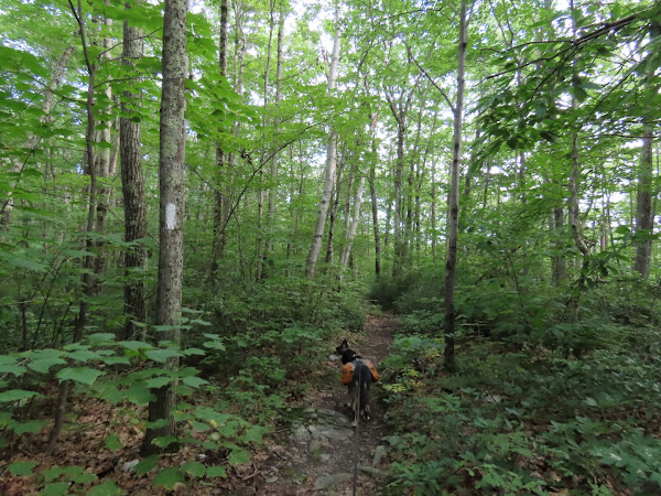
| Continuing north on the AT for the next 2.5 miles. |
 |
| At Riga Junction I had to make a decision. This is where the climb up Bear Mountain begins. There is a difficult scramble the other side of Bear Mountain which is supposed to be easier going up rather than going down. Should I take the 3-mile loop around Bear Mountain, get to the other side and not be able to get to the top with Brodie, risking not getting to the top at all? I asked a man who was coming down from Bear Mountain and he felt I would be better off avoiding that scramble with Brodie. So decision made - continuing north on the AT to summit Bear Mountain. We would be back at this intersection two more times over the course of this hike. |
 |
| It's a rocky climb that gets steeper as you get higher but it was never a scramble heading this way. |
 |
| This guy hopped along side of me for a few steps. A bit later a gorgeous small green snake slithered across the trail in front of me but he was too fast for a picture. |
 |
| At the summit, you need to climb up these rocks for the view. |
 |
| I had tethered Brodie to a tree in the shade where he waited patiently. The man on the right is an AT thru hiker from Oklahoma. The woman on the left lives just blocks from where I used to live in St. Louis 40 years ago. She was highpointing - visiting the high point of every state. And here she is at the high point of Connecticut. |
 |
| A view from the back of the stone viewing structure. |
 |
| Retracing back down the way we came, the views are gorgeous. |
 |
| Back at Riga Junction, if I were to have continued to retrace back to the beginning of the hike, it would have only been an 8-mile hike, having done the summit as an out-and-back. I did not want to shorten this hike, especially on this gorgeous, dry, breezy75-degree day! Doing the full loop around Bear Mountain would add about 2.5 miles. OK, decision made - longer version it was so we tuned right on the unmarked Bear Mountain Road. |
 |
| This was a welcome change from the more rugged trails - smooth and flat all the way! |
 |
| There were a couple of seriously flooded out sections but I was able to rock hop them without getting wet. |
 |
| At the end ... |
 |
| ... right on gravel Mount Washington Road for a short distance to ... |
 |
| ... right through the next parking lot to ... |
 |
| ... unmarked Northwest Road. |
 |
| At this intersection, that intense scramble up Bear Mountain is to the right. We turned left a short distance to the Sages Ravine sign ... |
 |
| ... where we turned right on blue Paradise Lane. |
 |
| There is Bear Mountain that we are now looping around. |
 |
| In 2.1 miles Paradise Lane ends and we turned right on Under Mountain Trail. |
 |
| Back at Riga Junction, we now turned left to retrace all the way back on the AT. |
 |
| Climbing back up Lions Head. |
 |
| The blue bypass trail is to the right but we were almost at the top and the sun was in a better position than early in the morning to we stayed left to visit Lions Head again. |
 |
| Definitely better lighting for better pictures. |
 |
| How the heck did that little guy get way up here into that puddle? |
 |
| It's steep descending the way we had come up originally and it took some time but we made it down. |
 |
| The Appalachian Trail goes left and we continued straight on blue back to Bunker Hill Road. |
 |
| Last ones in the lot at 5:30 PM. |


