PERMIT REQUIRED FOR HIKING IN THE PEQUANNOCK WATERSHED. This hike is
mostly in Wawayanda State Park where a permit is not required but the
parking lot is a Pequannock Watershed lot so a permit is required to
park there for this hike. See THIS hike for permit details.
Alternate parking for this hike where no permit is required would be on Warwick Turnpike in the upper right corner of the map.
DIRECTIONS:
GPS Coordinates 41.105758, -74.406189
P8 permit parking used for this hike.
GPS Coordinates 41.157558, -71.367454
Warwick Turnpike parking where no permit is required, accesses the Terrace Pond North Loop from the north via the spur trail.
TRAIL MAP:
Until other maps are updated, this is currently the only map of the new trail.
From Warwick Turnpike the loop plus spur would be about 8 miles
THE HIKE:
Continuing on Stephens Road through the watershed gate.
At the second gate right at the boulder...
... to the red-blazed Terrace Pond Red Trail.
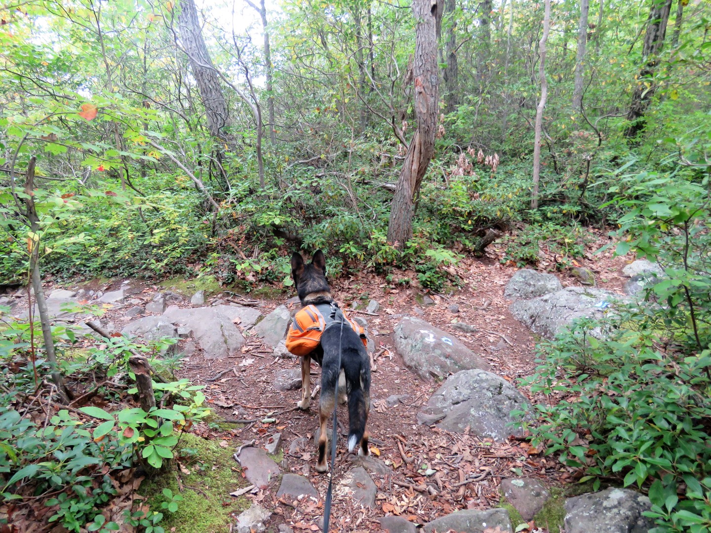
The blue Terrace Pond North Loop joins red; we turned left on red/blue to do the loop clockwise.
Red leaves to the left; staying right on blue.
Blue now follows a woods road that used to be yellow dot on white.
One partial remaining yellow dot on white blaze.
The woods road ends and the trail veers left uphill as a footpath.
Blue joins the original white-blazed Terrace Pond Circular Trail.
We now descended to Terrace Pond on steps where there were none when we were here back in May.
Right on blue/white with some views of Terrace Pond along the way.
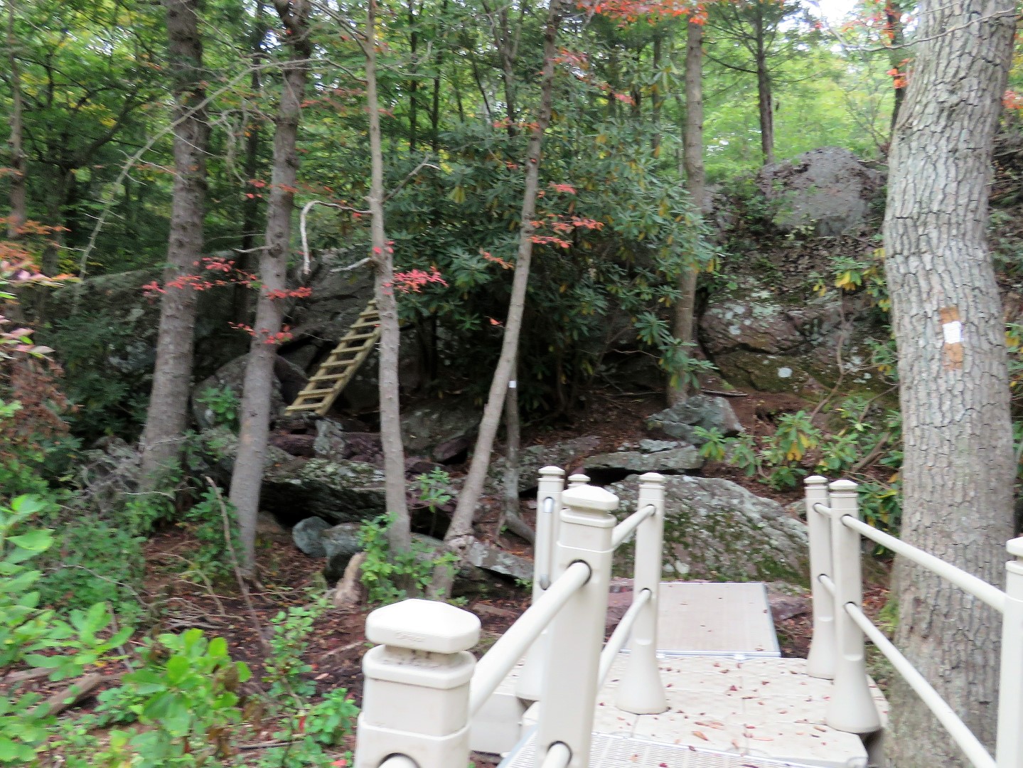
Where blue goes right and white goes left, we went left to check out the new floating walkway just a short distance downhill.
The original trail went to the right where I recall having to sit and slide down back in 2012 when I hiked here with Shawnee. Now the trail has been diverted to the left to avoid that.
The trail goes through a clear cut section which a trail conference volunteer who was there working told me had been cleared so the helicopter could deliver the materials for the walkway.
Seeing what was involved in getting to the walkway made me decide to tether Brodie to a tree for a break and go myself.
There is the new walkway down below and to get to it ...
... a ladder. Nope not doing that with Brodie so solo I went while he was on break.
Ahhhh, old memories of crossing on those logs back in 2012 with higher water.
Terrace Pond from the walkway.
Heading back ...
... and back up the ladder ...
... to a very worried dog who thought I had abandoned him. Silly dog, I left my backpack and keys with him!
Back at the top, left on blue to continue the loop.
The trail turns right into the gas pipeline cut.
Leaving the gas pipeline to the left where ...
... there would normally be outstanding views but not on a foggy day like this one. This hike from May 2020 shows the views on a clear day.
Although there were no views, I took a break intending to look at the pretty fall foliage when there was some action overhead.
This would be a view of the New York City skyline on a clear day.
The blue-blazed Terrace Pond North loop ends. To the left is the black dot on blue spur trail to Warwick Turnpike (used to be blue). The Terrace Pond North loop starts to the right. This begins the brand new section of trail that did not exist previously.
We turned right to continue the loop.
Crossing back through the gas pipeline cut.
The fog was starting to lift so Greenwood Lake was coming into view.
A short distance beyond the gas pipeline cut, a side trail to an overlook.
I think I almost stepped on this little snake. I stepped down with my left foot and heard something leap into the brush. When I looked to see what it was I saw this poor snake hissing and rattling at me. I took a quick shot and moved on so I wouldn't stress him out any further. Sorry little guy!
Coming up on what looked to be a view up ahead I was distracted and missed a turn.
Ended up on some other trails.
A yellow trail also. Looks like they might lead down to Pinecliff Lake but exploring further was not on the agenda for the day so I backtracked to get back on course.
Coming up from that other trail I now see the arrows on the rock. We had come out where Brodie is standing.
So standing where I was before I went wrong going straight, here is the hard right turn that is easy to miss.
Back on track.
Crossing the outlet of Pinecliff Reservoir.
Eastern Phoebe
Here ends the section of new trail from where we turned right at the spur trail. To complete the loop we would have turned right for half a mile to meet up with where we had joined blue from red. But here we went left instead on what used to be the blue-blazed Spring North Trail but has now been eliminated.
Although the blazes have been removed, the trail is still there ...
... mostly. At this time there were 3 blow downs to navigate around/through so that will just get worse with no further trail maintenance.
This one was particularly challenging as there was no way around it.
I had to remove my backpack and feed it through ahead of me and let Brodie find his own way which was different than my way. I could not have made it his way.
Other than those three areas of blow downs that weren't there back in May, the trail was still clear.
Balloon #47 of the year.
Back out on Stephens Road, a left turn back to parking P8.


Nice walkies! Love the fall colors. Be well friends,
ReplyDeleteNuk & family
Fall colors are way ahead of schedule and are coming at warp speed. Fits right in with this crazy year.
DeleteEnjoyed the blog. I have not seen any of these in awhile. Kevin from Hike NJ
ReplyDeleteThanks, Kevin!
Delete