ABOUT THE PARK:
Pequannock Watershed - City of Newark
Wawayanda State Park - NJDEP
PERMIT REQUIRED FOR HIKING IN THE PEQUANNOCK WATERSHED.
(The only parts of this hike in the watershed are the parking area and the very beginning/end of the hike.)
See THIS hike for permit details.
DIRECTIONS:
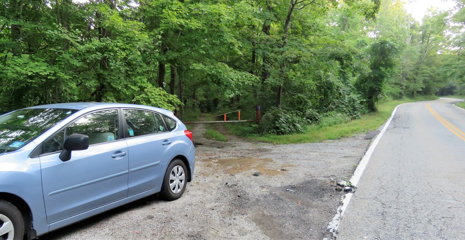
GPS Coordinates 41.123432, -74.422053
 |
| Room for one car at parking P5 where a watershed permit is required to park. This hike can also be accessed from P7 farther up Clinton Road where no permit is required however that is an insanely busy lot where everyone parks to go to Terrace Pond. Personally, I prefer this private spot, one of the permit perks. |
Wildcat Loop - Trailforks
PEAK BAGGING:
Boulder Pine Peak - NJ1K.org
HIKE DISTANCE: 9 miles
THE HIKE:
I had wanted to return to hike the
Wildcat Loop that I had happened upon previously in addition to another loop incorporating the Boulder Pine Peak summit.
 |
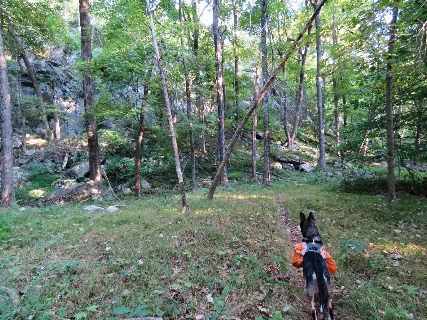
| Beyond the gate it's a short unmarked woods road to ... |
 |
| ... right on yellow. |
 |
| Crossing the swamp outlet that has really nasty looking water which Brodie was not allowed to drink no matter how hard he tried. Somehow he thinks it's much tastier than the water I lug along for him. |
 |
| The swamp. |
 |
| Just after the swamp I had to start looking for the way over to the Wildcat Loop. I had hiked a short section of it previously and bushwhacked over to yellow so I had my track from that hike to follow. It is literally a 20 step bushwhack (red) to the trail. I counted. |
 |
| Coming out at the bend in the trail, we headed right and would be returning from the left. |
 |
| It's very pretty back in here and the trail follows along to the left of the swamp. |
 |
| Swamp |
 |
| Although unmarked, the trail is very well-defined and easy to follow. |
 |
| Coming up on another swamp on the left. |
 |
| The Wildcat Loop comes out on the yellow trail. It continues on the other side a bit down on the left but we'd be taking that on the way back. For now, right on yellow. |
 |
| At the end of yellow ... |
 |
| ... left on red Old Coal. |
 |
| Up the hill and right on an unmarked woods road. |
 |
| At the clearing, left on a different woods road. |
 |
| Along here something creepy happened. I never expected to run into anyone on these remote, rarely used woods road when suddenly there was a man coming towards us CARRYING A MACHETE!!!! That fact had not even reached my brain yet when he quickly put the machete in a sheath in his waistband. We passed one another uneventfully. Thank goodness. |
 |
| Continuing on. |
 |
| At the gas pipeline I could see the opening for the woods road across the way but getting there was a whole other story, |
 |
| See Brodie in there? Darn, I need a machete. It was making more sense now but I did not see where that man had hacked a path so in we went. The growth was soaking wet with dew and was over my head. I could see nothing and just followed the leash letting Brodie lead the way - like I had a choice. |
 |
| Somewhere in there I was attacked by a thorny bush. My legs look about the same. Wouldn't you know it was right at the end just before we surfaced. |
 |
| Although the woods road is grassier on this side, it was never as high as in the gas pipeline cut. |
 |
| Coming out at this gate I thought it would be a left on Cherry Ridge Road. |
 |
| Not quite. There wasn't much that resembled a woods road here so I veered left and came out at another gate at Cherry Ridge Road. |
 |
| This was the sign when I turned around after passing through that gate. There was nothing active going on in there and I had no idea I was trespassing since this was the first sign I saw. |
 |
| Yup, I was trespassing, They even have a cam on the tree. Oh well, left on Cherry Ridge Road. |
 |
| There are NO TRESPASSING signs everywhere lining both sides of the road but walking this road is OK since it leads to a Wawayanda State Park parking lot. |
 |
| The road becomes gravel ... |
 |
| ... then comes out at the parking lot. Left into the parking lot then ... |
 |
| ... the first left from the parking lot on a woods road. This is called Ferber Road on Trailforks. There is no sign and it is not blazed. |
 |
| At a fork a footpath leads to the right. This is Split Rock on Trailforks. |
 |
| Boards and boulders through the swamp. |
 |
| Rhododendron Tunnel |
 |
| Uh oh. Back through that overgrown gas pipeline cut. This part wasn't so bad. There was somewhat of an opening because it is used and it was a very short distance before it opened up... |
 |
| ... to a trail easily seen through the rest of the pipeline cut. |
 |
| Ascending to the summit of Boulder Pine Peak. |
 |
| I was allowed only this one shot. Maybe a blue-gray gnatcatcher? |
 |
| Just after this pine needle area ... |
 |
| .. the summit. |
 |
| Looking back at the summit with the pine trees after which it is named. |
 |
| We backtracked to that nice shady and breezy pine needle area for a break. |
 |
| Continuing on. |
 |
| Coming out on Old Coal where we turned left. |
 |
| Looking back at where we came out, a sign for Split Rock. |
 |
| Passing by the woods road we took earlier in the hike at the beginning of this loop. |
 |
| When red turns left, right on yellow. |
 |
| Just to the left is where we had come off of the Wildcat Loop earlier. There is a second trail on the left with a cairn, no clue where that goes. A little farther along on yellow... |
 |
| ... right to continue on the Wildcat Loop. |
 |
| This side is not used as much as the side we were on earlier. Lots of ancient spider webs were walked through but the trail is still well-defined. |
 |
| Balloon #46 of the year. |
 |
| Coming out on yellow, you can either turn right on yellow and finish that way or turn left a few step ... |
 |
| ... then right on the Wildcat Loop to finish the loop. |
 |
| Here we are at the 20 step bushwhack to the right which is right where the trail makes a left turn. |
 |
| Then left on yellow back to the swamp. |
 |
| Where yellow turns right, left on the woods road ... |
 |
| ... back to P5 parking. |


No comments:
Post a Comment