ABOUT THE PARK:
Sterling Forest State Park, NY - New York State Parks
DIRECTIONS:
GPS Coordinates 41.226242, -74.269628
 |
| Room for 2-3 cars at the West Valley Trail Head off of 17A. |
TRAIL MAP:
Sterling Forest Trails Map 100 - NY/NJ Trail Conference
HIKE DISTANCE: 9 miles
THE HIKE:
 |
| Starting on the green-blazed West Valley Trail from the parking lot. |
 |
| The gate was open but there is a warning sign that the road is not maintained. A low clearance vehicle would never make it. |
 |
| It's woods road for a while. |
 |
| After this gate about 1.5 miles in, there is no more vehicular traffic allowed so the woods road becomes more grassy. |
 |
| The orange-blazed Bare Rock Trail joins in from the left. |
 |
| At 2 miles from the parking lot the Bare Rock Trail leaves to the right which is the way we went. We would be returning from the West Valley Trail straight ahead. |
 |
| A mess of blow downs to navigate through. |
 |
| Side trail to the vistsa. |
 |
| Lots and lots of sparrows hanging out at the vista. |
 |
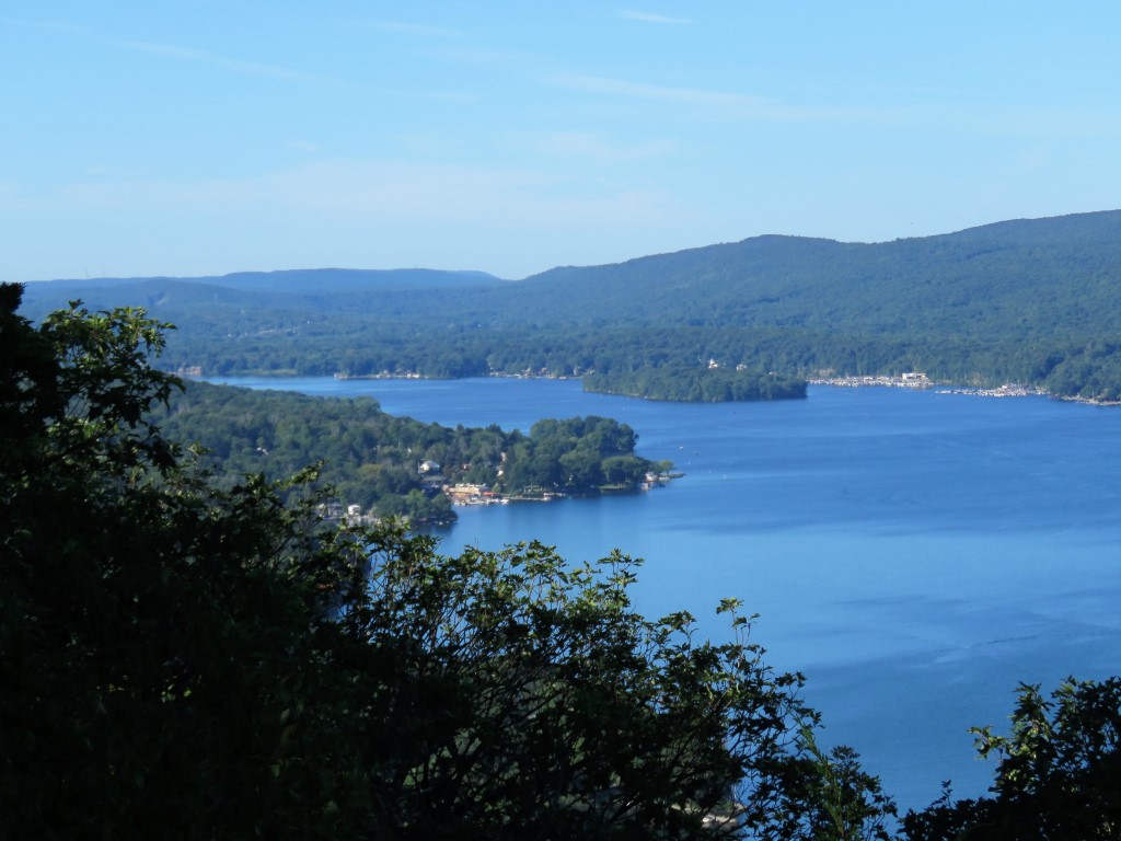
| Greenwood Lake |
 |
| A female black-throated green warbler. |
 |
| Although it's pretty and we stayed a while since nobody was there, the peace and quiet was soon broken by the
sound of motor boats on the lake and that becomes very annoying. |
 |
| Heading back to the Bare Rock Trail. |
 |
| From this point on there had been recent trail maintenance (thanks!) so no more blow downs to climb over on the Bare Rock Trail. |
 |
| Coming up on ... |
 |
| ...the Fire Tower View. |
 |
| Can't tell who this shy bird is. |
 |
| Zooming in to the Sterling Fire Tower in the distance. |
 |
| At the end of the Bare Rock Trail, we turned left on green/red. |
 |
| After this mess of downed branches we ran into two separate pairs of hikers one just minutes after the other, the only other people we ran into the the trail the entire hike. |
 |
| At the swamp, we turned right on red leaving green for a 0.5 mile out-and-back to incorporate a section of the red Fire Tower Trail that I had not hiked before. |
 |
| The map shows this as a "difficult crossing" at the outlet of the swamp. Presumably the downed trees on the left allow for crossing during high water. But this time of year, a rock hop to the right was all that was needed to get across. |
 |
| After the crossing the trail becomes a woods road. |
 |
| At the intersection where I had intended to turn around it was just a short distance to an overlook so what the heck, may as well go. I sort of recalled a steep climb up having done this years ago. I had remembered correctly. |
 |
| This would be that steep climb up. |
 |
| Yes, Brodie, all the way up. |
 |
| This squeezer part was very narrow and Brodie wasn't having that (nor would he have fit) so he found us an easier route up... |
 |
| ... just to the right of the squeezer. It's a well worn path that others have taken before. |
 |
| Once at the top, the view was very disappointing considering the effort it too to get there. |
 |
| Heading back down. |
 |
| Turning right to retrace to the swamp. |
 |
| The swamp was my favorite part of the hike so we took a break and explored the area some before heading back. |
 |
| Back over the water crossing. |
 |
| Eastern Phoebe |
 |
| Right on green with nice views of the swamp along the way. |
 |
| The Bare Rock Trail joins in from the left before leaving to the right; now retracing back to the start. |


No comments:
Post a Comment