ABOUT THE PARKS:
Abram Hewitt State Forest - NJDEP
Wawayanda State Park - NJDEP
DIRECTIONS:
GPS Coordinates 41.157558, -74.367454
 |
| Parking for 9 cars at a pullout on the opposite side of Warwick Turnpike from the trailhead. There are a couple more smaller pullouts along Warwick Turnpike. These parking pullouts are also for the more popular Bearfort Ridge/Quail Trail Loop. |
TRAIL MAPS:
North Jersey Trails Map 116 - NYNJ Trail Conference
Abram Hewitt State Forest Trail Map - NJDEP
HIKE DISTANCE: 8 miles
THE HIKE:
NOTE: Since this hike the trail blazes have changed. See THIS HIKE for updated map showing trail changes.
 |
| Cross Warwick Turnpike, turn left, then right on the blue-blazed Terrace Pond North Trail. |
 |
| Caution tape was still across the trail from when the parks were closed. This being the first day state parks were reopened, I started hiking at 6:45 AM to beat the inevitable crowds although I figured this hike would be a good choice due to the limited parking. |
 |
| There was a lot of deadfall on the trail from a month of being closed so I removed all of that as we went along. |
 |
| It had rained heavily the previous day so there several wet spots. |
 |
| This is a rugged hike with a fair amount of scrambles. |
 |
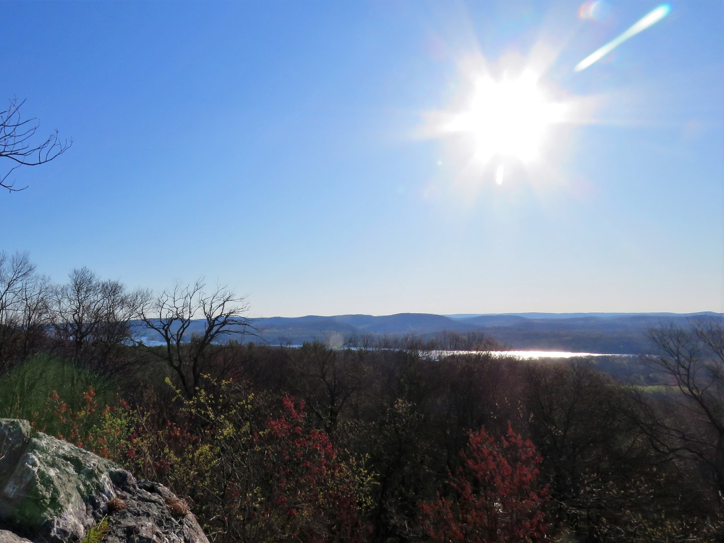
| But it brings you to incredible overlooks at the top. |
 |
| Greenwood Lake |
 |
| Balloon #23 of the year. |
 |
| Birds were singing everywhere. |
 |
| New York City skyline views. |
 |
| Entering the gas pipeline almost 2 miles in. |
 |
| Two really wet spots along this stretch. |
 |
| Leaving the gas pipeline to the left. |
 |
| Where the blue trail turns right, as I recall from hiking this in 2012, the trail descends steeply, at one point I had to sit in running water to slide down a vertical section, then there was a really nasty swamp crossing, and that was in the summer. So not wanting to repeat that, we turned left on white to do a different loop. |
 |
| Views of Terrace Pond along the way. Where the other side gets busy from the large parking lot on Clifton Road, I could see nobody over there yet and had not run into anyone else so far. |
 |
| The white trail turns left just before this last overlook which is a big party spot. Watch for broken glass everywhere. Grrrr. |
 |
| I could find no blazes for the left turn on white away from Terrace Pond and had to hunt around for it. |
 |
| Got on to the right track and made it a level up above Terrace Pond only to find a vertical scramble with water running down so we kept along the ledge as far as we could go ... |
 |
| ... and found a better way up. (Made mental note for the return.) |
 |
| Meeting back up to where white came up on the ledge. |
 |
| Making note of the yellow dot on white blazes to the left. We would be returning that way. For now continuing on white. |
 |
| After water crossings the trail starts to ascend. Watch for white to make a turn to the right. At exactly that point ... |
 |
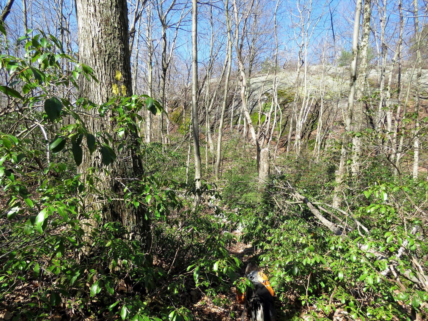
| ... left on yellow which may be a bit hard to see. This whole section of trail seems to be much less used than the trails we had been on. |
 |
| Going through a rocky valley. |
 |
| Red joins in with yellow for a few steps then yellow leaves to the right. We stayed left on red. |
 |
| Red turns left on a woods road along with yellow dot on white for a few steps ... |
 |
| ... then red leaves to the right. We stayed left on yellow dot on white. |
 |
| After 4 miles of rugged hiking, this stretch of woods road at the half way point was a welcome break. |
 |
| The woods road ends and the trail continues left uphill as a footpath. |
 |
| At the cairns at the top ... |
 |
| ... watch for those three yellow dot on white blazes from earlier and turn right; I saw no white blazes here until I made the turn. |
 |
| Where that vertical descent was just before Terrace Pond, we turned left along the ledge retracing the way we had come up. |
 |
| And the partiers dressed for illegal swiming have arrived. These knuckleheads, as Governor Murphy calls them (I prefer something stronger which is not fit for printing) are going to ruin it for the rest of us. |
 |
| Moving on to retrace on blue. |
 |
| It was after the overlook at the gas pipeline where the trail enters the woods on the left that we started running into other hikers. There is plenty of space so social distancing was always more like a minimum of 30 ft instead of 6 ft. |
 |
| At one point I heard a group of 4 hikers coming up behind us because of their constant chatter. We went out on a ridge and took a break to wait for them to pass. |
 |
| Brodie watching as they passed us in the distance ... |
 |
| ... and making sure they were getting far away before we continued. I like to wait until I can no longer hear chatter because really, who wants to listen to that while hiking? |
 |
| We encountered a few more individual hikers and we each made plenty of room for one another in passing. |
 |
| Back at the trailhead. |


I found that trail fairly overgrown during a hike on it in Sept. 2018. I also sank into a thigh-deep swamp somewhere where the blue trail intersects the pipeline. Thankfully it was a warm day and I dried off quickly.
ReplyDeleteYou sure that was by the pipeline? Sounds like the Terrace Pond outlet near blue and white where blue continues west. That conjures up memories of thigh-deep swamp.
Delete