DIRECTIONS: GPS Coordinates 41.74261, -74.25440
 |
| Jenny Lane parking lot - room for about 8 cars. No fee to park here whereas there is a fee to park in the main lots that do not open until 9 AM. |
HIKE DISTANCE: 11.1 miles
THE HIKE:
 |
| Starting from the parking lot ... |
 |
| ... the woods road goes a short distance before ... |
 |
| ... a right turn on the pink Wawarsing Turnpike Footpath. |
 |
| At the information board, the blue Jenny Lane Footpath comes in from the right. We would be returning that way. For now, straight ahead on pink. |
 |
| Crossing Sanders Kill. |
 |
| In 1 mile crossing Route 44/55 ... |
 |
| ... to a blue path near the boulders on the right ... |
 |
| ... into the lower parking area. With the main parking lots not yet open, it's a rare opportunity to experience peace and quiet here because it becomes insanely busy once the lots open, especially on weekends. Heading towards the left of the restroom building ... |
 |
| ... a carriage road that leads to ... |
 |
| ... the orange Sunset Carriage Road. |
 |
| View from the Sunset Carriage Road. |
 |
| We would be making that sharp right turn but first a few steps straight ahead to ... |
 |
| ... a view of Lake Minnewaska. |
 |
| Continuing on to the green Upper Awosting Carriage Road. |
 |
| View of the Catskills from the Upper Awosting Carriage Road. |
 |
| After 1.6 miles on the Upper Awosting Carriage Road, left on the blue Blueberry Run Footpath. |
 |
| This trail goes uphill gradually and starts out easy but becomes more rugged towards the end. |
 |
| Blueberries on the Blueberry Run Footpath. |
 |
| Coming out on the Castle Point Carriage Road where we would be turning right but first a few steps to the left to ... |
 |
| ... views at Castle Point. |
 |
| Continuing on with one view after another of Lake Awosting and the Catskills. |
 |
| A right turn here on ... |
 |
| ... the orange Rainbow Falls Footpath. This trail is no joke. There are some wicked scrambles. I had hiked this in the opposite direction with Shawnee 14 years ago and remember one scramble in particular that we would be coming up on shortly. |
 |
| And here it is. It's about an 7-foot drop down with a narrow ledge about half way. How I ever managed to get 70+ pound Shawnee UP this vertical wall is beyond me but then I was 14 years younger at the time. Now the problem was getting Brodie DOWN. Once I threw my trekking poles and backpack down to the bottom, there was no turning back. I managed to work my way down then with gravity on my side, I pulled Brodie's leash. His spreadeagled attempt at hanging on at the top was to no avail. I pulled until he started sliding downward then he went straight down and I grabbed him before he hit bottom. Whew. |
 |
| Looking back at that scramble it doesn't look that bad but trust me, it is. I am 5'4" and the top is a good 2 feet over my head. |
 |
| Lake Awosting |
 |
| This scramble wasn't so bad. There was another long vertical down scramble that I was able to bypass. |
 |
| Crossing over Upper Awosting Carriage Road to continue on the Rainbow Falls Footpath. |
 |
| Rainbow Falls |
 |
| Just a trickle even after storms during the previous days. |
 |
| Back in 2012 Backpacker Magazine contacted me asking to use the picture of Rainbow Falls I had taken on the hike in October, 2010. What an honor for my picture to be in the magazine! |
 |
| Continuing on from the falls ... |
 |
| ... a steep uphill scramble that would not be so bad if you aren't fighting to get an unwilling dog up. |
 |
| This used to be the route of the Long Path before it was rerouted to the Mine Hole Footpath so there are still some aqua blazes here and there. |
 |
| At the end of the Rainbow Falls Footpath, right on the Lower Awosting Carriage Road just to the top of the hill ... |
 |
| ... then left on the blue Jenny Lane Footpath. |
 |
| Just as Brodie passed the boulder to his left, I came a few steps closer to see something right under the boulder, just inches from where Brodie had passed. |
 |
| OH HOLY MOLY! (The cleaned up version of what I said.) I was able to jump off the trail and make a wide circle around and zoom in for the picture. I can see three timber rattlesnakes in there when I enlarge the picture. This is the second time I have encountered timber rattlesnakes on the Jenny Lane Footpath. |
 |
| Proceeding very carefully but no more rattlesnakes were seen. |
 |
| Crossing Sanders Kill. |
 |
| The Jenny Lane Footpath continues on the other side of Route 44/55. |
 |
| Coming up on that information board, left on pink. |
 |
| Retracing back to ... |
 |
| ... the Jenny Lane parking lot. |
 |
| Just 15 minutes away is my favorite farm stand. I had planned this hike just so I would have enough time to get there before they closed. |


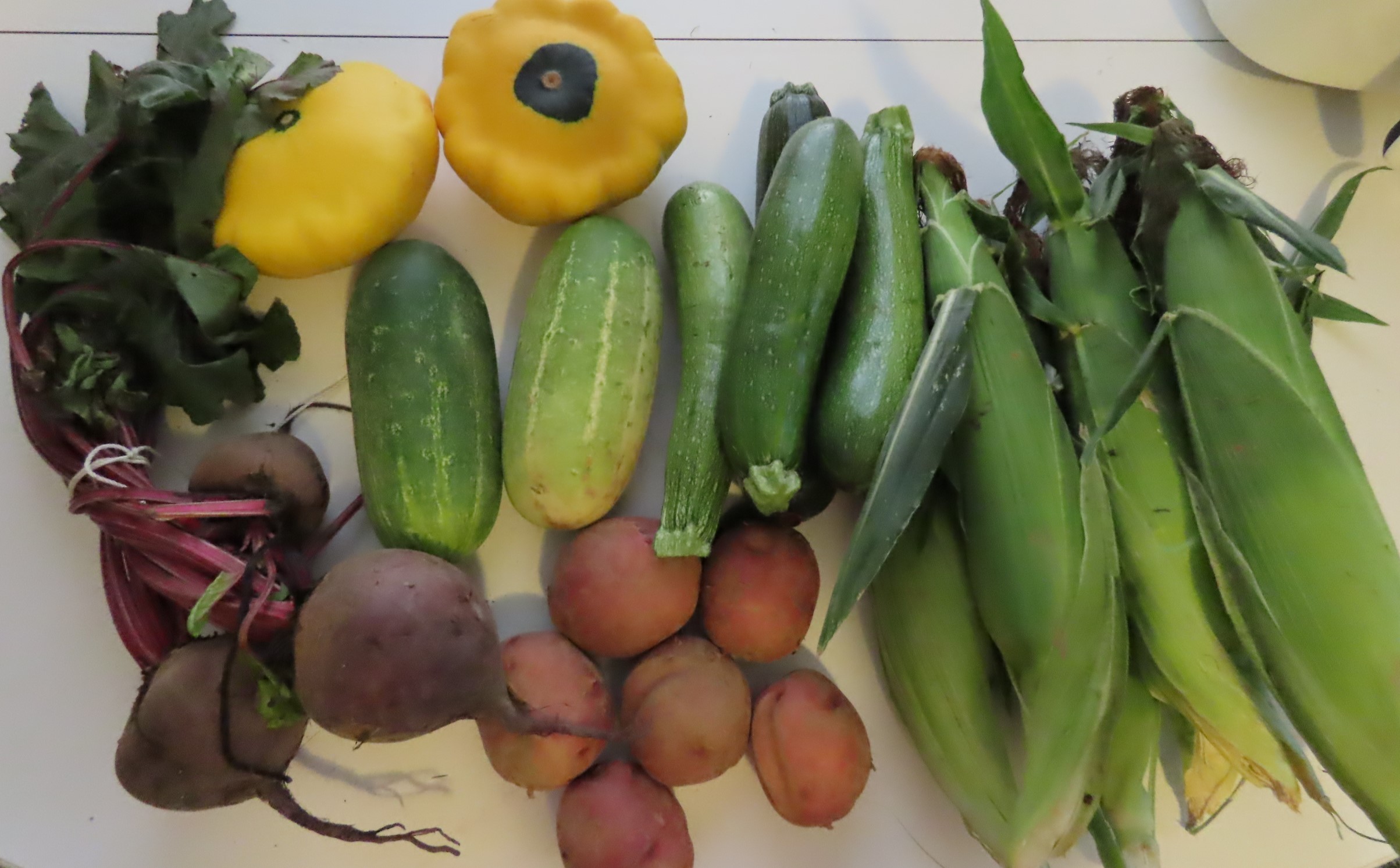
Hi Daniela -- I have to say, I'm not quite sure what my favorite picture is: The awesome trail pix, or the yummy-looking vegetables in the last pic!! LOL! But seriously, these trails _totally_ have some "Acadia National Park" aspects to them...especially the Rainbow Falls Footpath -- WOW! (I can tell, if I ever took Penny here, I would _totally_ have to carry her up some of those scrambles...fortunately, she's only 7.5 pounds!!) But those views of Lake Awosting and the Catskills are _totally_ worth it!
ReplyDeleteAwesome job, as usual...now that I have a new Samsung Galaxy A14 5G phone, I actually have enough space for the Merlin Bird app, as well as for the Gaia app (which I have yet to install, but I _will_ be loading that one, as I LOVE the features it has!!)
Cannot wait for your next adventure; hopefully at some point, you'll also hit another South Jersey park/trail! Until then -- happy hiking!
-- Jim
This is one of my favorite places to hike. The views are incredible. And those veggies are as yummy as they look. The corn needs nothing on it. No salt, no nothing it is that good. I'll be back in South Jersey in the off season. Can't drag me down that way with the summer shore traffic!
DeleteI do miss the gunks! I was just thinking, if I ever am back visiting NY, I'd want to squeeze in a hike there.
ReplyDeleteI don't blame you. There is no other place like the Gunks. But then look at all the places you have to hike where you are now!
Delete