ABOUT THE PARK:
DIRECTIONS: GPS Coordinates 41.201500, -74.391610
 |
| Pullout parking on either side of Warwick Turnpike where the Appalachian Trail crosses over. |
TRAIL MAP:
(formerly North Jersey Trails Map 116)
HIKE DISTANCE: 13.8 miles
THE HIKE:
It had been 13 years since I hiked this section of the Appalachian Trail and there had been some reroutes since then. I also wanted to add in the William Hoefferlin and Iron Mountain Trails north of the AT and try to make a loop using an unmaintained trail along the ridge of Wawayanda Mountain rather than retracing on the AT from Pinwheel Vista.
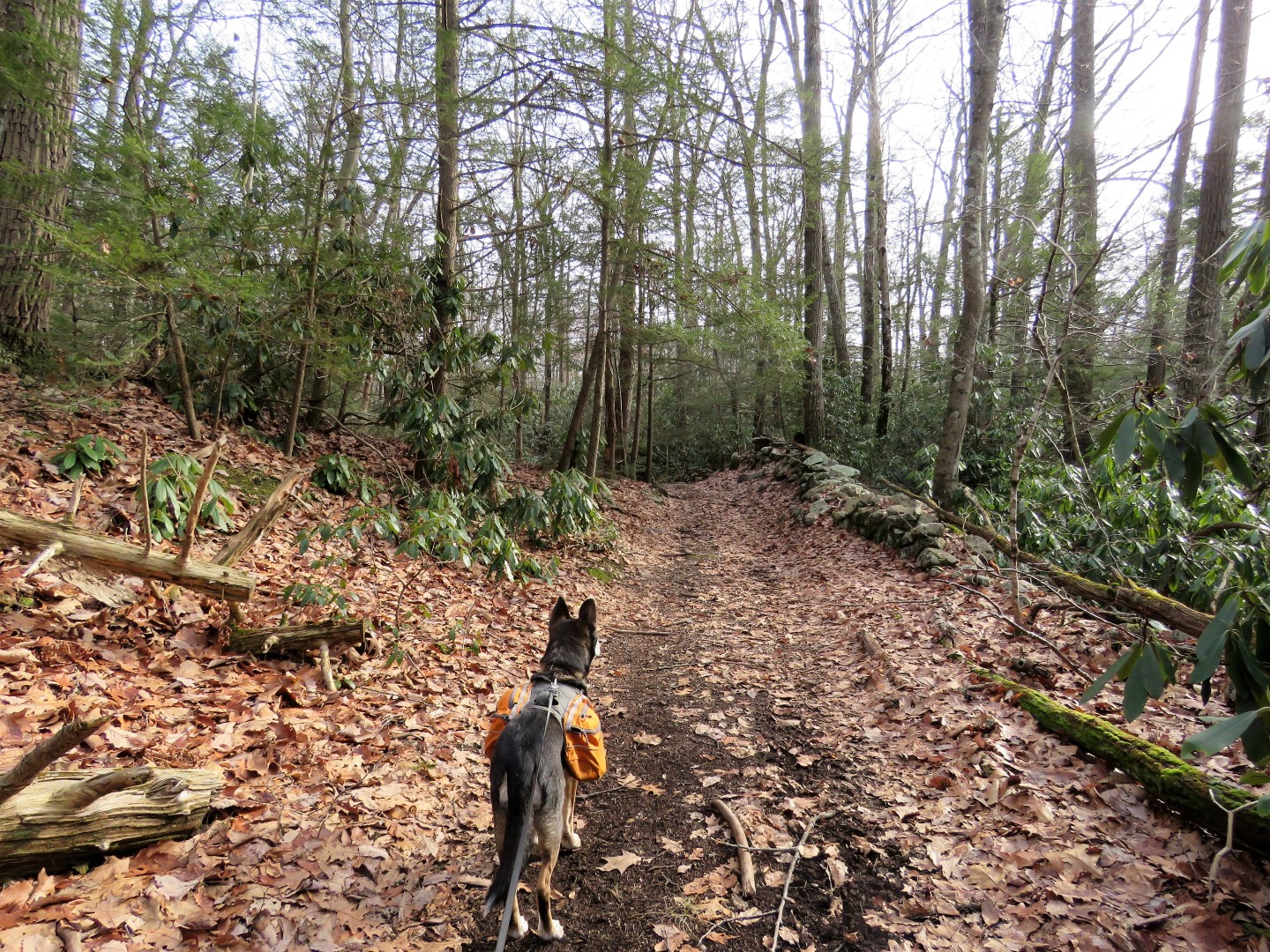
 |
| Heading south on the Appalachian Trail from Warwick Turnpike. |
 |
| Coming up on ... |
 |
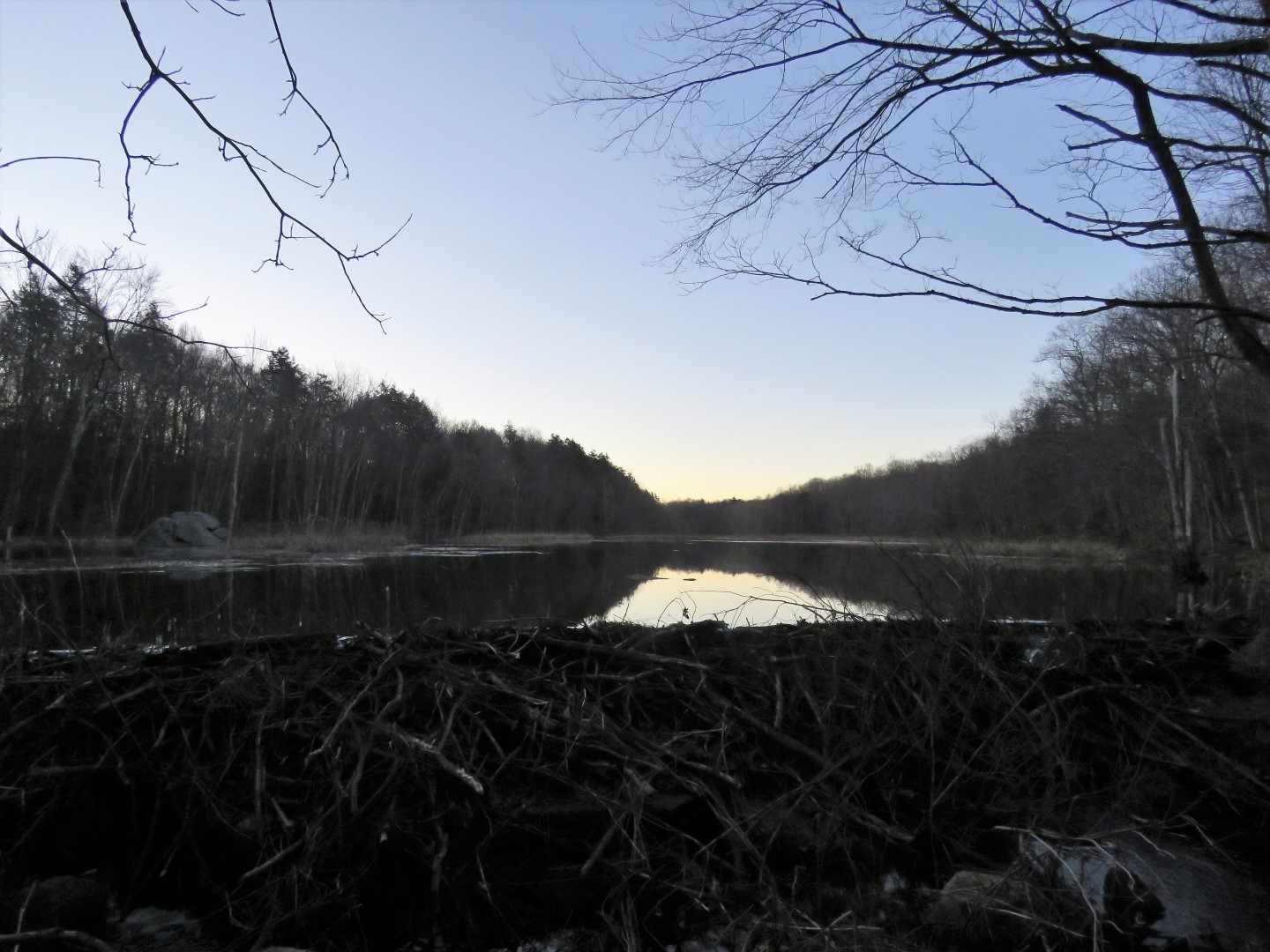
| Parker Lake |
 |
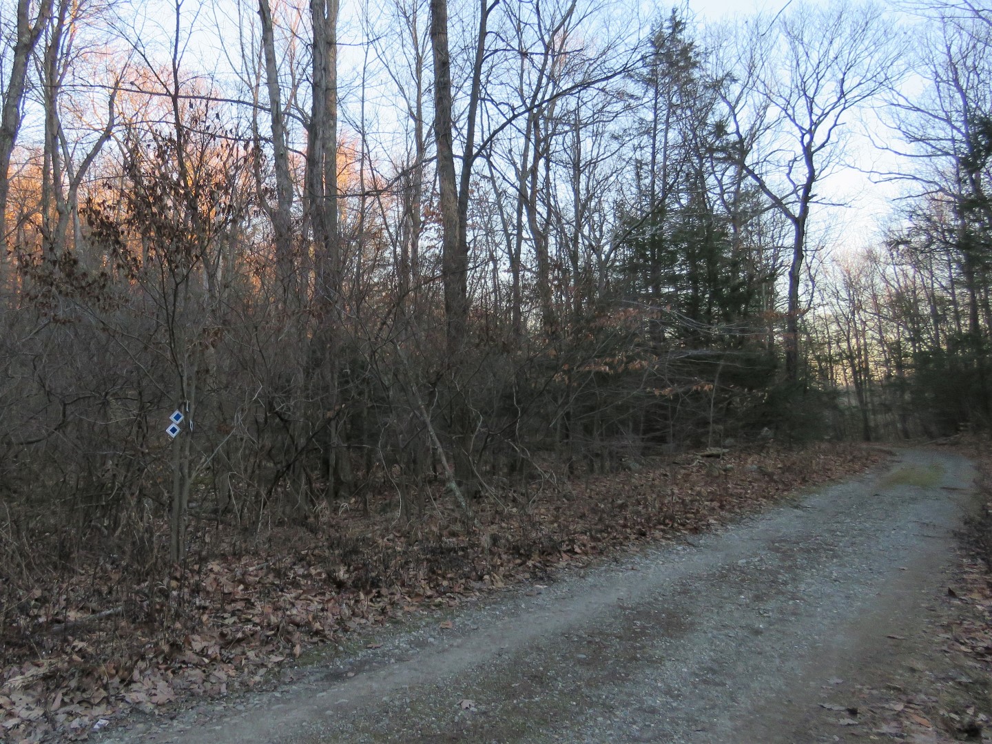
| Right on the blue-blazed William Hoefferlin Trail which starts as a woods road ... |
 |
| ... then turns right on a gravel road. |
 |
| The trail veers left on the gravel road at the Old Wawayanda Road sign - we'd be coming back here after looping around Wawayanda Mine in bit. |
 |
| Leaving the gravel road on a path along a creek. |
 |
| At the point where the trail is closed (beyond this point there would not be much trail left anyway) we turned back. |
 |
| We made our way over to another path I had seen on the way out along the creek. |
 |
| This looped around Wawayanda Mine ... |
 |
| ... and ended up back at the Old Wawayanda Road sign where we continued straight on the blue trail. |
 |
| The blue trail ends ... |
 |
| ... at the Iron Mountain Trail. It dead ends to the right; we turned left. |
 |
| Ruins of something along the way. There were two of these. |
 |
| The AT joins in from the left - we would be returning to this point after finishing the loop. |
 |
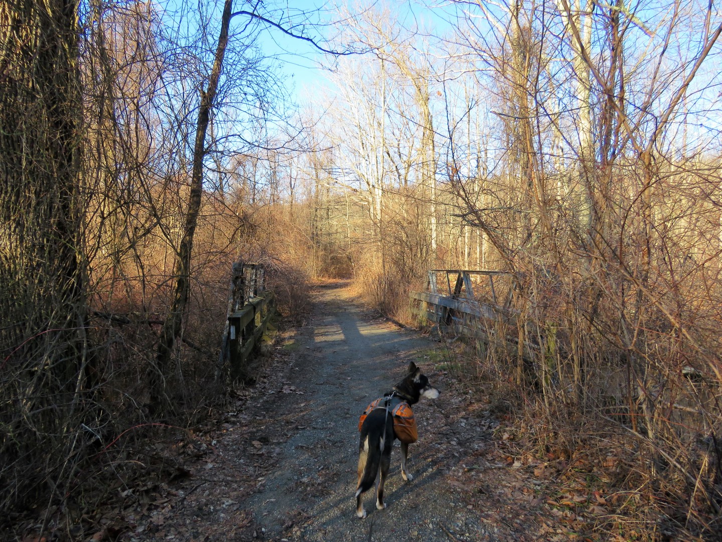
| A short distance along Iron Mountain/AT, an old bridge crossing... |
 |
| ... over Double Kill. |
 |
| At a very wet section, the Iron Mountain Trail turns left, where we would be returning from later, and we continued on the AT straight ahead. |
 |
| Coming up on the Barrett Road crossing. |
 |
| Steep descent to ... |
 |
| ... a bridge over a creek with pretty cascades. |
 |
| Uphill after the creek back to the top. |
 |
| Making note of the trail to the left at the AT register. This is the unmaintained trail I would be taking but since we were so close, on to Pinwheel Vista first. |
 |
| Descending on stone steps ... |
 |
| ... then right on blue at the large rock pile. Straight ahead descends Stairway to Heaven which is hugely popular. Very few approach from our direction because it is a much longer route to the overlook. |
 |
| It was loud here with people sitting everywhere and chatter and laughter, even on a 27 degree winter day. Not my idea of a peaceful hike so I snapped a few picture and we headed back. Little did I know I would be coming across a much better unknown overlook pretty soon. |
 |
| View from Pinwheel Vista. |
 |
| Left on the AT at the huge rock pile ... |
 |
| ... and back up to ... |
 |
| ... the AT register where we turned right on the unmaintained trail. |
 |
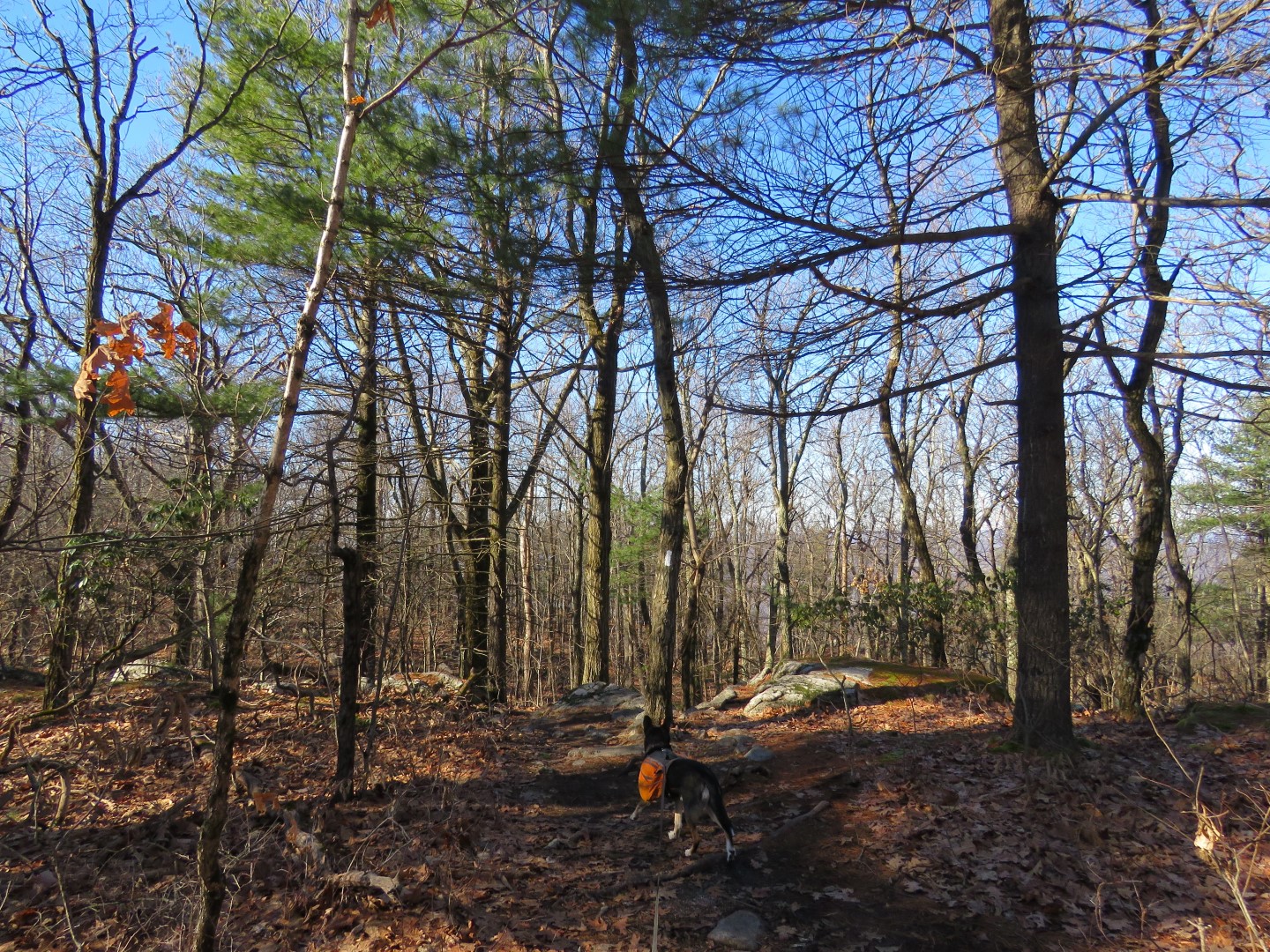
| It was actually very well defined and easy to follow. |
 |
| On the Gaia app it is called the Blue Trail and indeed, there were remnants of old blue blazes. |
 |
| This goes all along the ridge of Wawayanda Mountain. |
 |
| Nice winter views along the way. |
 |
| The trail became hard to follow so I referred to the app and found it descended to the left. Once I made the left turn the blue blazes were much more plentiful so it was easier to follow the blazes than the trail. |
 |
| The trail goes along a swamp then ascends steeply back up to the ridge. |
 |
| More winter views.... |
 |
| ... then completely unexpected when we veered right off trail to a clearer view ... |
 |
| ... we found a wide open view which was even better than Pinwheel Vista and it was completely quiet and peaceful. I would have skipped Pinwheel Vista had I known. |
 |
| You can see High Point Monunment ... |
 |
| ... and the Gunks. |
 |
| We continued on the trail descending Wawayanda Mountain. After rock hopping over a few creeks ... |
 |
| ... it's all woods road the rest of the way. At a 4-way interesction, we turned left on an unmarked woods road, leaving blue which continued straight. |
 |
| Unfortunately there are signs of ORV use along there. |
 |
| Passing a swamp on the left ... |
 |
| ... with some ruins on the right. |
 |
| Got a lung full of exhaust from this. Grrrr. Fortunately it was the only one I encountered. |
 |
| This woods road comes out on Wawayanda Road where we turned left. No wonder there is so much ORV usage - the woods road is not gated. |
 |
| This road is pretty busy and cars zoom by well in excess of the 35 mph speed limit. It's about a 1-mile road walk to make the loop. |
 |
| At the guardrail there is not much room to walk so you really have to hug the guardrail and hope nobody comes flying around the bend. |
 |
| Where the busy road turns left (and I did not see anyone stop at the stop sign coming from the left) we crossed very carefully and quickly to continue to the right on a much quieter road ... |
 |
| ... that leads directly to the auxiliary entrance of Wawayanda State Park. |
 |
| Just after the "parking regulations strictly enforced" sign on the right ... |
 |
| ... left on a trail into the woods. |
 |
| At the fork we veered left. Straight ahead leads to a parking lot. |
 |
| This unmarked trail is clear throughout and we ran into a couple of other people on it. |
 |
| Left on the park road for a short distance ... |
 |
| ... then left on Iron Mountain. |
 |
| Some horses on the trail and there is lots of evidence of horse usage along this route. |
 |
| At the wet section the AT comes in from the left. We turned right ... |
 |
| ... back over the old bridge ... |
 |
| ... then right on the AT where it leaves Iron Mountain. |
 |
| Now it was the AT all the way back. |


Hi Daniela -- loved the shots of Pinwheel Vista (especially from the "not-so-crowded" spot)! And the rock pile reminded me a little of Jemima Mount in Wharton SF (South Jersey, of course)...albeit without the ATV "gashes"/tracks up the main side of the mount. Finally, I loved the comment regarding Iron Mountain... "lots of evidence of horse usage along this route..." Ehh, I think I *might* just know what you mean [and I'll leave it at *that*!!!] As always, great pix, and I cannot wait until your next endeavor!
ReplyDelete-- Jim
Thanks, Jim, and yes, you know exactly what I meant, LOL.
DeleteWhat a great hike! Thank you for sharing. I almost went down that "blue" trail years ago when I was exploring in high school, but it was summer and way too overgrown. I'll have to check it out!
ReplyDeleteSame here. I tried once in early fall when I came up Stairway to Heaven and didn't get very far because of overgrowth but it was completely clear this time of year with lots of winter views along the way. Definitely worth checking out!
DeleteHappy new year mates!!!
ReplyDeleteNuk
Happy New Year!
DeleteI combined this western ridge bushwhack with a 3/4 lake loop across the street. Blue trail 100% south from AT has some amazing vistas completely free of Stairway to Heaven crowds. My only gripe is traffic on Route 94 below still audible above, so while it's breathtaking, I didn't want to stick around.
ReplyDeleteAt that ruined chimney, that rusty bed frame was standing up on its end when I passed by. Then, I got lost in some woods roads trying to cross the swampy part to the Orange trail. For a Lake Loop, there aren't many views of said lake, and so buggy!
There is a pond or lake on the western ridge I have my eye on that appears completely isolated which I plan to bushwhack in the winter since no trails go close to it.