ABOUT THE PARK:
DIRECTIONS:
GPS Coordinates 40.500701, -74.276635
 |
Public parking lot at the far western end.
|
TRAIL MAP:
None
HIKE DISTANCE: 2.8 miles (1.4 miles each way)
THE HIKE:
On a long awaited gorgeous, sunny, 51 degree day in the middle of the week, a long lunch hour was in order.
 |
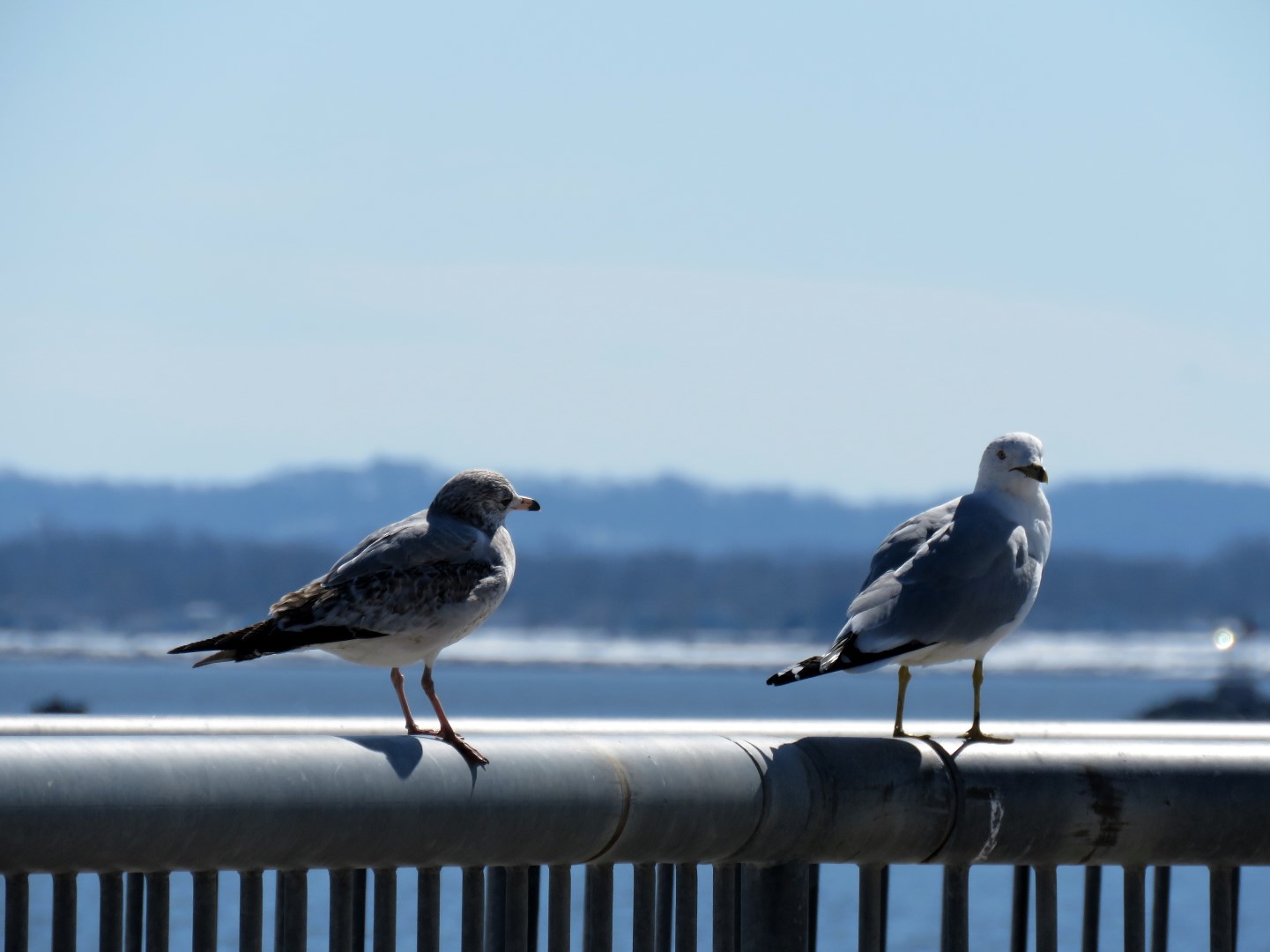
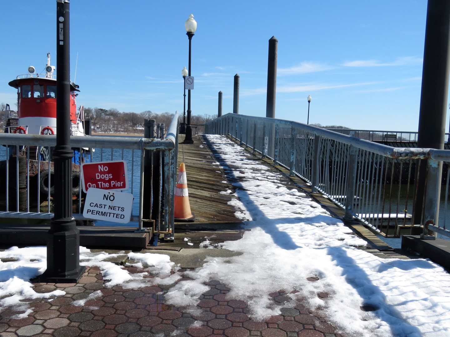
We went out on the first pier where apparently dogs are allowed because there was no sign. Dogs are not allowed on the other two piers along the way.
|
 |
Perth Amboy Wildlife
|
 |
The walkway splits and we intended to loop back from the left but it turned out to be too icy that way.
|
 |
The back of a Veterans Memorial.
|
 |
The would be that Great Beds Lighthouse across the Raritan Bay.
|
 |
Another possibility to loop a section when the upper level is not icy.
|
 |
Raritan Yacht Club
|
 |
No dogs allowed on these piers.
|
 |
This would be the end where we tried to loop around but ran into ice.
|
 |
There were some clear steps to the upper level so we gave that a try.
|
 |
You can see three different levels - the highest where we were and one on either side of the parking lot - some options when everything has melted.
|
 |
Heading back down.
|
 |
Back at the parking lot.
|


I was born and raised along the Raritan Bay further south. As a kid, the bay froze over a couple times. You could see the wave action slowly move the ice up and down. Along the shoreline the broken up ice was almost 2 feet thick. The cross on the lighthouse is new to me, but I haven't been to Perth Amboy in probably 25 years. We went to church on High Street not far from what we called the Tottenville Ferry which we would take occasionally after church. The ferry was an open deck affair that would hold just a few cars as I recall. The waterfront in Perth Amboy was so much different from the rest of the town.
ReplyDeleteThe Victory Bridge was a flat bridge in the 50's thru 80's with a turntable thing back in the day to allow Hess coastal tankers through to the terminal. I don't ever recall ships going further upstream even though the Parkway & Edison Bridge are accommodative. Maybe after WW2 and into the 1950's when the Raritan Arsenal was operational. Today the Arsenal is a large warehousing facility and the Middlesex County College occupies the original Arsenal HQ since 1964. The warehousing facility which occupies the low land came much later.
ReplyDeleteLike I said I haven't visited Perth Amboy in awhile but have passed by on either the Rt 9 "Edison Bridge" or the Parkway bridge. In 1979 I lived a block from the waterfront on Madison Avenue for a short while and my daughter was born there on the 3rd floor. But that's a story for another day.
So interesting! Thanks for sharing. The waterfront is still much different than the rest of town.
DeleteI love to do what I call "Urban Hikes". When I did this one, instead of doubling back I looped thru the city. There are several historic sites and markers that made the walk interesting.
ReplyDeletePS: Great to see you "hiking" again. A few other level similar waterfront "hikes" you can do are the Weehauken waterfront and promenade, the Bayonne waterfront, and the paved walkways along the river in Hackensack near Fairleigh Dickenson University.
Thanks for the recommendations, Ken! I do hope to be back to trail hiking (still easy ones) as soon as this snow melts. My physical therapist is glad all this snow has held me back, LOL. But I think I am ready now to kick it up a notch.
Delete