

Blue Marsh Lake - US Army Corps of Engineers
DIRECTIONS:
GPS Coordinates 40.37274, -76.00872
 |
| Rebers Bridge Parking Area |
TRAIL MAP:
Blue Marsh Lake Trail Map and Guide - US Army Corps of Engineers
HIKE DISTANCE: 10.4 miles
THE HIKE:
 |
| From the parking lot left on Rebers Bridge Road over the grated bridge. Brodie wasn't fond of walking on that but he did it. |
 |
| Just after the bridge left on the Rebers Bridge Connector Trail. |

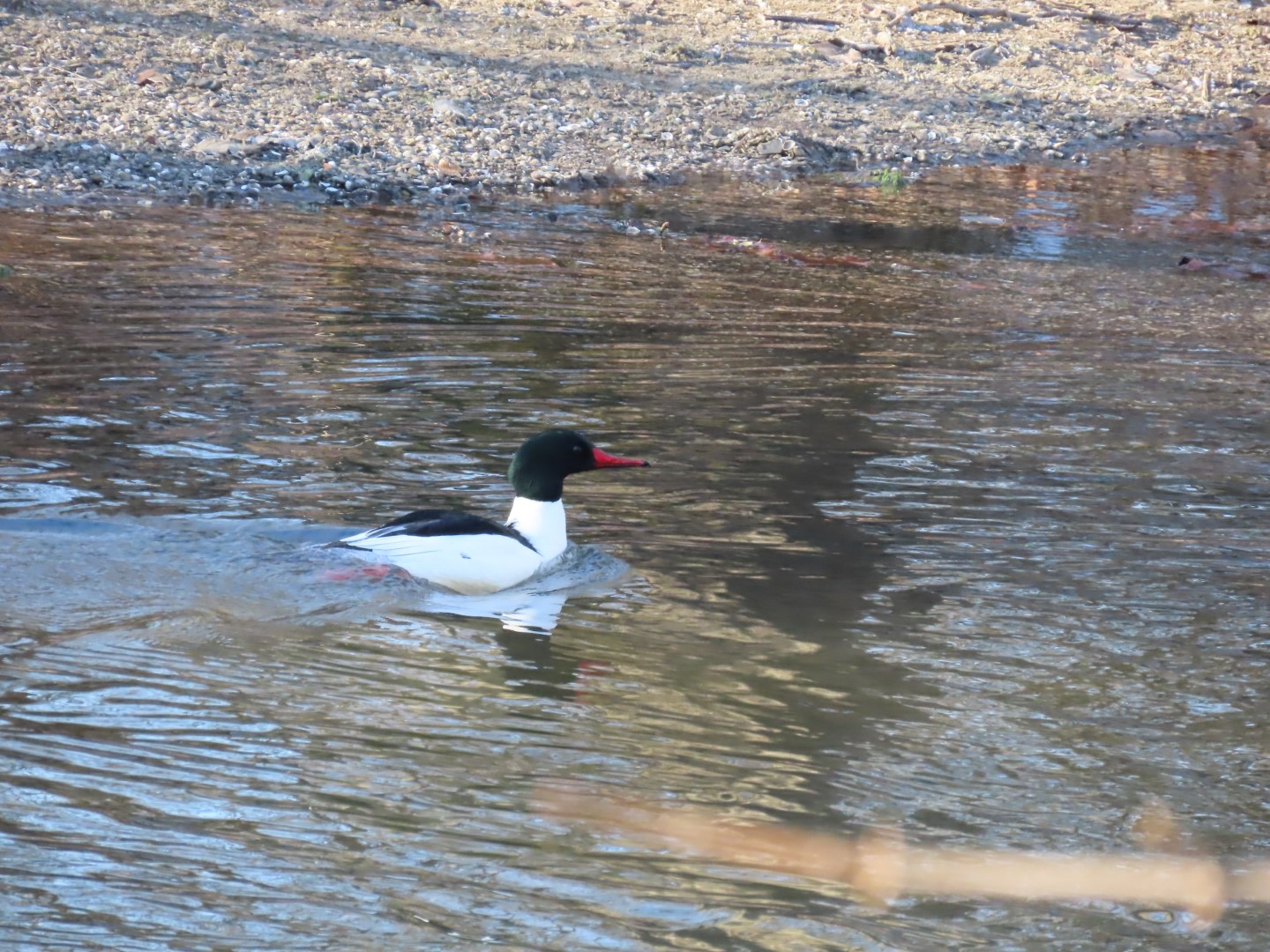 |
| A Common Merganser in Tulpehocken Creek. |
 |
| The trail follows along Tulpehocken Creek for a bit. |

 |
| Swiftwater Lane parking area, an alternative to where I parked at Rebers Bridge. Parking here would make this hike about 2 miles shorter. |


 |
| This female Northern Cardinal was posing nicely. Her husband, however, was very shy but I could see some if his red feathers in his attempt to hide in the more dense part of that tree. |

 |
| Crossing through the Stilling Basin parking area. |
 |
| Eastern Bluebird |


 |
| Coming up on Dry Brooks Boat Launch. |

 |
| Views of Blue Marsh Lake along the way. |

 |
| After the last two hikes on solid ice, seems Brodie has taken to ice hiking because while I was off the ice, he was on it. |

 |
| Taking a short trail to the lake. |
 |
| Frozen Blue Marsh Lake |
 |
| I was going to walk along the lake instead of going back up to the trail until Brodie snarfed something down. I have no idea what it was but back to the trail we went. You would think the darned dog gets nothing to eat at home. |


 |
| There are a few more opportunities to leave the trail for lake views. |


 |
| I should have turned right at the top of this hill but I missed the turn. It was actually impossible to see going in this direction. |
 |
| Having missed it, I came up on some nice views before I realized what happened and headed back. |


 |
| Back on the trail connecting over to ... |
 |
| ... the trail along fields. |


 |
| Bats roost in this barn. |
 |
| Taking a detour around the visitor center. (Those knots in the leash are because the retracting mechanism broke. They last a few years so time for a new one.) |
 |
| Lake view from the visitor center. |
 |
| We had come in from the left, now turning right on a trail to Stilling Basin. This will loop around and connect back to where we need to be. |


 |
| Back to the connector trail. |


 |
| Across Rebers Bridge Road is the Berks County Union Canal Trail where dogs are not allowed. |
 |
| For us it is right on Rebers Bridge Road back across the grate to the parking lot. |

No comments:
Post a Comment