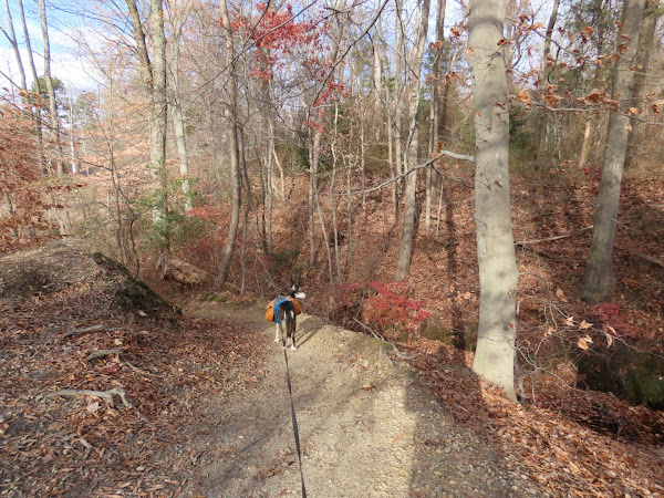
ABOUT THE PARK: There are two sections of park separated by Chestnut Branch. From what I read on mountain bike forums, there used to be a connecting bridge around 2007 but it seems that is gone now. Others who have crossed over from one side to the other apparently use the Route 55 overpass. I hiked this as two separate sections, driving from one to the other.
DIRECTIONS:
GPS Coordinates 39.74846, -75.14693
 |
| Parking Lot off of Main Street |
TRAIL MAP: 
This hike is the orange track.
HIKE DISTANCE:
Hiked together, all a 5 - 10 minute drive apart:
Ceres Park, NJ - 1.5 miles
THE HIKE:
 |
| Starting at the gate ... |
 |
| ... then right on yellow a short distance in. |
 |
| Yellow joins with red ... |
 |
| ... then leaves to the right. |
 |
| Marl Lakes - blue-green algae? |
 |
| This is where yellow ends but going around the lake to the left ... |
 |
| ... a wide woods road heads back. |
 |
| Taking a trail to the left... |
 |
| ... to Cedar Lake. |
 |
| Emerald Lake |
 |
| The trail loops around Emerald lake. |
 |
| Passing by Cedar Lake down on the left. |
 |
| Back to the parking lot. |


So neat to see that you were in my neighborhood. There used to be a very wide log connecting the 2 parts of Ceres, and this summer with no rain walking across the creek was easy. As you may know, Rowan's new fossil park will open just across the way in March and will eventually have its own 3 miles of trail. There’s a great history of the area here if you haven’t seen this: http://thisweekinmantuatownshiphistory.blogspot.com/2019/05/ceres-park-and-gardening-of-state.html
ReplyDeleteIt was 4 degrees warmer in your neighborhood so that was the deciding factor, LOL. My daughter-in-law had just sent me something about that fossil park last week and when I was looking at my track in Gaia I saw where that was so close to where I had been. Will definitely have to go back and I want to hit those Wenonah Trails also. I can certainly make another day out of it to warrant the hour and a half drive. Thanks for the info!
DeleteThe fossil park will have lots of cool kid stuff: digs for 65 million-year-clams and oysters, a playground, and the life-size indoor dinosaur replicas.
DeleteHi Daniela -- glad to see you back in South Jersey, and excellent choice(s), with this park and Tall Pines. I visited both places in July 2017; I don't remember the trail markers in Ceres back then. But the trails are fairly easy to follow; I don't think you did the one that goes by the (Chestnut Branch?) Creek, but it's pretty neat going under Route 55 and out to Main Street. (Actually, I think this trail leaves the park at some point.) But great pix as always!
ReplyDeleteLooks like I'll be back in the area to see the new Fossil Park next year (thank you for the info, "Anonymous")...cannot _wait_ to see it!
I've also been to the Wenonah trails (both "East/West of the tracks", as South Jersey Trails put it.) You will not be disappointed if you go! :)
As always, happy hiking, and I'll be on the lookout for your return to South Jersey!
-- Jim
Hi Jim! Always thinking about you when I am in South Jersey. I did both sides of Ceres but drove from one side to the other. I didn't realize that I could have actually walked to the Wenonah Trails from Tall Pines until I saw it on the map when I got home but then I would have missed Ceres so yes, I will just have to go back again!
Delete