ABOUT THE PARK:
DIRECTIONS:
GPS Coordinates 40.96266, -74.45756
 |
| Splitrock Reservoir Parking Lot |
TRAIL MAP:
HIKE DISTANCE: 11 miles
THE HIKE:
- I did a version of this hike July 2010 when the trails were poorly blazed and incredibly hard to follow but the walk on the old dam on Split Rock Road offered great views of the reservoir.
- I did another version of this hike August 2019 after the trails had been mapped and reblazed and the new dam, one lane with chain link over the views, was constructed.
- Now going back to do it a bit differently again, avoiding the narrow dam which is probably dangerous to be on with traffic. The parking lot had been enlarged since I was there 5 years ago.
 |
| Turning right out of the parking lot on Split Road Road, I took the first left on a narrow unmarked trail into the power cut. |
 |
| This goes steeply downhill on loose rocks which is like walking on marbles and can cause an uncontrollable fall resulting in a busted up elbow. Just sayin'. |
 |
| Not sure what this ruin is but it leads to ... |
 |
| ... Split Rock Furnace |
 |
| To the left the new dam with construction debris? |
 |
| We followed a wide, smooth unmarked path along Beaver Brook. |
 |
| The green Righter Mine Trail comes in from the left. |
 |
| When green turns left, right on the blue Splitrock Trail... |
 |
| ... to the bridge over ... |
 |
| ... Beaver Brook. |
 |
| A bunch of baby turkeys took off into the trees. |
 |
| Mama turkey was on the trail anxiously calling them so Brodie and I stepped out of sight for a bit until she had gathered the children and departed into the woods. |
 |
| At the end of blue ... |
 |
| ... right on the white Four Birds Trail. |
 |
| On this day it was more like the Eight Birds Trail. In this spot the Merlin Sound ID app picked up: Yellow-throated Vireo, Tufted Titmouse, Worm-eating Warbler, Field Sparrow, White-breasted Nuthatch, Red-eyed Vireo, Prairie Warbler, Indigo Bunting |
 |
| Back through the power cut. |
 |
| Blueberries |
 |
| Coming up on Split Rock Road ... |
 |
| ... where we veered left then turned right. |
 |
| At this point we had already logged 2.1 rugged miles and the ruggedness is just beginning. |
 |
| There are some stretches of smooth trail but then back to ... |
 |
| ... rocks, rocks, rocks ... |
 |
| ... up, up, up. |
 |
| More and more rocks ... |
 |
| ... and more uphill climbs (alternating with steep downhills, of course). |
 |
| The first overlook. |
 |
| I love how they hover when I am on a steep downhill. |
 |
| My favorite mosquito killing machines. |
 |
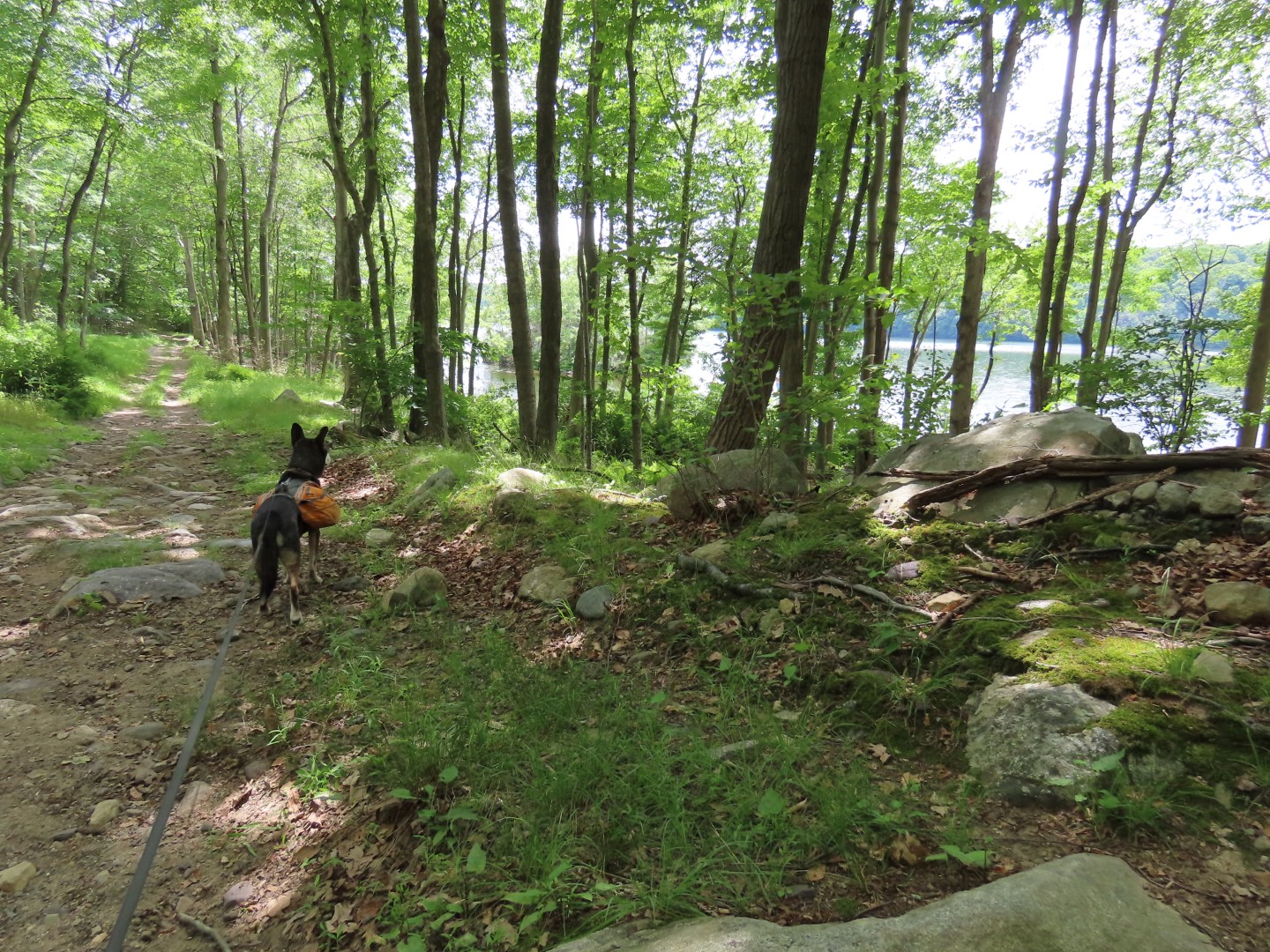
| Finally coming up on views of the reservoir. |
 |
| Coming off of one of the rock outcrops at the reservoir, along came a huge hiking group of about 30 people playing music and yelling over the music to be heard. It was a total disregard of group hiking etiquette. Shame on the leader for allowing this. |
 |
| I was so relieved that they continued straight on the Four Birds Trail when I turned right on the orange trail. |
 |
| But then I heard them louder again. Was I hearing them from over on the Four Birds Trail? |
 |
| No, they turned back and decided to take the orange trail and were coming up behind me. It took forever for all of those people to pass. |
 |
| They were so incredibly loud and disruptive and the noise was not out of earshot. |
 |
| Coming up on the reservoir I spotted a downed tree ... |
 |
| ... where we sat to take a break to wait for that crowd to get away and for the noise to subside. It turned out to be the best break spot ever. A great view, a comfortable log, and the most heavenly breeze. Thanks obnoxious hiking group for forcing us into this break spot. We stayed well after that group was long gone. I could have sat there all day. |
 |
| But continue on we must. |
 |
| We turned right on Charlottesburg Road when orange continued straight. |
 |
| This road had lots of ORV damage. |
 |
| We turned right on blue when it crossed over from the left. |
 |
| Blue rejoins Charlottesburg Road and follows that route for a while. |
 |
| We did not take blue to the left when it went off into the woods because that would have been more uphill and downhill and I just did not have any more in me. |
 |
| The last time I hiked here I took blue on the right when it crossed over from the left and it followed the reservoir all the way to Split Rock Road. |
 |
| This time we lost the trail in a swamp and there were no blue blazes to be seen so we backtracked to the road. |
 |
| At the Charlottesburg Road gate we continued straight on a gravel road. |
 |
| Up ahead when the gravel road bends left, we turned right on another gravel road. |
 |
| This road has private property on the left, WMA on the right. |
 |
| It comes out at Split Rock Road where we turned right. |
 |
| Passing by blue on the right where we would have come out had we been able to follow it. |
 |
| Back at the parking lot. |


This is right in my backyard. I’ve lived in Rockaway since 1979, and it took me years to discover the reservoir. When my husband and I started hiking, we tried going around the reservoir, but could never find the trail on the right. But we often just hiked partway along, and also started off Greenpond Rd. Almost to the end, which brought us to the upper end of the reservoir. Definitely a great area to hike. Also, there is so little traffic, that we never hesitated to walk on the dam.
ReplyDeleteYes, that right side has always been dicey. I know it was reblazed several years ago but I never have enough energy to try the left side of Charlottesburg Road when I get around to that point. Blue leaving the to the right was fine 5 years ago but I guess nothing has been done with it since. Do you mean the old dam? The old one was fine to walk on but this new one I find a bit scary. It curves to where you can't see cars coming and they can't see you and it is so narrow. On this hike there was already a car coming in behind me driving over the dam at 6:45 AM and while I was in the parking lot three more cars drove over.
DeleteYes, I mean the dam - as far as I know there’s only one. Nothing scary about that to me, you can’t really speed on it, and you hear cars coming, But I just realized that you’re not alone. That does make a difference.
DeleteYes, there is only one dam. The new one replaced the old one that was wide open not closed off like the current one.
DeletePicture of the old one: https://blogger.googleusercontent.com/img/b/R29vZ2xl/AVvXsEglpdlWWmDkvblkzCY0KQR0eJGCqfDD5HkoH0-MTYf1-8U-fELONYHMORuo7aefIazXzdJiS0dgwrONsEl3yo4VKK-b8_62BZ21A8etjkcImnqdRfgNS5Pb7qTsVEwpJvFCTJG-BxquUxoX/s1600/dam.jpg
Picture of the new one: https://blogger.googleusercontent.com/img/b/R29vZ2xl/AVvXsEiOJjuNsArmDPVI7bX6RK9JwwznHX4xWM-YBe6y57ifCjhRF9r2Zok1MR-nAKH09RHZI8p2qHBk9p8sJMPLhbH9BLOBNkWicU0-JbrjXdWJfiN5HLtjtd-VxcFWkJ7srP8aGNdTJpo3DPQ/s1600/IMG_4979+%25282%2529.JPG