ABOUT THE PARK:
DIRECTIONS:
GPS Coordinates 41.04943, -75.37009
 |
| First parking lot on the right side of Camelback Road. I had intended to park in the second lot at the top of the mountain but there was a man sitting in a pickup truck staring at me when I pulled in. It gave me a really creepy feeling so I went back to the lower parking lot, which actually turned out to be better for this particular hike. |
TRAIL MAP:
There really is no good map. Gaia shows some trails, the USGS Pocono Pines quad map shows some, there are more than what is shown in either place and some that are shown are completely overgrown. So basically, you need to approach with a general plan and adapt as you go along.
 |
| USGS Quad Map with some labels added in. |
HIKE DISTANCE: 11.1 miles
THE HIKE:
A lot changed in the 10 years since I last hiked here. Back then I ran into a local man at Wolf Swamp and he showed me some "secret" mountain bike trails that had recently been constructed. He later mailed me a hand drawn map of the trails and I always intended to go back and check them out. Would they still be there 10 years later? Secret trails tend not to get much traffic and become overgrown rapidly. The trails were not on Trailforks, a mountain biking app, and I had thought that 10 years later they would be. Some are on the Gaia app.
 |
| Starting at the gate from the parking lot ... |
 |
| ... left into a power cut. |
 |
| Right into a wider power cut. |
 |
| To the left at the top is where the hike would have started had I parked at the upper lot. There are nice views down the power cut from up there. But you really don't want to have to hike back up there at the end of a hike because it is way steeper than it looks. Because of the way this hike unexpectedly turned out, had I parked up there, I would have had to have hiked up at the end. |
 |
| From this lower level, not so much of a view. |
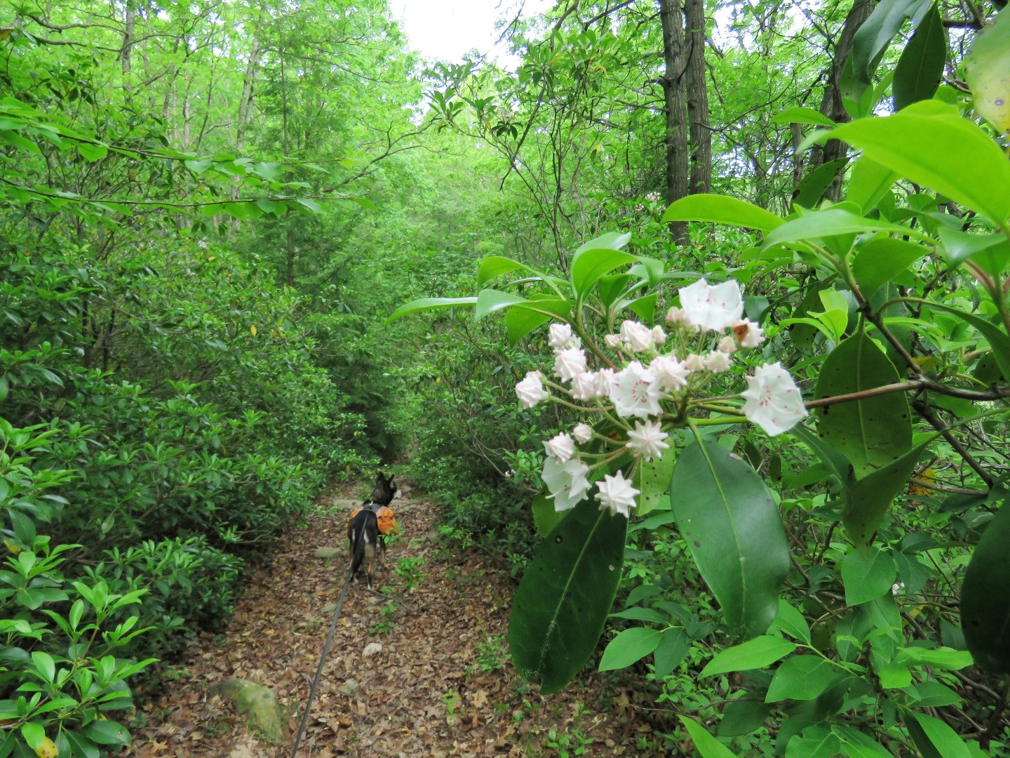
 |
| But there is a ton, and I mean a ton, of mountain laurel which had just started to bloom. |
 |
| The gravel road in the power cut veers left ... |
 |
... on an old railroad grade which doesn't look much like it did in the inset from 2012, amazingly taken in the exact same spot. Note how the trees on the left match.
|
 |
| Nope, not looking the same at all. |
 |
| Turns out it has been widened into a construction access road. |
 |
| So sad. |
 |
| I was not able to tell what this construction was for but it goes all the way to Spring Lake |
 |
| I found a trail that runs along Spring Lake. It is not on any map but it is clear and easy to follow. |
 |
| Crossing Sand Spring Run was challenging. There was no way to rock hop and I did not want to get my shoes wet this early on so I changed into water shoes and forded over. |
 |
| Sand Spring Run |
 |
| The trail goes all the way around the lake back to ... |
 |
| ... the construction site. |
 |
| Spring Lake - pretty without the construction mess. |
 |
| I had wanted to get over to the blue line which was my planned route but the mountain laurel and rhododendron was so thick it was not possible. |
 |
| So backtracking a bit to the first right. |
 |
| This becomes a nice, pleasant grassy woods road, sometimes alternating with rocky and muddy sections. |
 |
| Ten years ago I turned right just before Deep Lake to get to Sand Spring but it was not possible now as the entire woods road was a swamp and impassible. |
 |
| So we continued on to a side path over to Deep Lake. |
 |
| Deep Lake |
 |
| Continuing on and keeping to the right at intersections heading towards The Knoll. |
 |
| I couldn't remember which was it was so I went to the right first. |
 |
| There was a snippet of a view between the tree branches but it was not the correct way to I headed back to that intersection and took the left fork. |
 |
| This comes to a clearing where a woods road goes left and a path straight ahead leads to ... |
 |
| ... The Knoll. The inset is from 2012. |
 |
| Back in 2012 there was a nice view. There is no more view now. |
 |
| Back to that clearing and now a right. |
 |
| A little bit of a view from the clearing. |
 |
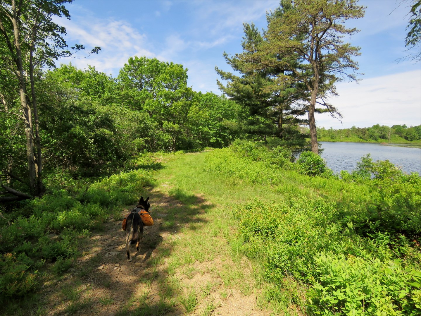
| This woods road leads to a very pretty unnamed lake. |
 |
| I had never seen so many dragonflies at one time. It was like walking through a field of fireflies. The good news is they are the mosquito's worst enemy so where there are dragonflies, there are no mosquitoes. |
 |
| We continued on and turned left on the first grassy road which runs along the state game lands boundary but is not on any maps. |
 |
| It comes out at a field where we kept to the right along the field. |
 |
| Cedar Waxwing |
 |
| A left on Deep Lake Road. |
 |
| That chunky, hard to walk on gravel ends at a huge puddle where some of that gravel could have been used. Beyond that it was much more pleasant grassy woods road. |
 |
| Back at the road where we had come in on heading to The Knoll, we turned right. |
 |
| Left at the number 18 post. |
 |
| Eastern Towhee |
 |
| Keeping to the left the woods road starts to follow along Wolf Swamp. |
 |
| There were a lot of wide, deep puddles but I was able to get around all of them. |
 |
| Regular size tadpoles in abundance in the puddles... |
 |
| ... along with ginormous tadpoles (bullfrog?). |
 |
| Some of each to show the size difference. |
 |
| Wolf Swamp with the communication towers on Rocky Ridge. |
 |
| Right across the Wolf Swamp dam. |
 |
| There were two Canada geese families with triplets out enjoying the beautiful day. |
 |
| Wolf Swamp |
 |
| Acadian Flycatcher |
 |
| Just before the bend in the gravel road from the dam ... |
 |
| ... an entrance to the "secret" trails on the left. |
 |
| Although vegetation was starting to encroach on the trail, it was still very passable and apparently has seen some light usage. |
 |
| There are even bridges across Wolf Swamp Run. |
 |
| Another bridge at the second water crossing but ... |
 |
| ... the third has no bridge, no rock hops, it's mid-shin deep so water shoes came into action again. |
 |
| A makeshift bridge at the 4th crossing. |
 |
| In the area of that makeshift bridge the trail turned left but I did not want to go that way because I could tell it headed back to Deep Lake. I searched to the right and found a faint, pretty overgrown trail but that is the direction I needed to get to the waterfall in Wolf Swamp Run so we gave it a try. |
 |
| I came across a little more distinct of a trail that turned sharply right when I could hear the waterfalls. |
 |
| This trail led down to the waterfalls but ... |
 |
| ... the wider trail on the other side of the falls where we needed to be was not reachable. The falls were raging, it was a steep drop down and the rocks in the creek looked very slimy. I did not feel it was safe to even attempt so we went back to the overgrown trail and continued on. |
 |
This trail was taking us around The Beehive and would connect with the black dashed squiggly line. We never lost the trail but it was mostly very overgrown. The blue line was where I had wanted to go had I been able to cross at the falls.
|
 |
| Just beyond this large rock ... |
 |
| ... a right to retrace on the grassy woods road from the beginning of the hike. |
 |
| A jogger came flying around the bend which startled both of us. He said he never sees anyone and I had not seen anyone else the entire hike. This is the place to be for solitude. |
 |
| Back on the railroad grade ... |
 |
| ... to the power cut ... |
 |
| ... to a left at the smaller power cut. |
 |
| A little bit if a view before the right turn ... |
 |
| ... back to the parking lot. |
Wildflowers seen on the hike:


Men that stare at women and make them uneasy,especially in isolated places, shoudld be reported. IN Pa. probably to the state police. That way, even if nothing can be done, it will bring them to the attention of police and put such creeps on notice.
ReplyDeleteHi Daniela. Another ambitious hike. I had a similar experience on my hike at Ringwood State Park, the Skylands side. It has been at least 6 years since I hiked the trail to the beautiful mountain (1K) overlooking the NYC skyline. The trail conference completely rerouted the one section of the trails. It's all switchbacks, more to the liking of the bikers. It added extra miles to my hike with Abby. Everything looked different and the ponds were all overgrown. Now I want to hike the area of Awosting Reserve and follow the paths you and Brody took. Since you went in the winter the paths seems pretty clear. In your opinion, do you think the bushwhack trails would be overgrown in spots? I want to head up to Murray Hill like you did and take a break at the Lake. I am leaving Abby home because this side is very steep. My last visit there was Sept. of 2016. I want to look for Thoreau Falls. You had mentioned they were hard to photograph because of their location. I planned this hike for the Sunday, June 19. Thank you. (By the way, the dragonflies in your photo above are Chalk-fronted Corporal's)
ReplyDeleteHi Christine. I would expect that the bushwhack part would be pretty overgrown now as well as swampy. I do think, though, if you stayed left instead of going right (I had veered right thinking it was a better way and it turned out not to be), you should be on a more defined woods road meeting back up to where I came out of the bushwhack, which wasn't even all that easy in the winter. If you look at my track you can see on the bottom left where I went up and over and a woods road connects bypassing the bushwhack https://www.gaiagps.com/map/?loc=13.8/-74.2874/41.6887&pubLink=ObufslY07GI7GzSXRkyXgfBj&trackId=14bf8ec95dd2cfcd6dac615d475b091e. At least you won't have any ice to deal with! Let me know how it goes.
DeleteThank you. It’s suppose to be a beautiful day Sunday. I feel awful leaving Abby at home. This is the first hike without her. I’ll look at your map. I just received my new Nynj trail conference maps for the Shawangunks and Kittatinny. I’ll let you know how my friend and I do. Christine
Delete