ABOUT THE PARK: DIRECTIONS:
GPS Coordinates 38.98160, -79.23116
 |
| Room for 6 cars in the lot (I got the last spot at 7:45 AM) with more pull off parking along the roadside. |
TRAIL MAP:
HIKE DISTANCE: 7.5 miles
THE HIKE:
There are so many views along this hike and none of the pictures do them justice. Although there were many other hikers there, it's by no means crowded like Dolly Sods. Yet. When I researched this hike I read in older posts that the trail was hard to follow and not well marked and that Chimney Top was hard to find. Now the kiosk looks new, there are new trail markers, the marked trail is very well defined and easy to follow and Chimney Top is easy to find. Unmarked trails can be a little dicey but with some tracks loaded into my app I was able to follow them to additional overlooks and find my way back to the marked trail.
On a side note, we saw several people hiking with dogs, probably about 10 dogs total and 100% were on leash! These positive encounters helped so much with Brodie's reactiveness, a result of being charged by off leash dogs over and over again.
 |
| North Fork Mountain Trail northern trailhead. |
 |
| It is blazed with blue diamonds. |
 |
| The trail switchbacks up the mountain pretty gently most of the way. |
 |
| Nearing the top the trail becomes somewhat steeper and rockier. |
 |
| When the trail turns left, don't miss the first overlook at the end of the side trail to the right. |
 |
| View of New Creek Mountain |
 |
| Smoke Hole Canyon |
 |
| It literally feels like you are taking off in an airplane looking down at the little houses and cars. |
 |
| Looks like there was a little more fall foliage happening across the way in the Dolly Sods Wilderness Area. |
 |
| Continuing on the North Fork Mountain Trail, there are many, many side trails to the right for additional views from different heights and angles. The peek pictured here is our destination, Chimney Top. |
 |
| A view slightly more to the east showing the low clouds I had driven through on the way. I was worried the mountain would be fogged in but fortunately all was clear to the west of North Fork Mountain. |
 |
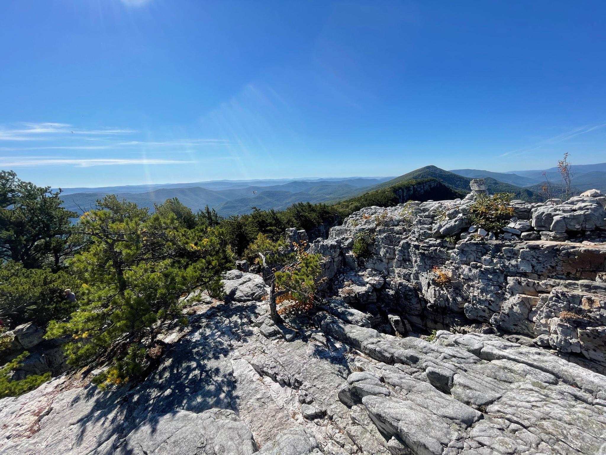
| The trail becomes considerably rockier and steeper. |
 |
| There is a cairn at the unmarked side trail to Chimney Top. |
 |
| This is the steepest section of the hike. |
 |
| Looking back at views to the east. |
 |
| Finally at the top where I parked Brodie off to the side in the shade with my backpack. I wanted to venture out onto the rocks without him first. |
 |
| Chimney Top |
 |
| Gorgeous rock formations. |
 |
| Another view of Chimney Top. People climb to the top from the backside. |
 |
| But I was going to be satisfied with views from where I was standing. |
 |
| People on top of Chimney Top towards the right side. |
 |
| Checking on Brodie before going around a different side. |
 |
| There were other hikers around so we were taking pictures for one another. |
 |
| The following five pictures are from the top of Chimney Top taken by another hiker and texted to me. I had taken pictures of them up on top from below and texted those to them. |
 |
| I retrieved Brodie and we continued on stopping at some other viewpoints. |
 |
| I think that couple on top of Chimney Top are the ones who texted me the pictures. |
 |
| It's from this point that everyone turns around and retraces back to the parking lot. |
 |
| Of course, we dare to be different so we continued on. |
 |
| Off on an unmarked side trail to a scenic break spot. |
 |
| It's here where the North Fork Mountain Trail continues on somewhat less defined than it has been up to now. That would be at the intersection with the Landis Trail which is to the left at this point. |
 |
| The Landis Trail is also blazed with blue diamonds. It heads downhill steadily al the way but never very steeply. |
 |
| At the end of the Landis Trail at Smoke Hole Road, another parking lot. We passed several hikers coming uphill from this lot towards Chimney Top, most likely also doing an out and back hike. That would be because it's an easier way up, although the climb is more sustained versus spurts of flat and steep like the way we came up and ... |
 |
| ... to make a loop you have to road walk 2 miles. |
 |
| I do not regret going this way at all. It's a pleasant road walk with great scenery. |
 |
| That peak is Chimney Top. |
 |
| Returning to where we parked there were more cars parked along the road. |
 |
| Thrilled to have been able to do grocery shopping at a West Virginia roadside farm stand on the way home. |


Absolutely gorgeous photos! Great views :)
ReplyDeleteThanks! But even better in person if you can imagine that.
DeleteThat's a great hike. There's another up the back side of Seneca Rocks as well.
ReplyDeleteLots of great hiking there. It is definitely worth the drive.
Delete