ABOUT THE PARK: Catoctin Mountain Park - National Park Service
DIRECTIONS:
GPS Coordinates to the Visitor Center parking lot: 39.633804, -77.449692
View Larger Map
TRAIL MAP:
The park service has maps and descriptions for hikes of various lengths here.
This hike is the 8-Mile Loop Trail.
HIKE DISTANCE: 8 miles
HIKE DESCRIPTION:
Facing the visitor center from the parking lot, turn right and head towards the hiking trail sign.
Keep to the right of the sign and follow the trail towards Chimney Rock as it winds through the woods parallel to MD77. At the next intersection, the trail turns left just before the park headquarters. Although the trail is not blazed, is it obvious and easy to follow.
From Chimney Rock continue on to Wolf Rock.
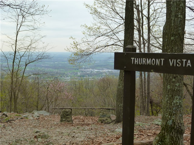
After Wolf Rock the trail levels out along the ridge of the mountain heading towards Thurmont Vista.
... then Hog Rock:
The trail then descends arriving at MD77. Cross over carefully (speeding traffic on this road) and follow the boardwalk into Cunningham Falls State Park for .20 mile to a viewing platform at Cunningham Falls.

 Return back to the other side of MD77 and continue following the trail parallel to MD77 back to the visitor center parking lot.
HIKE SUMMARY:
[ 0.00] Facing visitor center, turn right and at end of parking lot take trail to right of sign
[ 1.00] Turn left towards Chimney Rock when straight goes to park headquarters
[ 1.25] Trail switchbacks sharply to left
[ 1.60] At intersection turn left towards Chimney Rock (per sign)
[ 2.00] At intersection turn left towards Chimney Rock (per sign)
[ 2.05] Chimney Rock; retrace and go straight following sign to Wolf Rock
[ 2.50] Turn right to Wolf Rock at intersection; retrace and continue right on trail
[ 2.95] At fork go right towards Thurmont Vista
[ 3.60] Thurmont Vista on right
[ 4.00] Turn right to Hawk Rock at intersection
[ 4.70] Blue RIdge Summit Overlook
[ 5.20] Go through parking lot/picinic area, cross road and proceed on Hog Rock Nature Trail
[ 5.30] At intersection keep straight to Hog Rock Vista
[ 5.45] Hog Rock Vista; Keep straight towards Cunningham Falls
[ 6.40] Cross MD77 towards Cunningham Falls
[ 6.60] Cunningham Falls; retrace back to MD77
[ 6.80] Cross MD77 back to trail and turn right towards visitor center
[ 7.75] Cross footbridge; left through gravel parking lot; cross Park Central Road to visitor center
[ 8.00] Back at visitor center parking lot


I enjoyed your pictures. Did parts of this loop, and others in the Catoctin Park, in mid Sept. 2011 with my daughter. Also,had a great time camping in the Federal Park . Patti
ReplyDelete