ABOUT THE PARK:
Allamuchy Mountain State Park - Village of Allamuchy
DIRECTIONS:
GPS Coordinates 40.921180, -74.738480
View Larger Map
My GPS brought me in on Colonial Road. At the end of Colonial Road it told me to turn left then right - this is incorrect. At the end of Colonial Road cross straight over Waterloo Road and that is the parking lot for the Sussex Branch Trail.
TRAIL MAP:
The map put out by the State of New Jersey Department of Environmental Protection is the official map but it is pretty useless as it does not show unmarked trails and I did find an error on it. The NY/NJ Trail Conference will be putting out a new map set the end of April 2011 which will show the trails in this park. But for now, the best ever map is the "unofficial" map put out by JORBA - I found it to be completely accurate and easy to follow for the route I took.
Allamuchy Mountain State Park - North - JORBA
NEW JERSEY 1K CLUB HIGH PEAKS:
Allamuchy Mountain North
Allamuchy Mountain
HIKE DISTANCE: 10.65 miles
HIKE DESCRIPTION:
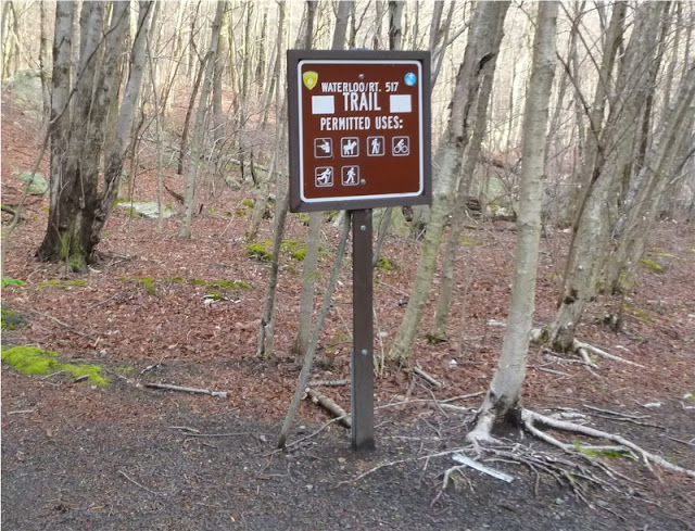
The hike starts on the Sussex Branch Trail, a rail trail, from the far end of the parking lot. After a very short distance, turn left on the white-blazed Waterloo/Rte. 517 Trail. A yellow-blazed trail merges in for a while before leaving again.
An unmarked trail called the Ice Cream trail is intermittently marked with old painted blazes and takes you to the summit of Allamuchy Mountain North.
 A view of the Delaware Water Gap and Kittatinny Mountains is reached from an unmarked trail:
As an alternate return route, the red-blazed trail comes out at Jefferson Lake across from the Sussex Branch Trail, a short distance from the parking lot.
HIKE SUMMARY:
[ 0.00] Start on Sussex Branch Trail at restroom for short distance then left on white
[ 0.20] Straight on white when unmarked goes left
[ 0.30] Yellow trail joins in from left; keep straight on white/yellow
[ 0.70] Straight on white/yellow when teal Highlands Trail crosses over
[ 0.80] Right at fork on white/yellow when unmarked goes left
[ 1.25] Right on white when yellow leaves to left
[ 1.35] Left on white when unmarked goes right, stay on white when passing other not well defined possible unmarked trails
[ 1.80] Left on white at fork when unmarked goes right
[ 1.90] Cross bridge; left on white when unmarked goes right
[ 2.50] White goes left when unmarked goes right
[ 2.55] Right on white when unmarked goes left (although there is a white circle marker on a tree to the left)
[ 2.65] At white turn blazes painted on tree to the right, turn left on unmarked trail following the painted blazes - this is the Ice Cream Trail - sign on tree to the left
[ 2.80] Trail splits, go either way but straight is shorter
[ 2.90] Trails merge back together and some faded white paint blazes are visible
[ 3.30] Summit of Allamuchy Mountain North
[ 3.40] Turn right at intersection on unmarked trail
[ 3.55] Turn left at intersection on unmarked trail
[ 3.80] Keep right at fork at old white metal diamond marker
[ 3.85] Keep left at trail comes in from the right; additional old white metal markers on trees
[ 4.30] Rock hop over stream; left on purple at intersection
[ 4.40] Straight on purple when unmarked comes in from right
[ 4.65] Purple turns right when unmarked goes straight
[ 5.00] Turn right on unmarked when purple goes straight
[ 5.05] Survey markers; summit of Allamuchy Mountain
[ 5.25] Straight at intersection on unmarked, not well defined trail (can turn right on more defined trail also to purple then left on purple)
[ 5.35] Turn right at T-intersection
[ 5.80] Other side of huge blowdown, left on purple
[ 5.85] Purple ends at white; right on white
[ 5.95] Stone building ruins on left
[ 6.45] White makes hard right when unmarked goes left
[ 6.50] Right on unmarked when white turns left towards creek
[ 6.65] Turn left on unmarked when unmarked goes right
[ 6.90] Short side trail to left to rock outcrop and view
[ 7.25] Left at fork
[ 7.50] Trail ends at white, turn right on white
[ 7.60] Keep left on white trail when Ice Cream trail comes in from the right
[ 7.70] Keep left on what at fork
[ 7.80] Right on white at fork
[ 8.35] Right on white when unmarked goes left; cross bridge
[ 8.50] Left on unmarked when white goes right; short distance ahead right at fork on unmarked (there is another trail to the right on the map at that intersection but I did not see it - could just be a poorly defined trail)
[ 8.65] Keep right at fork; few steps ahead right on red
[ 9.10] Keep left on red when unmarked goes right
[ 9.50] Keep left on red when unmarked comes in from right
[ 9.60] Teal Highlands trail joins from left; stay on red/teal trail (only teal blazes at first)
[ 9.70] Keep left on red when teal leaves to the right
[10.25] Keep right on red when other end of red comes in from left and unmarked comes in from right; Jefferson Lake straight ahead
[10.30] Right on Sussex Branch Trail
[10.65] Back at parking lot


No comments:
Post a Comment