Sunday, April 24, 2011

Mount Pleasant National Scenic Area, George Washington National Forest, VA - Mount Pleasant Loop


ABOUT THE PARK:
Mount Pleasant National Scenic Area - USDA
Mount Pleasant National Scenic Area Hiking Trails - USDA

DIRECTIONS:
GPS Coordinates 37.759545, -79.190515

View Larger Map


TRAIL MAP:
National Geographic Map #789 Lexington/Blue Ridge Mountains Trail Map

HIKE DISTANCE:  6.15 miles
This hike can be done in conjunction with the Cole/Cold Mountain Loop for a 12 mile hike.

HIKE DESCRIPTION:
With your back to the gravel road you came in on, take the trail to the far left, the blue-blazed Pompey Mountain Trail, which begins at the horse gate.
Near the summit of Pompey Mountain, watch for an unmarked side trail to a rock outcropping with a limited view at the top of the rocks.
Follow the trail to the Mount Pleasant Summit with west and east overlooks.
The west overlook requires a short rock scramble to the views.
The east overlook:
Retrace your steps back to the intersection with the Henry Lanum Memorial Trail and follow the Henry Lanum Memorial Trail back to the parking lot crossing a scenic creek on your way down.

HIKE SUMMARY:
[ 0.00]  From the Mount Pleasant parking lot take the far left trail, the blue-blazed Pompey Mountain Trail, beyond horse fence
[ 0.70]  False summit of Pompey Mountain
[ 1.10]  Trail turns left when obviously unused trail goes right
[ 1.55]  Unofficial trail to left goes to limited views
[ 1.70]  After out and back to view, continue left on blue-blazed trail
[ 2.45]  At intersection with Henry Lanum Memorial Trail turn left to Mount Pleasant Summit
[ 3.05]  At sign turn right to West Overlook
[ 3.20]  Come to clearing, climb rocks on left to view; retrace steps
[ 3.35]  At intersection, continue straight to East Overlook
[ 3.45]  Keep right past several side trails on left to rock outcrop with views; retrace
[ 3.55]  At intersection turn right retracing back to Henry Lanum Memorial Trail
[ 4.15]  At intersection continue straight on Henry Lanum Memorial Trail
[ 5.00]  Turn left when unused trail comes in from right; rock hop over creek with waterfalls
[ 5.10]  Trails turns right when unused trail comes in from left
[ 6.15]  Arrive at Mount Pleasant parking lot

Saturday, April 23, 2011

Appomattox Court House National Historical Park, Appomattox, VA


ABOUT THE PARK:  Appomattox Court House National Historical Park - National Park Service

DIRECTIONS:
GPS Coordinates 37.376238, -78.797153

View Larger Map

(NOTE:  Parking fees apply at the historic village unless it is a free entrance day.)

TRAIL MAP:
This hike consists of two separate areas, the historic village on the west side of Route 24 and the hiking trails on the east side of Route 24.  The two do not officially link together but I did make a loop out of both for this hike by walking along the grassy part of Route 24 to get from one to the other.
Historic Village Birdseye View Map - National Park Service
Hiking Trail Map - National Park Service

I highly recommend downloading the free podcast which you can listen to on an iPod for the historic village tour at the beginning of this hike.  NOTE: The National Park Service web site states that the podcast is a 5-mile tour.  That is incorrect as it is a 5-stop tour of 1/2 mile.

HIKE DISTANCE:  6 miles

HIKE DESCRIPTION:
The historic village:
McLean House, site of surrender meeting between Generals Lee and Grant.
Store and Jonathan Woodson Law Office
Clover Hill Tavern where parole passes were printed.
Site of old jail house.
Peers House, site of final Civil War battle.
After the podcast tour of the historic village, the hike continues down to the Appomattox River and over to the hiking trails.  The northern end of the hiking trails start at Lee's Headquarters Parking.  Although I crossed over Route 24 and walked in the tall, wet grass .65 mile along Route 24 to Lee's HQ, it was not one of my better ideas and I do not recommend it although it is possible to do.  Just be really, really careful crossing over Route 24 as cars speed by FAST!  Or go back and get your car and drive there to do an out and back of the northern section of trails.  The southern trails are woods roads, therefore less interesting than the northern section so if you skip that part, nothing lost.


Trail crossed the Appomattox River on a concrete bridge.
This was a great hike to do on a dreary, drizzly day because the new spring leaves on the trees really brightened things up.
The southern section of the trail follows woods roads coming out at the North Carolina Monument.
The trail comes back out on to Route 24 at the North Caroline Monument parking lot.  On the other side of Route 24 is the Confederate Cemetery.
Leaving the cemetery heading away from Route 24, follow the fence towards the historic village back to the parking lot.


HIKE SUMMARY:
[  0.00]  From Appomattox Court House parking lot follow the podcast tour
[  0.50]  End podcast tour; continue down the hill on mowed grass trail towards Route 24
[  0.90]  Arrive at picnic areas at Appomattox River; cross river on Route 24 bridge and continue straight
[  1.00]  Sweeney historical marker and grave on left; cross over Route 24; turn left and follow Route 24 on grass
[  1.65]  Lee's HQ parking lot - northern trailhead; follow white-blazed History Trail
[  1.90]  Turn left to continue following History Trail; right goes back to parking lot
[  2.05]  Turn right on orange-blazed Nature Trail as white goes straight
[  2.25]  Cross footbridge
[  2.35]  Cross footbridge; come to end of the Nature Trail; continue across field back to History Trail
[  2.40]  At white-blazed History Trail junction, turn left briefly to Sweeney's Prizery
[  2.50]  Sweeney's Prizery; Retrace steps and continue straight on white-blazed History Trail
[  2.70]  Cross the Appomattox River on a concrete bridge and continue to the right
[  3.80]  Cross through power cut
[  3.95]  Cross paved River Ridge Road
[  4.75]  Trail switchbacks down and crosses Plain Run on wooden bridge
[  4.85]  Keep straight on white-blazed History Trail when blue-blazed Sears Lane goes right
[  5.40]  North Carolina Monument
[  5.45]  Lee's Last Attack wayside exhibit; turn right towards Raine Cemetery
[  5.55]  Cross through North Carolina Monument parking lot; follow mowed path through field parallel to Route 24
[  5.70]  Turn left leaving mowed path and cross Route 24 to Confederate Cemetery
[  5.80]  From Confederate Cemetery turn right (with back facing Route 24) and follow along split rail fence towards historic village
[  6.00]  Arrive back at parking lot

Friday, April 22, 2011

Catoctin Mountain Park, Thurmont, MD


ABOUT THE PARK:  Catoctin Mountain Park - National Park Service

DIRECTIONS:
GPS Coordinates to the Visitor Center parking lot: 39.633804, -77.449692

View Larger Map

TRAIL MAP:
The park service has maps and descriptions for hikes of various lengths here.
This hike is the 8-Mile Loop Trail.

HIKE DISTANCE:  8 miles

HIKE DESCRIPTION:
Facing the visitor center from the parking lot, turn right and head towards the hiking trail sign.
Keep to the right of the sign and follow the trail towards Chimney Rock as it winds through the woods parallel to MD77.  At the next intersection, the trail turns left just before the park headquarters.  Although the trail is not blazed, is it obvious and easy to follow.
From Chimney Rock continue on to Wolf Rock.
After Wolf Rock the trail levels out along the ridge of the mountain heading towards Thurmont Vista.

The next stop is the Blue Ridge Summit Overlook...
... then Hog Rock:
The trail then descends arriving at MD77.  Cross over carefully (speeding traffic on this road) and follow the boardwalk into Cunningham Falls State Park for .20 mile to a viewing platform at Cunningham Falls.
Return back to the other side of MD77 and continue following the trail parallel to MD77 back to the visitor center parking lot.

HIKE SUMMARY:
[  0.00]  Facing visitor center, turn right and at end of parking lot take trail to right of sign
[  1.00]  Turn left towards Chimney Rock when straight goes to park headquarters
[  1.25]  Trail switchbacks sharply to left
[  1.60]  At intersection turn left towards Chimney Rock (per sign)
[  2.00]  At intersection turn left towards Chimney Rock (per sign)
[  2.05]  Chimney Rock; retrace and go straight following sign to Wolf Rock
[  2.50]  Turn right to Wolf Rock at intersection; retrace and continue right on trail
[  2.95]  At fork go right towards Thurmont Vista
[  3.60]  Thurmont Vista on right
[  4.00]  Turn right to Hawk Rock at intersection
[  4.70]  Blue RIdge Summit Overlook
[  5.20]  Go through parking lot/picinic area, cross road and proceed on Hog Rock Nature Trail
[  5.30]  At intersection keep straight to Hog Rock Vista
[  5.45]  Hog Rock Vista; Keep straight towards Cunningham Falls
[  6.40]  Cross MD77 towards Cunningham Falls
[  6.60]  Cunningham Falls; retrace back to MD77
[  6.80]  Cross MD77 back to trail and turn right towards visitor center
[  7.75]  Cross footbridge; left through gravel parking lot; cross Park Central Road to visitor center
[  8.00]  Back at visitor center parking lot

Sunday, April 17, 2011

Allamuchy Mountain State Park - North, NJ


ABOUT THE PARK:
Allamuchy Mountain State Park - Village of Allamuchy

DIRECTIONS:
GPS Coordinates 40.921180, -74.738480

View Larger Map
My GPS brought me in on Colonial Road.  At the end of Colonial Road it told me to turn left then right - this is incorrect.  At the end of Colonial Road cross straight over Waterloo Road and that is the parking lot for the Sussex Branch Trail.

TRAIL MAP:
The map put out by the State of New Jersey Department of Environmental Protection is the official map but it is pretty useless as it does not show unmarked trails and I did find an error on it.  The NY/NJ Trail Conference will be putting out a new map set the end of April 2011 which will show the trails in this park.  But for now, the best ever map is the "unofficial" map put out by JORBA - I found it to be completely accurate and easy to follow for the route I took.
Allamuchy Mountain State Park - North - JORBA

NEW JERSEY 1K CLUB HIGH PEAKS:
Allamuchy Mountain North
Allamuchy Mountain

HIKE DISTANCE:  10.65 miles

HIKE DESCRIPTION:
The hike starts on the Sussex Branch Trail, a rail trail, from the far end of the parking lot.  After a very short distance, turn left on the white-blazed Waterloo/Rte. 517 Trail.   A yellow-blazed trail merges in for a while before leaving again.
An unmarked trail called the Ice Cream trail is intermittently marked with old painted blazes and takes you to the summit of Allamuchy Mountain North.
The purple Ditch/Cardiac Trail leads to another unmarked trail to the summit of Allamuchy Mountain.
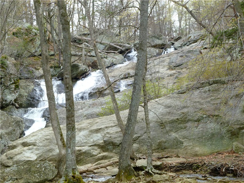
A view of the Delaware Water Gap and Kittatinny Mountains is reached from an unmarked trail:
As an alternate return route, the red-blazed trail comes out at Jefferson Lake across from the Sussex Branch Trail, a short distance from the parking lot.

HIKE SUMMARY:
[  0.00]  Start on Sussex Branch Trail at restroom for short distance then left on white
[  0.20]  Straight on white when unmarked goes left
[  0.30]  Yellow trail joins in from left; keep straight on white/yellow
[  0.70]  Straight on white/yellow when teal Highlands Trail crosses over
[  0.80]  Right at fork on white/yellow when unmarked goes left
[  1.25]  Right on white when yellow leaves to left
[  1.35]  Left on white when unmarked goes right, stay on white when passing other not well defined possible unmarked trails
[  1.80]  Left on white at fork when unmarked goes right
[  1.90]  Cross bridge; left on white when unmarked goes right
[  2.50]  White goes left when unmarked goes right
[  2.55]  Right on white when unmarked goes left (although there is a white circle marker on a tree to the left)
[  2.65]  At white turn blazes painted on tree to the right, turn left on unmarked trail following the painted blazes - this is the Ice Cream Trail - sign on tree to the left
[  2.80]  Trail splits, go either way but straight is shorter
[  2.90]  Trails merge back together and some faded white paint blazes are visible
[  3.30]  Summit of Allamuchy Mountain North
[  3.40]  Turn right at intersection on unmarked trail
[  3.55]  Turn left at intersection on unmarked trail
[  3.80]  Keep right at fork at old white metal diamond marker
[  3.85]  Keep left at trail comes in from the right; additional old white metal markers on trees
[  4.30]  Rock hop over stream; left on purple at intersection
[  4.40]  Straight on purple when unmarked comes in from right
[  4.65]  Purple turns right when unmarked goes straight
[  5.00]  Turn right on unmarked when purple goes straight
[  5.05]  Survey markers; summit of Allamuchy Mountain
[  5.25]  Straight at intersection on unmarked, not well defined trail (can turn right on more defined trail also to purple then left on purple)
[  5.35]  Turn right at T-intersection
[  5.80]  Other side of huge blowdown, left on purple
[  5.85]  Purple ends at white; right on white
[  5.95]  Stone building ruins on left
[  6.45]  White makes hard right when unmarked goes left
[  6.50]  Right on unmarked when white turns left towards creek
[  6.65]  Turn left on unmarked when unmarked goes right
[  6.90]  Short side trail to left to rock outcrop and view
[  7.25]  Left at fork
[  7.50]  Trail ends at white, turn right on white
[  7.60]  Keep left on white trail when Ice Cream trail comes in from the right
[  7.70]  Keep left on what at fork
[  7.80]  Right on white at fork
[  8.35]  Right on white when unmarked goes left; cross bridge
[  8.50]  Left on unmarked when white goes right; short distance ahead right at fork on unmarked (there is another trail to the right on the map at that intersection but I did not see it - could just be a poorly defined trail)
[  8.65]  Keep right at fork; few steps ahead right on red
[  9.10]  Keep left on red when unmarked goes right
[  9.50]  Keep left on red when unmarked comes in from right
[  9.60]  Teal Highlands trail joins from left; stay on red/teal trail (only teal blazes at first)
[  9.70]  Keep left on red when teal leaves to the right
[10.25]  Keep right on red when other end of red comes in from left and unmarked comes in from right; Jefferson Lake straight ahead
[10.30]  Right on Sussex Branch Trail
[10.65]  Back at parking lot