Sunday, March 14, 2021

West Avenue Nature Trails, NJ

ABOUT THE PARK: 
West Avenue Nature Trails - Burlington County Times 

DIRECTIONS: 
GPS Coordinates 40.062692, -74.932509
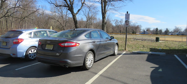
Dedicated trail parking at the end of West Avenue.

TRAIL MAP: 


HIKE DISTANCE: 
This was the most I have hiked in one day post-surgery.  Breaking it up into smaller hikes with 15-20 minute drives in between made my first day of 7.5 miles easy to do.

Roebling Bike Path/ Delaware River Heritage Trail - 3.3 miles
    10 miles/20 minutes to
West Avenue Nature Trails - 1.4 miles
    4 miles/11 minutes to
Amico Island Park - 1.9 miles
    6 miles/13 minutes to
Little Woods on the Rancocas - .85 miles

THE HIKE: 
The trail starts at the end of West Avenue next to the sign.
Heading to the right bypass the EMS access...
... heading towards the scout sign.
After that sign there will be white arrows leading the way on the white trail. Other than these arrows and some faded paint on other trails, the trails are not well marked.
A partial view of the Delaware River.
A balloon!  This would actually be #2 of the year since I found one in my neighborhood on my daily walks but I am way behind other years right now due to lack of hiking.
There was a path to the right partially blocked by intentionally laid branches but we beyond that and up the hill for a look and found the best Delaware River view of the hike. 
Signs of Spring!
Back at the center where parking is to the left, we continued across for the other section of trails.
Sometimes there are old paint blazes.
The official overlook of the Delaware River.
Continuing to loop around the perimeter trails ...
... back to the parking lot.

Wednesday, March 10, 2021

City of Elizabeth Bikeway Waterfront Park, NJ


ABOUT THE PARK: 
I am not quite sure what this place is called.
 
DIRECTIONS: 
GPS Coordinates 40.646934, -74.186060
Pier Parking

TRAIL MAP:

HIKE DISTANCE: 2 miles (1 mile each way)
 
THE HIKE: 
In my quest to do something different on a lunch hour for my daily rehab walks I decided to try the Elizabeth waterfront in hopes it would be as nice as the Perth Amboy Harbor Walk.  Sadly, it was not.  It's all nicely constructed with a ton of money having gone into it but the litter (especially booze bottles, beer bottles, cans and broken glass) is horrific.  Brodie was thrilled that he nabbed a dead fish. I was thrilled that he dropped it as I yanked him so I did not have to pry it out of his mouth.  Shudder.

The path starts from the parking lot as wood decking.
The Bayonne Bridge in the distance.
The path changes from wood to concrete.
Bayonne Bridge
This section was fairly quiet and peaceful ...
... until the trash truck came our way.
At the far end the path (I think this is an extension, not part of the actual bikeway) goes between idling trucks and razor wire on the left and chain link fence on the right.  We did not go all the way to the end as someone was fishing down there.
Heading back.
A very small sampling of the booze litter.  Too drunk to hit the trash can, apparently.
And a brand spanking new grand entrance and a new name?
Goethals Bridge
The highlight - a flock of something flying over.
They are brants, a type of goose that can drink salt water.
Back at the parking lot.

Sunday, March 7, 2021

Weltz Park, NJ


ABOUT THE PARK: 
Weltz Park - Monmouth County Parks

DIRECTIONS: 
GPS Coordinates 40.266807, -74.036703
Small parking lot with room for about 5 cars.  This park doesn't seem to get very busy - one person was leaving as we started and one person started as we were leaving and that was around noon.

TRAIL MAP: 
Weltz Park Map - Monmouth County Parks

HIKE DISTANCE: 
Weltz Park - 1.8 miles
     hiked together with
Joe Palaia Park Trail - 3 .8 miles (about a 5 minute drive between parks)

THE HIKE: 
The trail starts from the parking lot as a packed sand road.
So much nicer to walk on than the hard paved trail we had just been on.
After this gate, a little bridge, then ...
... an intersection.  We turned right and stayed with the outer perimeter.
Views of a Lexus dealership.

After looping around, back over the bridge and through the gate.
I had noticed a more narrow sand path running parallel so we took that on the way back.