ABOUT THE PARK:Ricketts Glen State Park - Pennsylvania Department of Conservation and Natural Resources
DIRECTIONS:GPS coordinates 41.30035, -76.27089
 |
| Glens Lot Trailhead Parking |
HIKE DISTANCE: 10.4 miles
THE HIKE:
Having hiked here just two weeks before on my way to Missouri, it reminded me that I had always wanted to hike the Old Bulldozer Road Trail and that Ricketts Glen State Park was the same distance away as the Catskills, so back I went on a peak foliage day. The main attraction is the Falls Trail and as expected, that was packed with people. I had to use that for the last 3 miles of the hike. But for the first 7.4 miles I ran into one local man early on who hikes the Old Bulldozer Road Trail often and saw a couple in the distance heading coming off of a trail I was going to be turning on. That was it. So beautiful and peaceful with nobody else around.
 |
| About the midway point of the parking lot is an access for the Old Bulldozer Road Trail. |
 |
| It climbs steadily. |
 |
| Blazed red denoting a multi-use trail, not a trail color. |
 |
| Arriving at the steepest part. |
 |
| It's steeper than it looks but it's all woods road, no scrambles. Just the kind of sustained steep that makes your heart pound in your ears. |
 |
| At the top! Elevation gain of 856 ft. in 1.2 miles. There would be more ups and downs throughout the hike but this was the toughest part, |
 |
| It was acutally 1.3 miles form Route 118. |
 |
| Taking a side trail to an overlook. |
 |
| Yellow blazes meaning foot traffic only. |
 |
| Valley View |
 |
| The yellow blazes continue on so I followed them only to find they abruptly stop at the park boundary at a private property sign. |
 |
| Heading back. |
 |
| Coming off of the side trail, turning right to continue on the Old Bulldozer Road Trail. |
 |
| Caterpillar of the hickory tussock moth. |
 |
| Looking back on the way we had come in on the Old Bulldozer Road Trail to see the signs, now making a sharp right on the Mountain Springs Trail. |
 |
| Left on the Little Cherry Run Trail. |
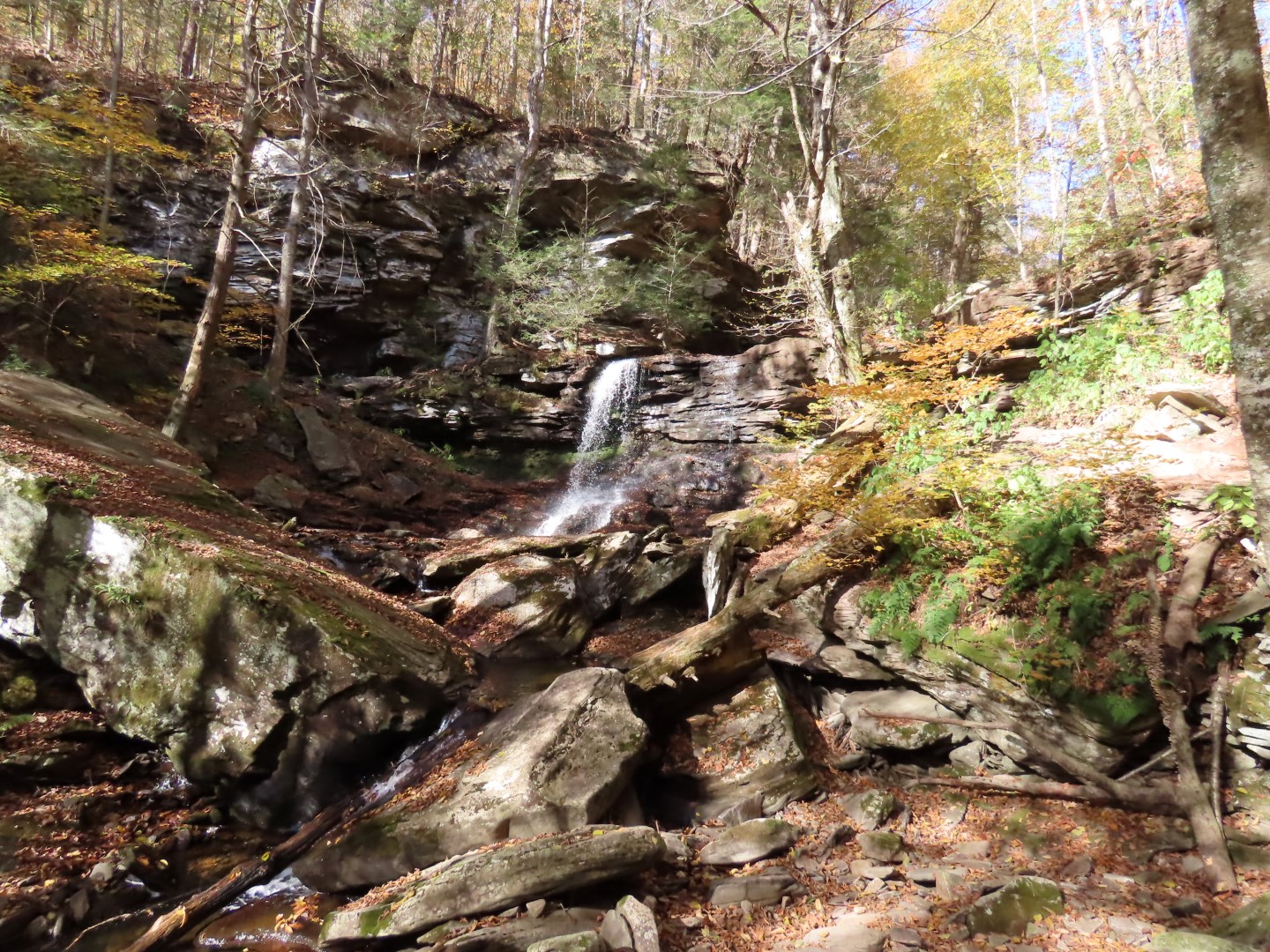
 |
| The Little Cherry Run Trail is beautiful with rock formations on the left and waterfalls and cascades on the right. |
 |
| The trail becomes a well-marked footpath through the woods. |
 |
| Left on the Cherry Run Trail in the direction of the park office. |
 |
| At the Lake Leigh dam is where peace and tranquility ended and the crowds began. |
 |
| Taking the Falls Trail all the way back to the parking lot on Route 118. |
 |
| Passing by the bench were we took a family photo two weeks before. |
 |
| Two weeks ago we had come up this part of the trail. Now we were going down and oh my, was it crazy steep going down on wet steps. I was being extra cautious after the 13 stitches incident a month ago. |
 |
| We took the lower trail which was far less difficult than what we had hiked on the Falls Trail this far. With all of the non-hiker tourists around, yes, it would have been difficult for them and I could hear them all on the upper trail. But for hikers, the lower trail would be considered moderate. |
 |
| Merging back with the upper trail, it's all smooth and flat the rest of the way. |


Glad to see this info on this lesser used trail. Coming to PA to hike with siblings and we will try alternatives to the Falls Tr when it is busy. Thanks and keep hiking!
ReplyDeleteThe lesser used trails are my favorites!
Delete