ABOUT THE PARK:
DIRECTIONS:
GPS Coordinates 41.126674, -74.954877
 |
| Tom's Creek Parking Area |
TRAIL MAP:
NOTE: Most of this hike is not on any map or app and follows old woods roads and trails.
HIKE DISTANCE: 8.6 miles
THE HIKE:
A few years ago I had heard that you could make it from Tom's Creek over to PEEC via an assortment of unmarked/unmapped trails. There have been storms, hurricanes, tornadoes and whatnot since that resulting in a lot of damage to the area so I did not know if this was still viable but I gave it a shot and surprisingly, it was completely doable. I did go with backup plans so the drive would not have been a total waste had this hike not panned out.
 |
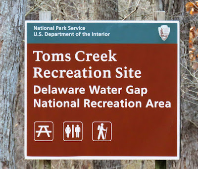
| Through the picnic area to the trailhead at the sign. |
 |
| Right off the bat, balloon 26 of the year. |
 |
| We had an unfortunate encounter with three off leash Great Danes. Imagine being charged by over 500 pounds of dog. And just when Brodie was making such good progress with his reactiveness towards other dogs on the trail, a result of just such encounters. I had to yell NOOOOOO at the dogs to keep them off of us and then yell at the owner who was much too far away to come and get his dogs. Needless to say, I was livid. The upside is this was the only time we ran into anyone during this hike. |
 |
| The trail ends at this bench but ... |
 |
| ... a well-worn footpath continues on. |
 |
| The path ascends steeply up the hillside. |
 |
| It's really steep. |
 |
| Tom's Creek down below. |
 |
| The trail continues at the top where I briefly lost it but ended up on this blue-blazed trail. This trail is on the Gaia app so I had a route (purple) saved but this hike would extend beyond that. |
 |
| The blue trail heads to ... |
 |
| ... Landis Lake on some maps, Egypt Mills Pond on the trail conference map. |
 |
| We worked our way around on footpaths to the dam... |
 |
| ... where we crossed a bridge over the outlet. |
 |
| Coming off the bridge we turned left; right would be the return route at the end of the hike. |
 |
| Following Big Egypt Road. |
 |
| After passing another pond on the right ... |
 |
| ... watch for a woods road gated with a wire between two posts. |
 |
| A very clear, easy to follow path ... |
 |
| ... along an unnamed lake. |
 |
| Balloon 27 of the year packed out. |
 |
| At this fork after the end of the lake, we stayed to the left. |
 |
| Still clear and well-defined. |
 |
| We did end up losing the path eventually but worked our way to the left and found another woods road where we turned right but ended up ... |
 |
| ... in an insurmountable mass of blowdown. |
 |
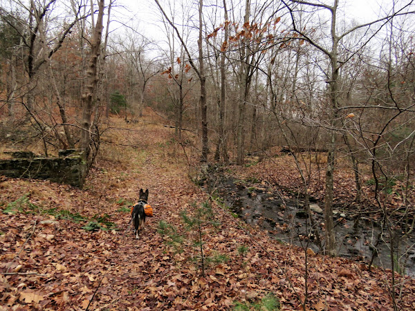
| I backtracked a little and found this path which wasn't so obvious at first because of minor downed trees but it opened up and was exactly where I needed to be. There were several more blow downs from this point on but all were easy to get over or around. |
 |
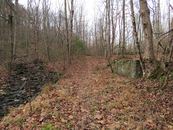
| There were lots of ruins along the way. |
 |
| Following a pretty creek. |
 |
| An easy rock hop over. |
 |
| Balloon 28 of the year and the third of this hike. |
 |
| I lost the path and had to bushwhack up to the ridge. |
 |
| Once there, I continued along the ridge to where it ended. I had hoped to be able to see Tumbling Waters in PEEC down below but the falls were not visible although they could clearly be heard. |
 |
| There were some nice views up here that don't show up well at all in the picture. |
 |
| Bushwhacking around a bit and meeting back up with ... |
 |
| ... the path we had come in on, now retracing. |
 |
| A very old tree. |
 |
| Left on Big Egypt Road at the wire barrier. |
 |
| We had come in from the right over that bridge on the dam, now going straight staying on a defunct part of Big Egypt Road. |
 |
| There are old wooden guardrails along the way. I had thought this would just be a ho hum way back to the car but it was not at all. |
 |
| The old road follows a pretty creek ... |
 |
| ... that starts out with some nice cascades. |
 |
| Presumably there was a bridge here at some point but it can still be easily crossed by foot. |
 |
| Once on the other side of the creek, the waterfalls rush down to the Delaware River. |
 |
| A tiny bit of the Delaware River is visible. |
 |
| We must have just missed this bear as it had rained overnight and this scat was not wet. |
 |
| The parking lot down below. |
 |
| I had to laugh at that stop sign. No cars going that way! |
 |
| A right on Little Egypt Mills Road for a very short distance ... |
 |
| ... back to the parking lot on the right. |


No comments:
Post a Comment