ABOUT THE PARK:
Wawayanda State Park - NJDEP
PERMIT REQUIRED FOR HIKING IN THE PEQUANNOCK WATERSHED.
This hike is mostly in Wawayanda State Park where a permit is not required but the parking lot is a Pequannock Watershed lot so a permit is required to park there for this hike.
See THIS hike for permit details.
Loop Trails Coming to Terrace Pond - Trail Walker Summer 2020 (page 8)
Trail Improvements in Progress at Terrace Pond in Wawayanda State Park - NYNJ Trail Conference
Some maps I saw along the way explaining the article above.
DIRECTIONS:
GPS Coordinates 41.105758, -74.406189
 |
| Room for about 5-6 cars at the P8 parking lot. |
TRAIL MAP:
North Jersey Trails Map 116 - NYNJ Trail Conference
HIKE DISTANCE: 8.3 miles
THE HIKE:
 |
| From the parking area continue on Stephens Road beyond the gate with the No Trespassing sign. As long as you have your watershed permit you are good. |
 |
| Continuing uphill on Stephens Road with Pequannock Watershed property on the left and Wawayanda State Park on the right. |
 |
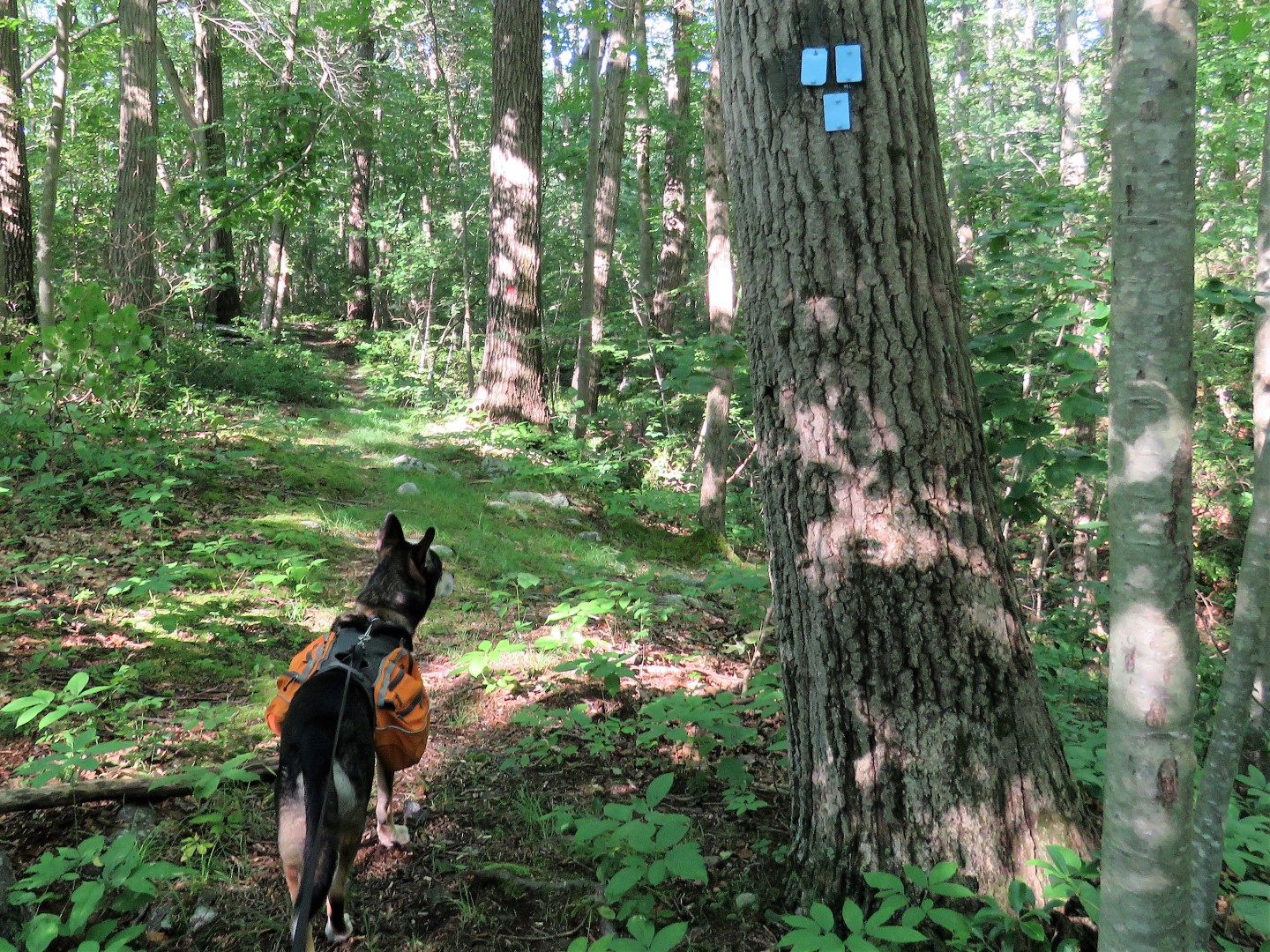
| Right on the blue Spring North Trail into Wawayanda State Park. (Note: This trail may not exist much longer. More on that at the other end of the trail.) |
 |
| I had recalled a short side trail to an overlook (not on the map) from years ago when I hiked here with Shawnee and the trail was still there. |
 |
| But the overlook is not. Maybe when the leaves are down. |
 |
| Back on the blue trail. |
 |
| At the bend in the blue trail, the maps showing the relocation. A new trail has been started straight ahead. |
 |
| We had just come in on the blue trail circled in red on the left. This trail is not shown on the reconfiguration map. Would be a shame to do away with it, it's a pretty trail. |
 |
| Continuing on blue. |
 |
| Blue ends at red. I went straight on red without checking my map. A while later I wondered if I hadn't been on red an awfully long time, longer than I though I should be. So I checked my GPS and by golly, should have turned right on red instead. But I was half way to Stephens Road already so I quickly came up with a different plan (which turned out to be way better than my original plan) and continued on. |
 |
| Rhododendron! It was only this one bush that was blooming. |
 |
| I could tell there was a swamp over to the right but couldn't see much of it at all. |
 |
| Red ends at Stephens Road... |
 |
| ... but that gate on the right blocks the continuation along Stephens road, shown as a woods road on the map. This was the new plan. So right we turned. |
 |
| Continuing right on Stephens Road. It's all private property on the left, Wawayanda State Park on the right. |
 |
| Oh yes! Coming up on that swamp I could barely see from the red trail. |
 |
| It was a gorgeous swamp, called Bunker Hill Lake on GoogleMaps. |
 |
| Part of the swamp spilled across the dirt road but we didn't care, we slogged on through ankle deep water. |
 |
| The dirt road becomes grassy and forms a cul-de-sac-like loop just beyond the swamp so I thought we would have to turn back but wait, what is on the other side of this gate that is not posted no trespassing? |
 |
| After a little bit of an overgrown section the woods road is still there and it opens back up so on we went. |
 |
| We turned right at a second intersection. The first one we turned right on fizzled out and could not be followed (it's on the map) so we continued on until we hit this second intersection. |
 |
| It's a short distance before ... |
 |
| ... running into the yellow Terrace Pond South Trail where we turned right. |
 |
| The yellow trail follows a woods road to another swamp. |
 |
| Beacon Hill Lake |
 |
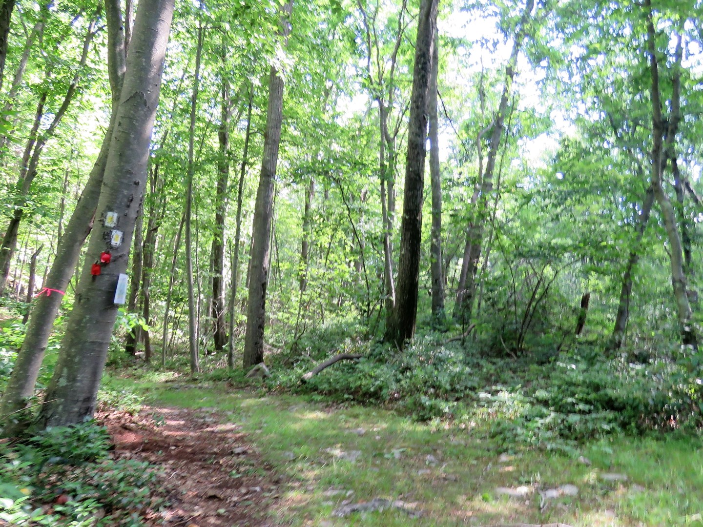
| Just past the swamp was another trail relocation map. |
 |
| We turned right on the yellow dot trail, soon to become part of the blue loop farther ahead. |
 |
| Red comes in from the left for a short distance ... |
 |
| ... then leaves to the right; we stayed right on red. (This is where yellow dot will become blue in the relocation.) |
 |
| At this point where blue starts on the left, we turned right on red. This is where I had come off of blue from the left earlier and kept straight on red instead of turning but had I not messed that up, I would have missed those two gorgeous swamps. |
 |
| Largest fungi I think I have ever seen. |
 |
| I really do lug water for him but he turns his nose up at it. Creek water tastes so much better than tap water, apparently. |
 |
| Passing by that one blooming rhododendron bush again. |
 |
| This time I got a shot of the back of that swamp. This is all that can be seen from the red trail |
 |
| A bear was here. |
 |
| Back at Stephens Road we turned left. |
 |
| Here we encountered one hiker coming uphill towards us and saw two people who did not look like hikers a short distance in on the blue trail where we had started. Those were the only others encountered this entire hike. |
 |
| I was surprised to see this many cars parked in the P8 lot. Only one car other than mine had a watershed permit decal. There was something going on at the horse farm straight ahead so I think most of the cars were from that. |


This one is very close to home for me! I've been on part of the Blue Trail. A lot of horses seem to use it. It's an old woods road. I wonder why they are rerouting and not including this trail? Great post as always! Great pictures!
ReplyDeleteThanks, Mike! I did not notice any evidence of horses on the blue trail but Stephens Road from the parking lot all the way around to the nice side of that swamp was horse poop hopscotch! I was wondering why the blue trail is being omitted, too. I suppose it will be around as an unofficial trail until it becomes obliterated with overgrowth and blow downs.
DeleteDaniela