

Wharton State Forest - NJ Department of Environmental Protection
Batona Trail Brochure - NJ Department of Environmental Protection
DIRECTIONS:
GPS Coordinates 39.674160, -74.529419
 |
| Pull out parking where the Batona Trail crosses Route 679. |
TRAIL MAP:
Batona Trail Brochure - NJ Department of Environmental Protection
Powered by Wikiloc
HIKE DISTANCE: 8 miles (4 miles each way) for only the Batona Trail but with side trips, our hike was 10.5 miles
THE HIKE:
This is my final section to complete the Batona Trail. It's a 53.5 mile trail that took me 10 years and 122.9 miles to complete. That would be because I only hiked it in the winter and would incorporate other trails to make loops when possible. Here is a full list of the day hike sections from north to south (I hiked them randomly, not in order.)
 |
| Heading north where the Batona Trail crosses Route 679. |
 |
| Mile marker 9 a few steps in on the trail. We were headed to mile marker 13. |
 |
| This immediately goes through a scenic swamp on a raised berm. |


 |
| Coming out on Route 563 where the Batona Trail turns left for a short road walk. |

 |
| Evans Bridge has a dedicated pedestrian section. |
 |
| Just after Evans Bridge we turned left on a woods road leaving the Batona Trail. This leads through a pretty area to ... |
 |
| ... the bank of West Branch Wading River that we had just crossed on the Evans Bridge. |

 |
| The woods road abruptly ends where the river horseshoe bends to the right. |
 |
| There is another road to the left which just loops around to retrace the way we had come. |
 |
| Back on the road walk where the Batona Trail crosses over and enters the woods just up ahead. |


 |
| Starting out as a footpath. |


 |
| The trail crosses a few sand road. |
 |
| The trail starts to widen and becomes a sand road. |

 |
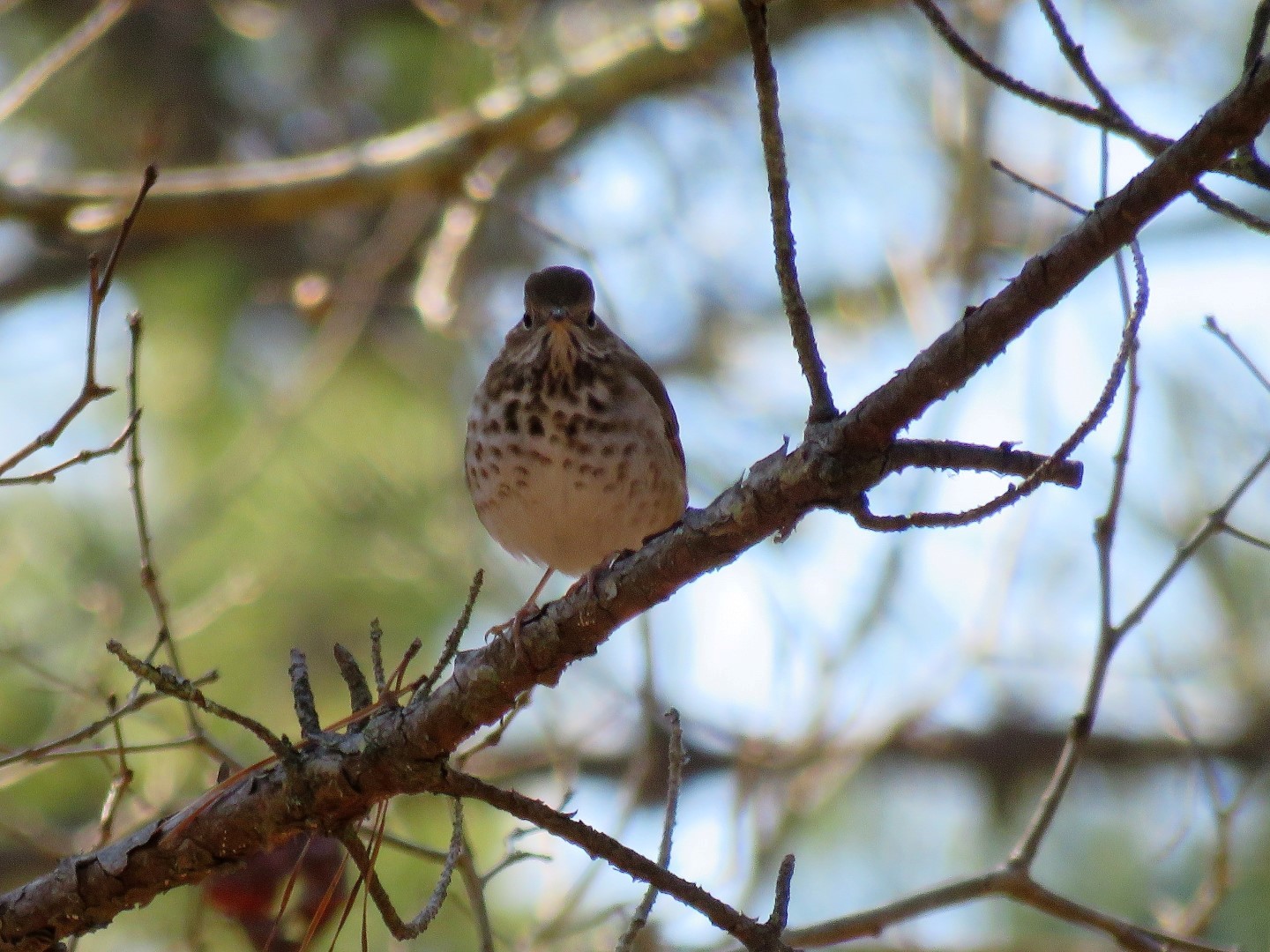
| Hermit Thrush |


 |
| A pretty little pond on the right. |


 |
| Mile marker 13 is actually a very short distance after this bridge. |
 |
| But with becoming distracted by something off to the right ... |
 |
| ... which would be balloon #14 of the year and the sun in my eyes, I completely overshot mile marker 13 and had to retrace. |
 |
| And here we are. No bells, no whistles, but the honor of being listed on South Jersey Trail's Batona Trail End-to-Enders Log. |
 |
| A celebratory snack.... |
 |
| ... and break at mile marker 13. |
 |
| Heading back. |


 |
| Just before Evans Bridge ... |
 |
| ... a side trip down to the river. There was a neat orange glow that I wanted to capture in the picture. Did Brodie really have to stick his tongue out? |
 |
| Some recent beaver activity. |
 |
| Crossing back over Evans Bridge. |


 |
| At mile marker 9, Route 679 just up ahead. |

Great choice, Daniela! (Back in South Jersey again, I see!) One can never go wrong on the Batona Trail, and I've done this section a couple times. (Well, at least the section between Route 679 and Route 563/Evans Bridge.) I had done Evans Bridge to Martha Bridge a couple times, and once did Evans bridge => Northbound for almost 6 miles (towards Buttonwood Hill Camp). Not extremely scenic, but definitely a nice walk regardless, what with the wide trail most of the way! And wonderful pix while near Evans Bridge (the water pix). I'm hoping to get out and do the beginning/end of the trail in Bass River SF and head Northward to Ives Pond. (Yes, your hike earlier this year inspired me!)
ReplyDeleteCome back to South Jersey soon!
Jim
Thanks, Jim. I might be done with South Jersey for the season unless we have a freak snowstorm up north and you just know anything can happen. Otherwise, I'll be back next winter. I think you'll enjoy the Bass River to Ives Pond section. There are some very scenic parts. Report back!
DeleteDaniela
Well, "Report back" you asked for, and "Report back" you'll get! Just did the Batona Trailhead => Ives Pond yesterday (a pretty hefty 8.4 miles round trip). I was last in this area in May 2012, and other than the relocated section (which was actually in place back then, sort of "concurrent" with the original portion, which was the section I actually did), it seems like not much has changed. Some great scenery along the way (especially with the other pond about 1.3 - 1.4 miles in...not sure if this one is named, but then, when I first laid eyes on Ives Pond, I didn't know it was named as such back then either!) Oh, and I guess the mile markers weren't around either in 2012...I think they went in sometime in 2014 or so, and was a _very_ welcome addition to this already great trail! Anyway, Ives Pond itself was gorgeous; I see it still spills over/through the bank closest to the trail. It looks like extra sand was added on the one side of the trail as well, but the boards on the side of the trail are still very necessary! I was hoping there's be some red-winged blackbirds around, but I didn't hear any. But no matter, I thoroughly enjoyed the hike!
DeleteO.K. -- I'd better read your latest post on Edith Stevens Memorial Wildlife Preserve, NJ before it gets too late! (Or, I can just read it tomorrow, I suppose -- but...no! I can't wait that long!) ;-)
Happy hiking!
Jim
Nice! Thanks for the report!
Delete