ABOUT THE PARK:
Elmhurst Tract - Pennsylvania DCNR
North Pocono Trails Association Facebook Page
Roaring Brook Trail - Tri-County Independent
DIRECTIONS:
GPS Coordinates 41.340198, -75.515302
 |
| Parking across the street from the trailhead at Old Mill Park. |
TRAIL MAP:
North Pocono Trail System - Pennsylvania DCNR (shows trails of the South Trails System)
The above map covers the trails in the southern section. I could find no map for the blazed trails in the northern section so I colored them in on my track:
 |
| The red-blazed Roaring Brook Trail continues all the way north to Elmhurst Reservoir and there are also purple and green blazed trails, purple connecting back to the orange-blazed Lower Juno Trail in the south trails system. |
HIKE DISTANCE: 12 miles
THE HIKE:
 |
| From the parking lot, a sign indicating to cross the street to find the trails. |
 |
| Turn right and cross the bridge over Roaring Brook. |
 |
| Just after the bridge, left on the grassy area between the guardrail and split rail fence. |
 |
| While the map (as well as the online map currently) show 7 miles of trails, there are more blazed trails north of the map. |
 |
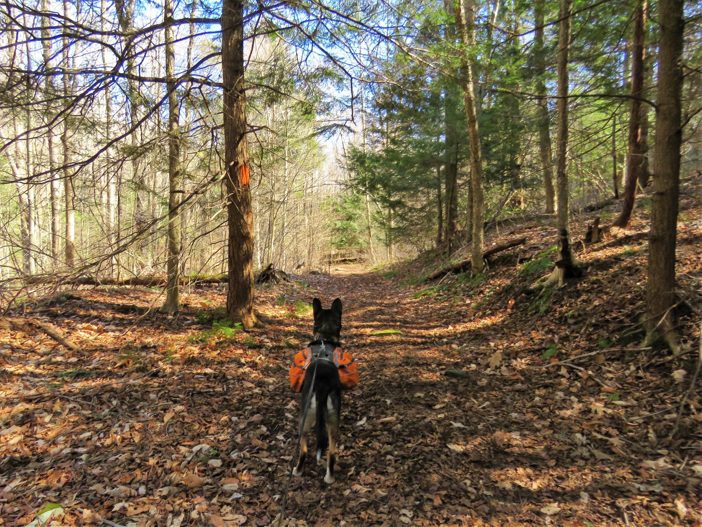
| Starting off on yellow Creekside/red Roaring Brook Trails. |
 |
| When the trails split, we went left on the yellow Creekside Trail and would be returning on the red Roaring Brook Trail, |
 |
| Roaring Brook |
 |
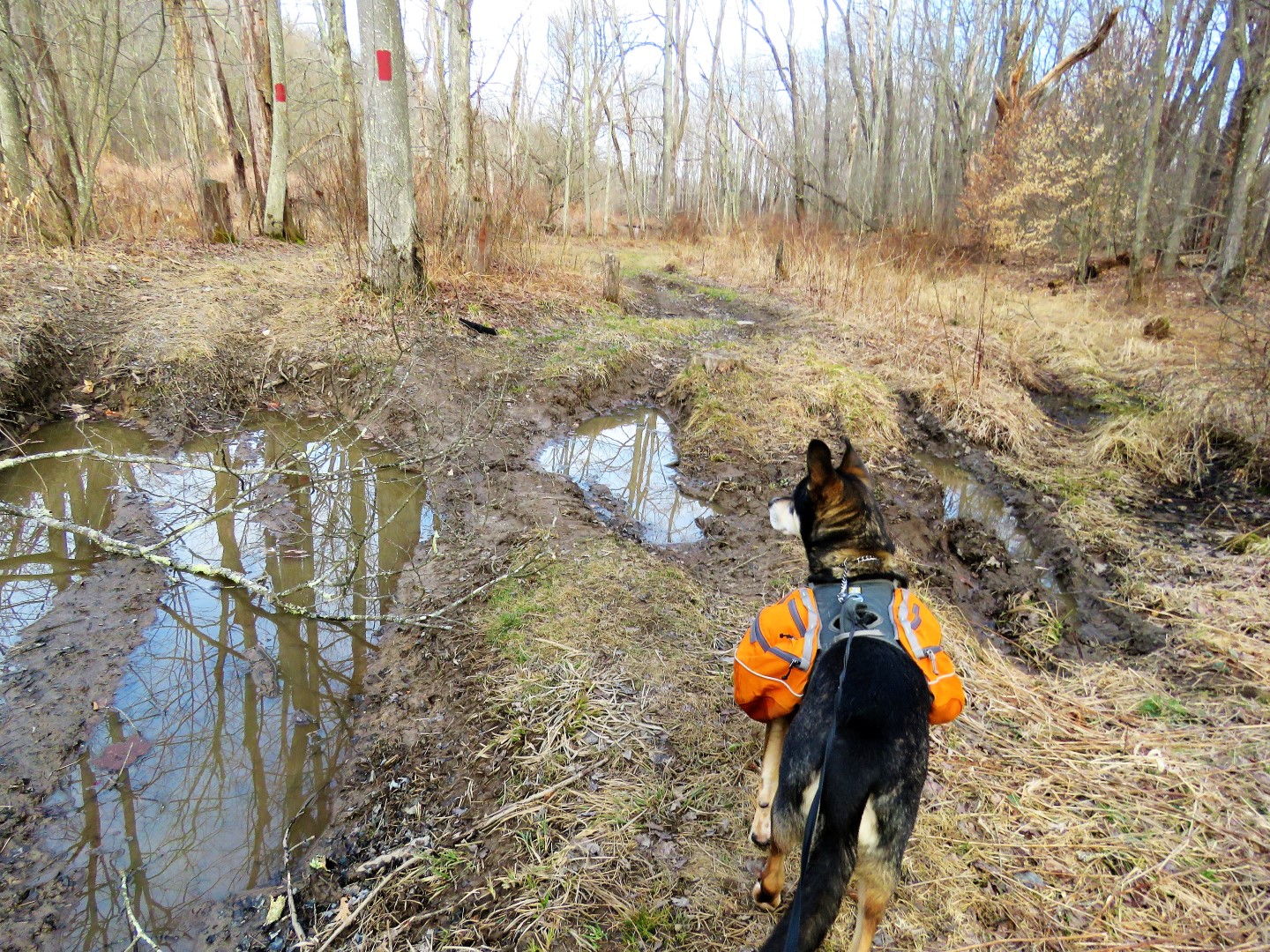
| When red ends on the map, it continues the other side of Kellum Creek via a doable rock hop. |
 |
| Initially the other side is muddy and rutted from ATV use but we were able to work through it. |
 |
| I made note of this green trail not on the map with the intention of exploring it on my way back. |
 |
| Elmhurst Reservoir to the left. |
 |
| A purple trail not on the map to explore on the way back. |
 |
| There are a few wet/muddy rutted areas along the way but we were able to get through/around all of them. |
 |
| Where red turns right on an old paved road, we turned left ... |
 |
| ... down to Elmhurst Reservoir. |
 |
| Maybe when that sign was new there was a bridge ... |
 |
| ... but it's gone now. |
 |
| Elmhurst Reservoir |
 |
| Heading back to continue on red. |
 |
| Red ends at a parking lot on the left beyond the barrier. |
 |
| From the parking lot there is an unmarked woods road to the left which we took for a short distance to see where it would go. |
 |
| When the woods road started to go downhill I could see there was not going to be much left so we turned back. |
 |
| Coming back up on the parking lot ... |
 |
| ... where we turned right to retrace on red. |
 |
| We turned left on the purple blazed trail.... |
 |
| ... and were treated to some antics of a white-breasted nuthatch. |
 |
| I was hoping I would run into green to be able to make a loop and indeed I did. Purple continues to the left and green starts to the right. I really wanted to know where purple went but decided it might take me too far out of my way and so I took green being fairly certain it would take me back to red. |
 |
| Green follows along a scenic creek down in a deep gorge. |
 |
| Here we are back at red where we turned left. |
 |
| Back along Roaring Brook ... |
 |
| ... then back across Kellum Creek. |
 |
| From red we turned left on blue. |
 |
| Then a short distance along a white trail to the left leads back down to Kellum Creek to a scenic area called Mathew's Grove. |
 |
| Retracing on white and crossing over blue, white becomes the Buzzsaw Trail. |
 |
| We passed several other trails but stayed with white until this intersection where we turned left. |
 |
| The orange Juno Trail was my destination so I stayed with orange as the other colors split off. (That purple trail is the Sword Trail, not the same as the purple trail I was on in the northern section.) |
 |
| Now on just the Lower Juno Trail. |
 |
| This leads back to Kellum Creek with a rock hop across. |
 |
| Kellum Creek |
 |
| But just the other side where orange turns right, there is a purple trail not on the map to the left. Could it be the other end of that purple trail I was on earlier? I just had to find out so left it was. |
 |
| Following along Kellum Creek for a bit ... |
 |
| ... then uphill on a woods road. |
 |
| Black-capped Chickadee |
 |
| I could tell by the track that we were coming up on a swamp but it turned out to be a very pretty swamp with lots of beaver activity. |
 |
| The picture does not do it justice. |
 |
| Found a log to sit on to take a break. |
 |
| Because I could tell by my track that we were going to run into where I had turned off on green earlier, I decided to head back after seeing the pretty swamp. |
 |
| Back down at Kellum Creek, purple runs right into ... |
 |
| ... where we left off on orange. |
 |
| The orange Lower Juno Trail is particularly scenic as it follows along Kellum Creek. |
 |
| At this rock hop back over Kellum Creek, I could smell the strong stench of decomp. The source was a partially decomposed deer in the water just upstream to the left. Between trying to rock up and keeping Brodie from taking a swig of water along the way, the keeping him from drinking part was pretty unsuccessful. |
 |
| The other side of the creek is the Upper Juno Trail, still blazed orange. |
 |
| This goes uphill, steeply at times, all the way to the top. |
 |
| At the top the footpath becomes a woods road with nice winter views along the way. |
 |
| Elmhurst Reservoir down below. |
 |
| The trail descends, steeply at times. |
 |
I did not know what this sign meant until I saw it later on the North Pocono Trails Association Facebook page: "Thank you to whomever made the Pointe du Hoc sign for Upper Juno Trail.
Although found on Utah Beach at Normandy, this steepest location on the
NP Trails is named in honor of the U. S. Rangers who captured it from
the Germans during the D-Day Invasion." |
 |
| The Upper Juno Trail continues as the Lower Juno Trail at the red Roaring Brook Trail where we turned left on red. |
 |
| Now retracing where red and yellow come together. |
 |
| At the end heading back to the parking lot with Brodie's pack filled with flattened beer cans from the remote sections picked up along the way. |


Nuthatch, nuthatch, what a clown. Hopping trees upside down. Thanks for sharing your hike!
ReplyDeleteHa ha ha, that's cute, thanks!
DeletePA Department of Natural Resources has closed state park and forest facilities. However parking and access to hiking trails are still open. The message isn't being properly communicated. Some park rangers have been chasing people off the trails.
ReplyDeleteCommunication is the key here... [sarc]thanks Gov. Wolfe[/sarc]
Happy trails!
https://www.media.pa.gov/Pages/DCNR_details.aspx?newsid=646
Yes, I follow PA DCNR on Facebook and they posted as you stated then they also posted that parks are completely closed (including parking lots - so how do you get to the trails?) in some counties where they have the highest concentration of presumptive and confirmed cases. So confusing.... Then in NY they are waiving all state park entrance fees because they want people to go to the parks.
DeleteJust read that NJ state parks are open for trail use, but buildings will be closed. Sounds the same for Ocean and Burlington county parks. Planning on Cattus Island tomorrow if the weather cooperates, just have to stop at closest wawa for restroom break. IF they're still open.
ReplyDeleteI heard the same and that NJ state parks are also waiving entrance fees. Have fun at Cattus Island. One of my favorite places.
DeleteJust a note...went to Cattus today as I worked later than expected yesterday. All those kids that have no school...they were there. Sigh.
Delete-Louise & Max (woof)
Ohhhh. Ouch. I just read today that state parks are insanely packed now. Look for unknown places. I find lots of solitude doing that.
DeleteMight be hood hiking for a bit. Stay safe, stay healthy!
ReplyDelete-Louise & Max
Sure does look that way :( You stay safe, too.
DeleteHi -- have you tried hiking since the Shelter in Place order went into effect ? I am concerned that even unused trails will be crowded and possibly have some novice/rowdy kids there. The Del Water Gap trails were crowded even on weekdays last week.
ReplyDeleteNo, I did not hike last weekend because the order had just gone into effect, I was hearing conflicting interpretations and just wasn't quite sure what was appropriate so I decided to err on the side of caution and regretfully spent that beautiful, sunny Sunday at home, kicking myself for not having gone Saturday before it went into effect. The key is to go early, as close to sunrise as possible, and go to places most people have not heard of. Delaware Water Gap, stay far, far away. Don't even think about state parks. Many have been closing early having reached capacity. I read that some nature preserves in PA have closed down because people were overrunning them. I think wildlife management areas/state game lands might be a better option. They put out lousy maps and you have to know what's there and how to navigate around. Take a look through my hikes down the right column. I have been to many, many places where I hardly ever see anyone else. I usually avoid the highly popular places on a normal day. I hope to be out this weekend - far, far away from the crowds :)
DeleteI can ditto Daniela. Allaire parking lot was full so I kept going in the car. I'm near the jersey shore and they just closed the boardwalks because they were overrun. I will be studying Daniela's previous treks in more remote areas. Not so sure about that sunrise part tho :)
DeleteSunrise is beautiful :) I didn't know where you were from but now that I know, one thing comes to mind - the Batona Trail, except the popular places like Apple Pie Hill, Batsto and Franklin Parker Preserve. I just finished section hiking it and hardly ever ran into anyone on that trail. https://gonehikin.blogspot.com/p/batona-trail-day-hikes.html
DeleteThanks for your suggestion about wildlife management areas. Any thoughts on Norvin Greene (the Northern trails that go to Lake Sonoma, not the High Point Trails) ?
ReplyDeleteSeems that would be a better option than the High Point trails but I honestly don't know. Personally, I am staying away from anything on a NY/NJ Trail Conference map for now.
Delete