ABOUT THE PARK:
Farny State Park -NJ Department of Environmental Protection
New Jersey's Great Northwest Skylands (nice history and description)
DIRECTIONS:
View Larger Map
 |
| This lot fills up fast in the summer and I believe tickets for parking on Split Rock Road run $200 and they DO ticket! |
TRAIL MAP:
Jersey Highlands Trail Map #125 - NY-NJ Trail Conference (show Splitrock Reservoir trails but does not show Wildcat Ridge and Righter Mine trails in Wildcat Ridge WMA)
Wildcat Ridge WMA Trails - Jersey Off Road Bicycle Association (shows Wildcat Ridge and Righter Mine trails but not the Splitrock Reservoir trails)
HIKE DISTANCE:
9.3 miles with 4 mile option
THE HIKE:
 |
| Crossing the Splitrock Reservoir dam at about 7:30 am on a gorgeous crisp morning after storms came through the night before. |
 |
| Looking back after crossing the dam. |
 |
| Splitrock Reservoir |
 |
| A left turn just after the dam brings you to the start of the new yellow-blazed Wildcat Ridge Trail. |
 |
| The yellow trail intersects with the white-blazed Four Birds Trail which leads to... |
 |
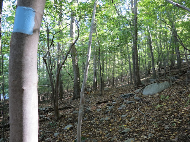
| The beginning of the blue-blazed Splitrock Loop Trail. |
 |
| Flowers with last night's raindrops on the blue trail. |
 |
| A tight squeeze on the blue trail. |
 |
| Down to the creek crossing. |
 |
| The aqua-blazed Righter Mine Trail follows along the creek. |
 |
| Pretty falls with a pool along the way. |
 |
| Some fall foliage. |
 |
| The aqua-blazed Righter Mine Trail comes out into a power cut ... |
 |
| ... with a pylon full of turkey vultures. |
 |
| A short walk from the end of the Righter Mine Trail on Split Rock Road meets back up with the blue-blazed Splitrock Loop Trail. |
 |
| Splitrock Reservoir from the blue trail. |
 |
| This marks a trail leaving to the right off of the blue-blazed trail to what I think is Double D Peak. |
 |
| Some views at the top. |
 |
| It made for a nice break spot. |
 |
| Charlottesburg Road along the reservoir. |
 |
| A cormorant on a rock way out in the reservoir. |
 |
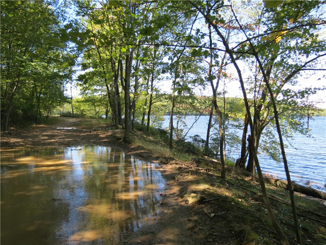
| There are always lots of puddles on Charlottesburg Road. |
 |
| A couple that calls those puddles home. |
 |
| Looking back towards the dam. |
HIKE SUMMARY:
[ 0.00] From the parking lot, turn right and walk on Split Rock Road across the dam
[ 0.30] Immediately after crossing dam, turn left to the yellow-blazed Wildcat Ridge Trail (sign up ahead) then enter power cut
[ 0.40] Leave power cut into woods, descend and follow trail to the right as it joins a woods road
[ 0.65] Left on white when white crosses over just before yellow NO TRESPASSING sign
[ 0.70] At top of hill, turn left on blue at the triple blue blazes
[ 1.35] Cross woods road
[ 1.45] Cross woods road then keep left as a woods road veers right (not marked)
[ 1.65] Rock hop over creek then turn right on the aqua-blazed Righter Mine Trail (woods road)
[ 1.90] Keep right at fork
[ 2.05] Keep straight when woods road comes in from left at metal shed
[ 2.10] Watch for faint path to waterfall with pool on right (you will be able to see and hear the waterfall); retrace back to aqua, turn left on aqua and retrace
[ 2.55] Straight on aqua when blue crosses over
[ 2.85] Aqua leaves woods road as footpath to the right at turn blazes
[ 3.00] Cross over blue at a cairn
[ 3.30] Keep left at fork
[ 3.35] Veer right uphill then turn left to resume with aqua blazes when the blue trail is to the right
[ 3.55] Turn right into power cut and follow aqua along woods road through power cut
[ 3.70] When aqua Righter Mine Trail ends at Split Rock Road, turn right on Split Rock Road
*** Turn left on Split Rock Road back to parking for 4 mile hike.***
[ 3.90] At the far end of the next power cut, watch for the blue trail to enter woods on the left; left on blue
[ 4.30] Cross woods road
[ 4.75] Cross woods road
[ 4.95] Cross Charlottesburg Road
[ 5.05] Keep straight when a woods road goes left
[ 5.95] Turn right at tree with blue ribbon and 3 red thumbtacks, follow path marked with an occasional blue ribbon on a tree; at top of ascent follow cairns to the right to view; retrace
[ 6.05] Turn right on blue
[ 6.85] Turn left on woods road where blue crosses over with a cairn on either side of trail; woods road fizzles out but rock hop down creek bed towards the reservoir
[ 6.95] Left on gravel Charlottesburg Road just before reservoir; multiple paths to right with views
[ 8.00] Turn right on blue before yellow gate across Charlottesburg Road
[ 8.10] Cross woods road
[ 8.25] Keep right at fork
[ 8.60] Cross woods road
[ 9.00] Turn right on Split Rock Road
[ 9.30] Back at parking lot


Im looking forward to hiking Split rock.... I'm just waiting for it to cool down alil. When i was a kid i'd sneak in there to fish lol
ReplyDelete