ABOUT THE PARK: Cacapon Resort State Park - West Virginia State Parks
DIRECTIONS:
View Larger Map
I did this hike on my way from New Jersey to Virginia. In addition to breaking up the drive with a hike, it enabled me to bypass a section of traffic-heavy I-81 on pleasant country highways.
After entering the park, follow the signs to the lodge registration office and park in the lodge parking lot.
TRAIL MAP: Cacapon Resort Trail Map
HIKE DISTANCE: 6.50 miles
HIKE DIRECTIONS:
Walk back the way you drove in from the parking lot to the 4-way stop intersection. Walk across the intersection towards the cabins. At the end turn right, then turn left between cabins 21 and 22 to the green-blazed Laurel Trail.
Keep left on green at the intersection with the red trail where the reservoir can be seen to the right. At .60 miles where the green Laurel, red Central and orange Ziler trails intersect, turn left on the red-blazed Central Trail.
Cross Middle Fork Road with cabins on the right. At 1.65 miles the blue Ziler Loop Trail joins the red Central Trail for a short distance. Stay straight on the blue Ziler Loop Trail when the red Central Trail veers to the right.
There may be a few limited, seasonal views along the way.
You will be ascending until you arrive at the ridge where you will find a bench at the intersection with the orange Ziler trail.
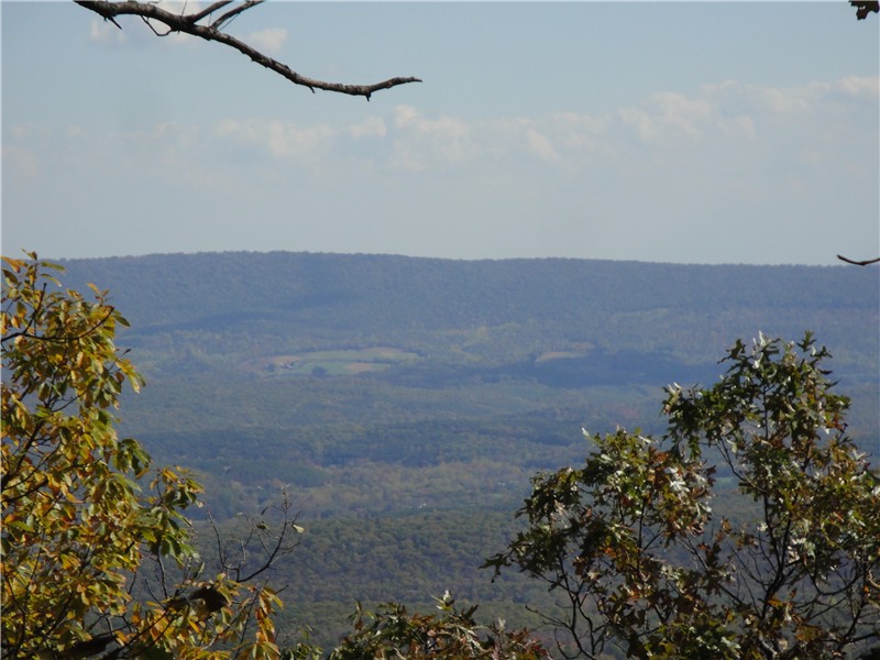
If you were to turn left on the orange Ziler trail for a few steps you will come to a woods road that runs along the ridge. I hiked out a short distance to the left and found no views. If you continue in that direction it would take you to the Cacapon Mountain Overlook, probably about 3 miles away. This overlook can also be reached by car via a bumpy gravel road (more on that later). For this hike, continue from the bench on the blue Ziler Loop Trail which will switchback down to a view around 4 miles.
At 4.80 miles the red Central trail joins the blue Ziler Loop trail briefly. Cross a gravel road, turn left and walk a short distance turning right on the red Central Trail. A short distance ahead keep right at an unmarked intersection. Although there is no blaze at the intersection, you will see a red blaze a short distance ahead. You might run into this friendly little guy.
As you near the reservoir at 5.60 miles, watch for the trail to make a sharp right turn which is easily missed. If you find yourself walking along the reservoir, you missed the turn.
At 5.90 miles turn left on the green-blazed Laurel trail. A white trail joins in after a short distance. At 6.25 miles turn left at the intersection to go between cabins 21 and 22 from behind. At the road turn right then left at the first intersection, through the 4-way stop and back to the parking lot.
If you would rather drive to the Cacapon Mountain Overlook (alternative is to add about 6 miles to the hike by taking the woods road at the bench intersection described above), drive as though you are exiting the park but turn right at the sign for the Cacapon Mountain Overlook. (I believe this road is closed in the winter.)
Signs will warn of the condition of the road although I did not find it to be all that bad in an SUV. Expect that your car will be covered in gravel dust.
Arrive at the Mountain Overlook at the top of the mountain.
You can also hike on the woods road along the ridge from this point. I hiked out about half a mile and it was a fairly level hike out and back with some gradual ups and downs.


No comments:
Post a Comment