ABOUT THE PARK: This hike incorporates Skyline Drive, the driving access to Crater Lake, which is closed to vehicular traffic on weekends from May 21 to October 2, 2022 according to the web site. So it's a good time to make that part of a hike as there are three viewpoints along the way.
DIRECTIONS:
GPS Coordinates 41.087801, -74.909211
 |
| Parking at the end of Fairview Lake Road. There will be a sign along the way that says "No Delaware Water Gap Access" because from this point the road is closed so you can't drive up but you can park and hike up. |
TRAIL MAP:
PEAK BAGGING:
HIKE DISTANCE: 10.5 miles
THE HIKE:
 |
| Fairview Lake Road ends at the gate so it's on foot from this point on. |
 |
| Looking back at parking before the gate at the dead end. |
 |
| Unexpected storms had come through making for a very unexpected foggy morning. With temps reaching into the 90's for the first time this year by noon, we were on the trail at 6:45 AM. I chose an easier hike using woods road so we could make better time and be done before the heat really set in. The only problem - no views because of the fog. But note the power lines in this picture because there would be something very special to be seen on our way down at the end of the hike. |
 |
| The closed part of the road is very eroded and switchbacks up the mountain. |
 |
| Little cascades along the way. |
 |
| Some parts of this hike had lots of red efts along the way so being careful not to step on any. |
 |
| Reaching the gate at the top. |
 |
| Just beyond the gate left is paved and goes to Blue Mountain Lakes, right is gravel and goes to Crater Lake. With this whole section from Blue Mountain Lakes on being closed on weekends, it made for very peaceful and pleasant hiking with nobody else around in otherwise crowded Delaware Water Gap. |
 |
| Skyline Drive to Crater Lake |
 |
| There are woods roads that leave to the left and connect up with other woods roads. |
 |
| Where there are small parking areas to the right, these lead to ... |
 |
| ... short trails to overlooks ... |
 |
| ... but on this morning we could not see anything. There are 3 such overlooks along the way although the map only shows one. |
 |
| Passing by a swamp just before ... |
 |
| ... Crater Lake. This place is insanely busy when the road is open but nice and empty with the road closed. |
 |
| Crater Lake |
 |
| Continuing on the gravel road which is now always gated to vehicular traffic. |
 |
| Brodie had perked up when several deer ran across. I stopped a little bit ahead to apply OFF since the bugs were waking up, heard rustling in woods and looked up to find this about 10 feet away ... |
 |
| I was worried she became separated from her mama and the rest of the herd that had crossed so I quietly put my backpack back on as to not to spook her, took one more picture and heard a very loud HISSSSSS. Mama was right there in the woods, very close to me, I just couldn't see her. But I knew all was well and the fawn was near her mama so we moved on along. Miraculously, Brodie did not notice any of this. |
 |
| The gravel road becomes more rugged and eroded. At a fork we stayed right to summit Mount Paradise. |
 |
| The summit of Mount Paradise is up ahead at the communication tower. |
 |
| Nothing spectacular at all but now we have bagged another NJ1K peak. |
 |
| This gave me pause for a second - another fawn? And Brodie did notice this one but fortunately it was fake. |
 |
| Retracing a bit and taking at right on a grassy unmarked path. |
 |
| A couple of very short sections were overgrown but we managed to get through. |
 |
| At the end, right on a wider woods road. |
 |
| This runs directly into the Appalachian Trail which comes in from the left. |
 |
| It's only a few steps on the AT before turning left on ... |
 |
| ... the blue-blazed Buttermilk Falls Trail. |
 |
| There are sections of smooth rock that were very slippery from the rain. |
 |
| Where blue crosses a woods road ... |
 |
| ... left on the yellow-blazed Woods Road Trail. |
 |
| Passing by a swamp with a variety of frog sounds going on. |
 |
| A little rock hop over the swamp outlet ... |
 |
| ... then a better view of the swamp. |
 |
| At the end of yellow ... |
 |
| ... left on green. |
 |
| A short orange side trail leads to ... |
 |
| Hemlock Pond |
 |
| Back on green. |
 |
| We would be turning left on blue here but fist straight ahead a few steps to another overlook of Hemlock Pond. |
 |
| Now continuing on blue, heading towards Blue Mountain Lake. |
 |
| I was going to keep straight here but figured I'd turn right instead and go along Blue Mountain Lake. |
 |
| An unmarked side trail leads to the far end of Blue Mountain Lake. |
 |
| Heading over to the trail that follows along the edge of the lake. |
 |
| I could already see many. many people in the water at the far end. |
 |
| It was pretty crowded here, not my idea of good hiking so we hurried on out of there. |
 |
| Coming out at the road, we went right a few steps ... |
 |
| ... to the gate to see just how packed the parking lot was. It was 11 AM and cars were coming in and circling for a spot. |
 |
| Heading the other way on the gated portion of the road which was pleasantly peaceful, quiet, breezy and mostly shaded. It had started to get really hot and it was mostly uphill almost all the way. |
 |
| Van Campen Brook |
 |
| The Appalachian Trail crosses over ... |
 |
| ... where we stopped to take our last break in the shade. |
 |
| The AT leaves to the left; we continued straight. |
 |
| Keeping right where gravel Skyline Drive turns left where we started the hike. |
 |
| Now retracing down the eroded road. |
 |
| Although humid and hazy, the morning fog was now gone so there was a little bit of power cut view. |
 |
| At the bottom part of that power cut I noticed something very, very tiny on the wire and zoomed in the best I could to find ... |
 |
| ... a hummingbird! Unfortunately the light was bad and he was so far away and tiny I could not get a very clear shot. |
 |
| Back at the car where two more cars arrived before I left. I can't imagine starting a hike at noon in 90 degrees. |
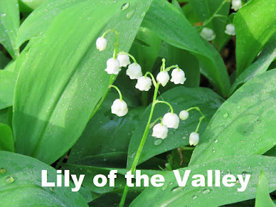
Many different types of wildflowers in bloom along the way.


