ABOUT THE PARK:
Morristown National Historical Park - National Park Service
DIRECTIONS:
GPS Coordinates 40.772242, -74.527680
View Larger Map
 |
| In the winter the restroom in this lot is closed but the one in the visitor center is open. The trail starts to the left of the restroom building. |
TRAIL MAPS:
Morristown National Historical Park/Jockey Hollow Area - National Park Service
HIKE DISTANCE: 9.1 miles
PEAK BAGGING:
Mount Kemble - Peakery.com
THE HIKE:
 |
| A pond and bench along the combined blue/white trail. |
 |
| The white-blazed Grand Loop Trail. |
 |
| The Patriots Path joins in from Lewis Morris Park. |
 |
| Reconstructed Revolutionary War soldier huts. |
 |
| Along the Aqueduct Trail |
 |
| A cold day on the Aqueduct Trail. |
 |
| Wick Farm |
 |
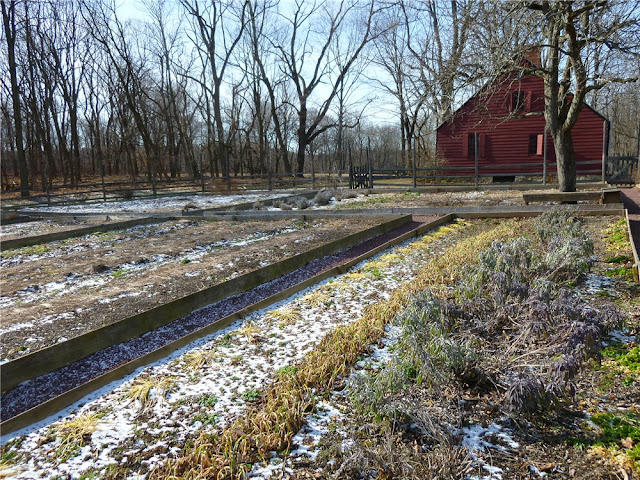
| Wick Farm Garden |
 |
| Hut behind Wick Farm where hiking trails are accessed. |
 |
| Along the Primrose Brook Trail |
 |
| Blue-blazed Old Camp Road/Patriots Path |
 |
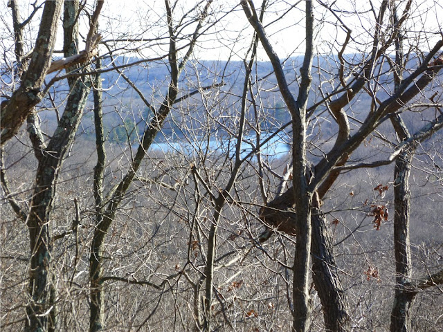
| Views from the blue-blazed Mount Kemble Loop Trail |
HIKE SUMMARY:
[ 0.00] Start on blue-blazed NY Brigade Trail at kiosk next to restroom building
[ 0.30] Turn left on blue/white when white comes in from the right; pond on right
[ 0.40] Turn left on the white-blazed Grand Loop Trail when blue goes right
[ 0.85] Cross over paved Jockey Hollow Road staying on white
[ 0.95] Keep right on white when unmarked trail goes left to soldiers huts
[ 1.75] Cross paved Sugarloaf Road
[ 1.80] Keep left on white/Patriots Path when Patriots Path comes in from left
[ 2.00] Turn left on Patriots Path towards soldiers huts when white goes straight
[ 2.10] Cross parking lot then turn left up path to soldiers huts
[ 2.30] At the single soldiers hut to the right up the hill, turn right on yellow; at sign post 41 keep right on yellow; keep right on yellow at next intersection when left goes to the Grand Loop Trail
[ 2.45] At T-intersection turn right on the yellow-blazed Grand Parade Trail
[ 2.90] At parking lot keep right on yellow towards the Aqueduct Trail; at the Aqueduct information board keep right across bridge when yellow goes left; keep right at fork when Aqueduct Stop B goes left; at fork at sign post #54 keep right and cross foot bridge straight ahead when green/Patriots Path comes in from larger bridge on the left
[ 3.15] At fork keep left when Patriots Path goes right up steps; Aqueduct Trail is unblazed but is well-defined and easy to follow
[ 3.30] At Aqueduct Stop N keep right on foot path when woods road is to the left
[ 3.40] After crossing foot bridge, trail makes sharp left turn and follows bank of creek; cross several more foot bridges and boardwalks
[ 3.75] At end of trail at stone well (?) turn left, cross bridge, proceed up to intersection at clearing and turn around to see three trails converge - the far right is the Aqueduct Trail you just came off of, take the far left trail that says "To Grand Loop Trail .1 mile"
[ 3.80] Cross over paved Sugarloaf Road
[ 3.85] Turn left on white-blazed Grand Loop Trail
[ 4.25] Turn left at sign towards park office when the white Grand Loop Trail continues straight towards the New Jersey Brigade
[ 4.30] Cross wide bridge, paved road, wide bridge and continue on unmarked horse trail
[ 4.60] Cross through Visitor Center parking lot, walk around Visitor Center and follow red paved path towards Wick Farm; continue through Wick Farm past barn towards old hut
[ 5.05] Turn right on yellow-blazed trail at old hut
[ 5.20] Keep right on yellow when unmarked goes left
[ 5.30] Keep left on yellow Grand Parade Trail when right goes to Jockey Hollow Road
[ 5.70] When the yellow trail comes up on paved Jockey Hollow Road at a trail intersection, turn right and cross over Jockey Hollow Road to the red-blazed Primrose Brook Trail slightly to the left before the bridge
[ 5.90] Turn right for "Long Loop" when "Short Loop" goes left
[ 6.25] Straight on red when white/Patriots Path cross over
[ 6.50] Straight on red when white crosses over; rock up over creek - a few steps later there is another rock hop back to the other side but the rocks were too far under the water - if you keep straight along the left bank, you can pick up the trail when crosses back over again a short distance ahead
[ 6.85] Turn right on paved Jockey Hollow Road a short distance then right on the blue-blazed Old Camp Road Trail/Patriots Path
[ 7.15] Keep straight on blue when the white-blazed Grand Loop Trail comes in from left; cross bridge, white-blazed trail leaves to the right
[ 7.45] Keep left on blue trail just before a yellow house (trail now called Mount Kemble Loop Trail)
[ 7.55] Keep right on blue as unmarked goes straight
[ 7.80] Keep left on blue when unmarked goes right
[ 8.00] View to right at open field at Stark's Brigade
[ 8.20] Straight at black metal gate when unmarked crosses over
[ 8.35] Turn left through black metal gate to stay on blue-blazed Mount Kimble Loop Trail as unmarked goes straight
[ 8.50] Stay right on blue when unmarked goes left
[ 8.60] Stay left on blue when unmarked comes in from right
[ 8.70] Left on blue/white when white goes right
[ 8.75] Pond and bench on left
[ 8.80] Right on blue towards NY Brigade Parking Lot when white goes left
[ 9.10] Back at parking lot


