ABOUT THE PARKS:
White Clay Creek State Park, Delaware State Parks
White Clay Creek Preserve, Pennsylvania State Parks
DIRECTIONS:
Delaware Side Parking:
Directions for this hike are from this parking lot (parking fee applies March 1 - November 30)
GPS Coordinates 39.733245, -75.760314
View Larger Map

Pennsylvania Side Parking:
This hike passes by two parking areas on the Pennsylvania side (no parking fees).
Park Office GPS Coordinates 39.746852, -75.774100
View Larger Map
Parking Lot #2 GPS Coordinates 39.749642, -75.771119
View Larger Map
TRAIL MAPS:
White Clay Creek Preserve Trail Map - Pennsylvania DCNR
White Clay Creek Watershed Trails - Delaware State Parks
HIKE DISTANCE:
These directions offer 3 options:
3.85 miles - from DE along White Clay Creek into PA historical area and back
4.90 miles - same as above with DE Nature Center option
6.70+ miles - same as above with visit to historic Arc Monument at The Wedge
HIKE DESCRIPTION:
The trail blazes/markers do not necessarily correspond with the map so I will try to clarify that in the summary below. The hike starts to the left of the information board in the Delaware parking lot. The trail will be marked in blue in various ways with posts or blazes:


After following along a clearing, the trail will join up with White Clay Creek.
 |
| The trail crosses into Pennsylvania |
 |
| The trail continues to follow scenic White Clay Creek. |
 |
| PA park office with indoor heated restroom open year round. |
 |
| London Tract Meeting House (1729) with old cemetery. |
 |
| Back along White Clay Creek. |
 |
| Continue back into Delaware. |
 |
| The yellow/blue-blazed Twin Valley Trail goes through fragrant pine forests. |
 |
| The Arc Monument dated 1892. |
 |
| Additional hiking on Twin Valley trail not included in directions - see *** below. |
 |
| Back to the parking lot along the Nature Preserve trail. |
- Trails do not always coincide with names/colors on map.
- Trail names are, for the most part, not shown on trail markers.
- Almost every trail marker has the round blue Mason-Dixon Trail emblem so this refers to just more than the Mason-Dixon Trail along White Clay Creek as shown on both maps.
- The trails along White Clay Creek are consistently marked with blue posts or blazes (Nature Preserve and Creek Road trails on DE map).
- Where the blue/yellow trail is referenced below, not all intersections are marked, sometimes trail markers have both colors, other times just blue or just yellow, sometimes old faded yellow blazes on trees - referred to as Twin Valley Trail on map in yellow/purple.
[ 0.55] Post indicating state line
[ 0.65] PA park sign; keep straight on blue-blazed trail
[ 1.35] Turn right over bridge; orange Edwin Leid trail goes straight
[ 1.65] 2 mile marker
[ 1.75] Turn left at intersection towards parking lot #2 then left at fork
[ 1.85] At end of trail turn left then immediately right; left on paved road/orange Edwin Leid trail
[ 2.25] Park office with restrooms on right then the historic London Tract Meeting House (1729) with cemetery; left on South Bank Road/orange Edwin Leid trail
[ 2.40] Trail turns left off of paved road just over bridge
[ 2.50] Keep straight on blue trail where bridge is to the left
[ 3.20] DE park sign; at split keep right on blue Pendell Trail (shown as Peltier Road on PA map, red Creek Road on DE map)
~ ~ ~ turn left at split to return to parking lot for 3.85 mile hike ~ ~ ~
[ 3.30] State line marker on post indicating green Creek Trail marker but still blue-blazed trail
[ 3.60] Cross over paved Chambers Rock Road
[ 4.00] Keep left on blue-blazed dirt road (still red Creek Road on DE map) beyond barrier where private drive goes right (private drive not on map)
[ 4.10] Keep straight on dirt road when trail goes to left (return route later); Nature Center on right
~ ~ ~ turn left on trail opposite Nature Center back to parking lot for 4.9 mile hike ~ ~ ~
[ 4.30] Cross over paved Hopkins Road; turn right up steps into pine forest on unmarked trail shortly after crossing barrier (if you cross the bridge you missed it)
[ 4.45] Turn right at intersection on blue/yellow trail (yellow/purple Twin Valley Trail on DE map); some old yellow blazes on trees
[ 4.75] Arc Monument on right, turn left uphill
[ 4.90] Keep straight at interection on unmarked where blue/yellow goes right
[ 5.05] Arrive at clearing with picnic tables; turn left on unmarked trail
[ 5.10] Turn right on yellow/blue trail where sign indicates trail to left goes to #32
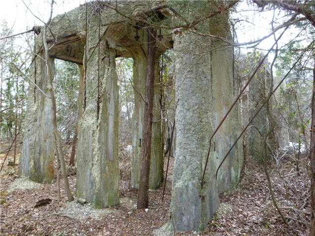
[ 5.20] Trail veers right through stone building ruins
[ 5.40] After crossing over bridge*** then turn left on unmarked trail (some trees have white blazes)
[ 5.60] Turn Left over bridge on wide blue blazed trail along White Clay Creek (red Creek Road on DE map)
[ 5.70] Cross over paved Hopkins Road
[ 5.90] Turn right on trail (referred to as red/white Nature Preserve Trail DE on map) leaving dirt road at Nature Center
[ 6.65] Cross over paved Chambers Rock Road
[ 6.70] Arrive back at parking lot
*** Turn right additional hiking. I had intended to include a longer loop through this section in the hike summary but because the trails were not well marked I ended up hiking an additional 5 miles with no cohesive way of including it for others to follow. It is certainly worth exploring if you want to and add some miles.


