ABOUT THE PARK: This is a fairly new addition to Lehigh Gorge State Park. There are now blazed trails although as of this date the park web site has not been updated to reflect this.
DIRECTIONS:
GPS Coordinates 40.96441, -75.77948 to the long gravel entrance drive.
 |
| The entrance drive is directly across from the Weatherly Country Inn. It looks like you are pulling into somebody's driveway. There is no sign. |
 |
| The long gravel drive will turn left ... |
 |
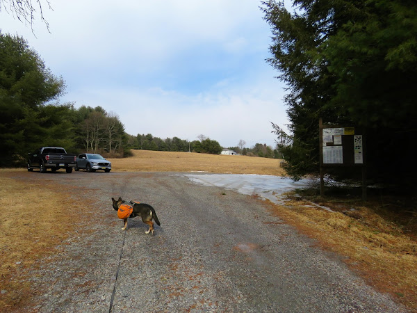
| ... to parking on the left and the start of the trail at the gate on the right. |
 |
| Bald Mountain Parking Lot |
TRAIL MAP
Bald Mountain is a little more than half way down the map right where LEHIGH GORGE STATE PARK is printed just to the right of Rockport.
Some of the above track was manually edited because my phone was not recording properly. It wasn't until I rebooted the phone that the problem was solved so I had to manipulate the track that was showing up as straight lines instead of actual recording. The track recorded in different colors where it kept stopping and starting.
HIKE DISTANCE: 11 miles
THE HIKE:
 |
| Starting at the gate ... |
 |
| ... on the blue-blazed trail. But wait, what is this solid sheet of ice? I had not expected that at all. Good thing I always carry microspikes in my backpack in the winter. |
 |
| Passing by a pond. |
 |
| Then the bridge over ... |
 |
| Indian Run |
 |
| The trail was a solid sheet of ice all the way up. |
 |
| At the top no more microspikes needed. |
 |
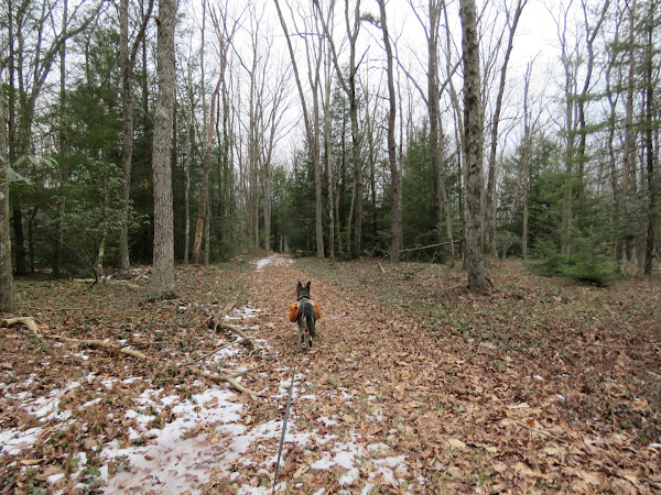
| It is pretty much all fairly smooth woods road. |
 |
| We went right at the loop portion and would be returning from the left. |
 |
| Passing by an old quarry ... |
 |
| ... where we took a woods road to the right just after the quarry. |
 |
| This woods road led to ... |
 |
| ... a nice view of the Lehigh Gorge to the south. |
 |
| Continuing back on blue. |
 |
| Blue goes left but for now straight on the yellow-blazed Vista Trail. |
 |
| At the loop portion, we went left and would be returning on the right. |
 |
| This portion becomes a footpath. |
 |
| The trail follows the rim ... |
 |
| ... with views of the Lehigh River down below. |
 |
| Looking at Bald Mountain from the Tank Hollow overlook in June 2021. |
 |
| Finishing the yellow loop, left on yellow. |
 |
| At the end of yellow, right on blue to continue the blue loop. |
 |
| Over on this side of the blue loop, the trail is a little more rugged but it does smooth back out eventually. |
 |
| I was thinking up here on the mountain would be prime balloon habitat and sure enough, balloon #8 of 2022. |
 |
| Back at the start of the blue loop, a woods road goes straight so I decided to check that out. |
 |
| It just goes downhill and ends at private property so we had to turn back. |
 |
| Heading back up. |
 |
| Another more faint woods road veers to the right so we checked that out but it eventually fizzled out. |
 |
| Back up at the intersection, left to retrace towards the parking lot. |
 |
| But on the way, another woods road to the right that I had noted at the beginning of the hike and wanted to check that out. |
 |
| The woods road makes a right turn and starts to go downhill. I decided not to continue on (although it looked like it was heading into a pretty area of pines) because it had started to rain. The forecast said 2% chance of rain. |
|
 |
| Back on blue where, of course, it stopped raining. |
 |
| Microspikes back on for the icy decent. |
 |
| And now the sun came out (and stayed out the rest of the day) and that was not forecast at all. |
Just 20 miles away right off of I-80 on the way home we stopped to hike at
Austin T. Blakeslee Natural Area. After all, didn't want to waste that sunshine that wasn't supposed to be.


