ABOUT THE PARKS:
Pequannock Watershed - City of Newark
PERMIT REQUIRED FOR HIKING IN THE PEQUANNOCK WATERSHED.
See THIS hike for permit details.
The first half of this hike on the Four Birds Trail is in the Pequannock Watershed and the second half on Green Pond Mountain is New Jersey Department of Conservation property.
DIRECTIONS:
GPS Coordinates 41.047783, -74.444425
 |
| Parking at a ball field on Bigelow Road. The map also shows pullout parking at the actual trailhead but that has been turned into a school bus turn around and is now signed no parking. |
TRAIL MAP:
Jersey Highlands Trail Map 125 - NYNJ Trail Conference
Powered by Wikiloc
PEAK BAGGING:
Mt. Newfoundland - New Jersey 1K Club
Green Pond Mountain - New Jersey 1K Club
HIKE DISTANCE: 9.5 miles
THE HIKE:
 |
| Continue on Bigelow Road from the ball field parking lot. |
 |
| After passing apartments and storage units ... |
 |
| ... the end of Bigelow Road about .2 miles in. The area on the left is now off limits to parking. |
 |
| The white-blazed Four Birds Trail starts behind the school bus turn around sign. |
 |
| A kiosk a little way in. |
 |
| Mountain laurel is in bloom! |
 |
| At this fork we veered right leaving the Four Birds Trail to summit Mt. Newfoundland. |
 |
| It's a fairly open path although I did loose it briefly and had to bushwhack. Not quite sure how that happened, maybe not completely awake yet. |
 |
| I had entered the coordinates of the summit into Gaia but I must have entered incorrectly because that turned out not to be the summit. |
 |
| But those coordinates led me directly to balloon #28 of the year. |
 |
| I continued on and did see the cairn marking the summit off to the left, a short bushwhack off of the trail. |
 |
| There is supposed to be a woods road leaving the summit that comes out at the White Pine Bluff overlook on the Four Birds Trail but I did not find it. |
 |
| I just stayed with woods roads I had been on keeping left at each junction... |
 |
| ... coming back out on the Four Birds Trail having overshot the overlook but no problem, would be hitting that on the return route. |
 |
| First time I have seen a red salamander, different than those little red efts we see all the time. |
 |
| There are some very rocky sections. |
 |
| An old Four Birds Trail marker. |
 |
| Something caught my eye off to the right of the trail... |
 |
| ... balloons #29, #30 and #31. |
 |
| When we came upon woods roads branching off, we made our way over to the woods road which runs along the top of Green Pond Mountain. |
 |
| Where the summit should be but nothing stood out denoting that. |
 |
| A raccoon was here. |
 |
| Approaching Green Pond, we took a trail to the left leaving the woods road in search of the overlook. Turns out this was not it but we did happen upon a trail running along Green Pond. |
 |
| I was hoping this would loop back around to the woods road and when I turned right at an intersection, that is precisely where I ended up. |
 |
| Having overshot the overlook, I now had a better idea of where to look for it. It's not easy to find, just a very faint path a little further into the woods that leads to a fire pit. |
 |
| And here we are. |
 |
| Green Pond |
 |
| Perfect spot for a break at about the half way point. |
 |
| Heading back to the woods road from the overlook. |
 |
| We bushwhacked a little off the woods road to try to locate the summit and I would say we got close enough. The vegetation became too dense to make further progress. |
 |
| Retracing back to the Four Birds Trail. |
 |
| We had not encountered any dirt bikes until almost back at the Four Birds Trail. This was the first of many more to come. |
 |
| He could have been run over by that dirt bike. |
 |
| ... the Four Birds Trail right in the vicinity of the overlook just before the trail descends down to Route 513. |
 |
| There are several places along the way to check out the view. |
 |
| Retracing on the Four Birds Trail. |
 |
| Green Pond way off in the distance to the right. |
 |
| Zooming in to Green Pond. |
 |
| Coming up on the White Pine Overlook that we had bypassed earlier. |
 |
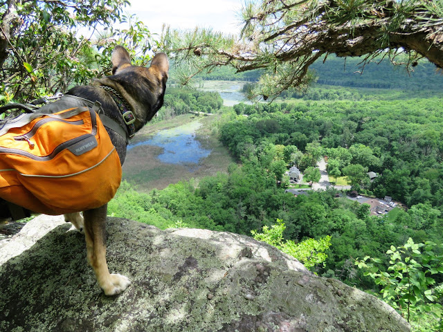
| View from White Pine Overlook. |
 |
| Heading back on Bigelow Road. |


