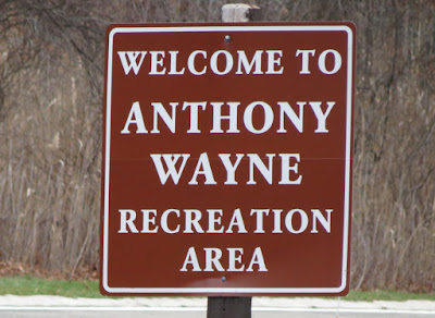
ABOUT THE PARK:
Harriman State Park - The Palisades Parks Conservancy
Harriman State Park - New York State Parks
DIRECTIONS:
GPS Coordinates to Anthony Wayne Recreation Area: 41.297745, -74.027070
 |
| Huge lot at Anthony Wayne Recreation area. Park near the kiosk where most of the cars are on the left. |
TRAIL MAP:
Harriman Bear Mountain Trails Map 119 - New York New Jersey Trail Conference
HIKE DISTANCE: 4.5 miles
THE HIKE:
 |
| Head towards the paved path on the other side of the entrance road and turn left. |
 |
| At the intersection turn right on the white-blazed Anthony Wayne Trail/bike path. |
 |
| At the next intersection, turn left briefly then right on the Fawn Trail. |
 |
| Fawn Trail |
 |
| Rising above the Anthony Wayne Trail below. |
 |
| Bear Mountain up ahead. |
 |
| Lots of nice winter views up here, even on a dark and dreary day (that was supposed to be sunny). |
 |
| Perkins Tower on Bear Mountain |
 |
| Descending on the blue Timp-Torne Trail. |
 |
| Some snow! We hiked in this area 4 days ago and there was no snow. Today, patches of snow everywhere. |
 |
| There are a lot of wet areas on the hike but plenty of rocks to step on to avoid getting wet. |
 |
| At the intersection with the start of the Anthony Wayne Trail, blue is a creek so you have to go around on the boulders to the left. |
 |
| Turn left on Seven Lakes Drive just after 1777 joins in. |
 |
| Crossing above the Palisades Interstate Parkway. |
 |
| Just after crossing the parkway, turn right on Queensboro Road. |
 |
| Queensboro Pond |
 |
| Queensboro Pond Dam |
 |
| Fortunately no shooting going on. The sound of gunfire always makes for a stressful hike :( |
 |
| I don't think I have ever seen so many markers and blazes on one post. Here is where we leave blue/1777 and follow red/1779. |
 |
| Historical signs. |
 |
| Two pileated woodpeckers were flying around and I managed to snag one of them. Plus... |
 |
| ... the first bald eagle I have ever seen at Harriman. |
 |
| And off he goes. |
 |
| At the other side of Queensboro Pond. |
 |
| Stay on red to the right when 1779 leaves to the left. We'll be coming back to 1779 after Turkey Hill Pond since we haven't hiked this part yet. |
 |
| A bridge down below on 1779. |
 |
| Coming up on Turkey Hill Pond. |
 |
| Turkey Hill Pond |
 |
| We backtracked on red and at the intersection with the woods road that crosses the creek, instead of going left back to 1779, we turned right on the unmarked woods road. |
 |
| After a short distance 1779 comes in from the left. This saved redoing a pretty rugged section that was a little hard for Shawnee. |
 |
| Bear Mountain on the left and Queensboro Pond down below. |
 |
| An elusive downy woodpecker. |
 |
| He would hide behind the branch (and laugh) every time I snapped a picture. |
 |
| 1779 goes through a maintenance area. After this post, no markers are visible but keep right towards ... |
 |
| ... the old stone park building where there is a marker then continue walking out the drive. |
 |
| 1779 leaves the drive to the left and descends to Route 6. |
 |
| Keep left on Route 6 then keep right on to Seven Lakes Drive (no markers or blazes along the circle). |
 |
| At the Seven Lakes Drive sign, two markers indicate where 1779 leaves to the left. |
 |
| At the cairn turn left on the white Anthony Wayne Trail that crosses over. |
 |
| Turn left on the Anthony Wayne entrance drive. That is the parking lot straight ahead. |
 |
| Zooming in to our car. |
 |
| Crossing over the Palisades Interstate Parkway. |
 |
| Back at the parking lot. |
 |
| Couldn't get this helium balloon for my collection because it was too high up in a tree. |
 |
| Her second hike this week so I kept it a little shorter. |


