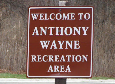
ABOUT THE PARK:
Harriman State Park - The Palisades Parks Conservancy
Harriman State Park - New York State Parks
DIRECTIONS:
GPS Coordinates to Anthony Wayne Recreation Area: 41.297745, -74.027070
 |
| Huge lot at Anthony Wayne Recreation area. Park near the kiosk where most of the cars are on the left. |
TRAIL MAP:
Harriman Bear Mountain Trails Map 119 - New York New Jersey Trail Conference
HIKE DISTANCE: 4.5 miles
THE HIKE:
 |
| Head towards the paved path on the other side of the entrance road and turn left. |
 |
| At the intersection turn right on the white-blazed Anthony Wayne Trail/bike path. |
 |
| At the next intersection, turn left briefly then right on the Fawn Trail. |
 |
| Fawn Trail |
 |
| Rising above the Anthony Wayne Trail below. |
 |
| Bear Mountain up ahead. |
 |
| Lots of nice winter views up here, even on a dark and dreary day (that was supposed to be sunny). |
 |
| Perkins Tower on Bear Mountain |
 |
| Descending on the blue Timp-Torne Trail. |
 |
| Some snow! We hiked in this area 4 days ago and there was no snow. Today, patches of snow everywhere. |
 |
| There are a lot of wet areas on the hike but plenty of rocks to step on to avoid getting wet. |
 |
| At the intersection with the start of the Anthony Wayne Trail, blue is a creek so you have to go around on the boulders to the left. |
 |
| Turn left on Seven Lakes Drive just after 1777 joins in. |
 |
| Crossing above the Palisades Interstate Parkway. |
 |
| Just after crossing the parkway, turn right on Queensboro Road. |
 |
| Queensboro Pond |
 |
| Queensboro Pond Dam |
 |
| Fortunately no shooting going on. The sound of gunfire always makes for a stressful hike :( |
 |
| I don't think I have ever seen so many markers and blazes on one post. Here is where we leave blue/1777 and follow red/1779. |
 |
| Historical signs. |
 |
| Two pileated woodpeckers were flying around and I managed to snag one of them. Plus... |
 |
| ... the first bald eagle I have ever seen at Harriman. |
 |
| And off he goes. |
 |
| At the other side of Queensboro Pond. |
 |
| Stay on red to the right when 1779 leaves to the left. We'll be coming back to 1779 after Turkey Hill Pond since we haven't hiked this part yet. |
 |
| A bridge down below on 1779. |
 |
| Coming up on Turkey Hill Pond. |
 |
| Turkey Hill Pond |
 |
| We backtracked on red and at the intersection with the woods road that crosses the creek, instead of going left back to 1779, we turned right on the unmarked woods road. |
 |
| After a short distance 1779 comes in from the left. This saved redoing a pretty rugged section that was a little hard for Shawnee. |
 |
| Bear Mountain on the left and Queensboro Pond down below. |
 |
| An elusive downy woodpecker. |
 |
| He would hide behind the branch (and laugh) every time I snapped a picture. |
 |
| 1779 goes through a maintenance area. After this post, no markers are visible but keep right towards ... |
 |
| ... the old stone park building where there is a marker then continue walking out the drive. |
 |
| 1779 leaves the drive to the left and descends to Route 6. |
 |
| Keep left on Route 6 then keep right on to Seven Lakes Drive (no markers or blazes along the circle). |
 |
| At the Seven Lakes Drive sign, two markers indicate where 1779 leaves to the left. |
 |
| At the cairn turn left on the white Anthony Wayne Trail that crosses over. |
 |
| Turn left on the Anthony Wayne entrance drive. That is the parking lot straight ahead. |
 |
| Zooming in to our car. |
 |
| Crossing over the Palisades Interstate Parkway. |
 |
| Back at the parking lot. |
 |
| Couldn't get this helium balloon for my collection because it was too high up in a tree. |
 |
| Her second hike this week so I kept it a little shorter. |


Just stumbled onto your blog while searching for more info on Perrineville Lake in NJ (I just rode my horse there last week!) Love that you seem to be local-ish to me and post so many photos. Just dropping by to say HI and let you know I'm excited to see where your adventures take you. Beautiful dog, too!
ReplyDeleteThank you! If I had to actually write more words than pictures, the posts would never get done so pictures work for me! By the way, my dog LOVES horses. I have pictures of her smooching with a wild pony in southwest Virginia. She is terrified of cows, though :)
DeleteDaniela