

Wharton State Forest - New Jersey Department of Environmental Protection
NJ State Long Trail - Sierra Club New Jersey Chapter
DIRECTIONS:
GPS Coordinates 39.64487, -74.64699
 |
| Batsto Historic Site Parking Lot |
TRAIL MAP:
Wharton State Forest Trail Map - New Jersey Department of Environmental Protection
HIKE DISTANCE: 14.1 miles
THE HIKE:
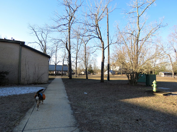 |
| Starting off through Batsto Village. |


 |
| It is a straight shot through the village to the hiking trails. |
 |
| The yellow trail was the destination but I wanted to capture the orange Tom's Pond Trail also since that trail was closed due to flooding when I last hiked this loop in 2010. I did not know what the blue marker with an S on it was for until I uploaded my track into Google Earth when I got home. Turns out that is the blue-blazed NJ State Long Trail. I had loaded tracks of the trail into Google Earth so I could see that is where I had been. This trail is not on the park map as it is pretty new. |
 |
| Continuing on orange/yellow/blue S. |

 |
| Just after this bridge we turned right on an unmarked trail as it looked like it would loop back around to orange/yellow/blue S but might be a bit more scenic. |


 |
| Back on orange/yellow/blue S. |
 |
| At this bridge is where the trails split apart. Yellow goes right over that bridge - that would be for later. |
 |
| To the left is blue - we'd come in the the other side of that after orange. |
 |
| For now straight on the orange Tom's Creek Trail. |


 |
| The trail forms a loop and after coming back over this bridge, orange retraces to the left but we veered right at the fork on un unmarked trail. |
 |
| That came out on a sand road where we turned left ... |
 |
| ... then left on blue. Blue continues straight on the sand road also but this would take us back to the intersection where we needed to pick up yellow. |

 |
| And here we are, now crossing the bridge on yellow where we would be for several miles. |


 |
| Mullica River Wilderness Camp. There are fire rings that I don't believe were there in 2010 because I had to call the park office about a camp fire that was left burning and it was not in a fire ring. |


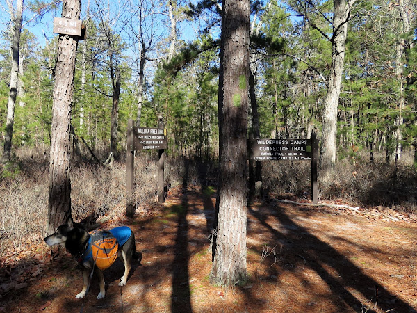 |
| Right on the green Wilderness Camps Connector Trail. |

 |
| Green will turn right with purple joining from the left... |

 |
| ... to the dreaded not-at-all-dog-friendly Quaker Bridge. At only 45 pounds I figured it would not be so hard to carry Brodie over. That was the case about half way over until he started slipping, my trekking poles balancing on top of him started slipping... I made it to the other side just in time before everything went down. Forty five pounds gets really heavy really fast. |
 |
| Right on the pink-blazed Batona Trail. |

 |
| This looks like a burn area with tons of baby pines coming up. |


 |
 |

 |
| The Batona Trail continues to the left; we veered right on the white trail. |
 |
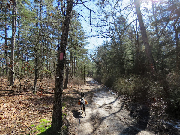
| The blue S NJ State Long Trail follows along this trail also. |

 |
| Note that these light blue blazes are a state forest trail, not the NJ State Long Trail, whish is probably why it is designated with the S where it overlaps state forest trails. |


 |
| Where I had not run into anyone the entire hike, this trail was starting to get busy wo we turned left on red. |


 |
| Then the green mountain bike trail ... |
 |
| ... back to the parking lot. |
Hey -- welcome back to South Jersey! Wow -- I don't know what's more interesting: The new "Long" Trail, or that they _finally_ replaced the bridge on the Yellow Trail!! (Still seems like just yesterday I was crossing the old one by sitting down on the very warped side and dragging myself across on my butt until the bridge was passable by walking over it normally -- LOL!) Wonder if they removed the blazes on the (now former) temporary relocated Yellow Trail. I liked that you paid a quick tribute to the Orange (Tom's Pond) Trail...always a pleasant hike/loop. Can't say I remember the boardwalk area before getting to the bridge...that must be new. (I think I know the section where that would be, as it could use a boardwalk.)
ReplyDeleteThe rest of the hike looked familiar; I liked that you also incorporated Wharton's own trails...love the bridge on the Red Trail. Also glad you and Brodie survived the Quaker Bridge...if I ever hike there with my dog (7-lb. Papillon), I'd definitely have to carry her over, because she will outright refuse to walk over that thing. LOL!
Anyway -- thank you for another excellent post in South Jersey...so much has happened since last year when I was there. Looking forward to your next adventure...happy hiking!
Jim
It's only been a year since those changes? Guess I went at the right time then. I had been meaning to do this hike for quite some time. I think Brodie might have tried walking across Quaker Bridge because he stepped out on it once before when we were hiking the Batona Trail but I was afraid it would do a number on his paws. No way could I have carried him the rest of the way!
DeleteWell, I checked again, and maybe it's been more than a year. I last went on 1/10/21, and one one of my pictures on Wharton's White Trail (one of the Batsto Lake Trails), I did notice the additional "S" blaze; I guess I didn't really try to research it. And I didn't go to the Mullica River Trails on this day, so perhaps the bridge was replaced two or three years ago. But I'm just glad they actually replaced it! Also checked out the NJ State Long trail via the link you provided, and wow! 383 miles...in little NJ?? Even though part of the Appalachian Trail passes through NJ, it looks like NJ has it's own Appalachian Trail now! I was planning to try to get out to the Assunpink Preserve later this year, and it looks like the trail by Assunpink Lake is also part of the Long Trail. (However, I may access the WMA via Perrineville Park (Monmouth County Park System), as there is a connector trail off the Rocky Brook Trail, blazed in white. After about a quarter mile, a big sign welcoming hikers into Assunpink WMA is present, and the white-blazed trail continues on. I'm thinking this will (hopefully) connect to the trail that runs by Assunpink Lake...getting excited already!
DeleteJim
I think that is one of the stretches I have been looking at, too. A lot of the Long Trail is road walking but it's nice to see where it goes on trails - makes for a lot more hiking options!
DeleteThis is one of my favorite winter hikes. Yes, I've carried my 50 lb dogs over Quaker Bridge as well.
ReplyDeleteIt's great to be able to hike there and look at green trees all day in the dead of winter. When I did this hike in 2010 fortunately my son was with me and he carried my 70-pound dead weight German shepherd over the bridge. She was not at all amused but obviously felt it was better than the alternative because there is no way her paws were touching that bridge.
Delete