ABOUT THE PARK:
Weiser State Forest - Pennsylvania DCNR
Roaring Creek Tract Brochure - Pennsylvania DCNR
 |
| I found this about half way down the advisory page on the main Weiser State Forest site after the fact. This closure affects part of this hike (more on what I did later as I did not know about this in advance in spite of all of the research I do in advance). |
 |
| Contact info to check on trail closures. |
DIRECTIONS:
GPS Coordinates 40.83624, -76.35503
 |
| Parking at Kline's Reservoir |
TRAIL MAPS:
Roaring Creek Tract Brochure - Pennsylvania DCNR
(Map on page 2 shows only a few of the trails that actually exist.)
Weiser State Forest Pubic Use Map - Pennsylvania DCNR
(The Roaring Creek Tract inset (snapshot below) shows many more trails than the brochure but still not all of them.)
Roaring Creek Region - Trailforks
(Shows most of the trails - the Trailforks app was used heavily to find my way around since the brochure map was not very useful.)
HIKE DISTANCE: 9.5 miles
THE HIKE:
 |
| First we headed across the parking lot to a view of Kline's Reservoir. |
 |
| We'd be crossing over on that road bridge in a few minutes. |
 |
| Walking back out the entrance drive ... |
 |
| ... then left on Route 42. It was not a long road walk, just over the bridge and to the end of the guardrail on the right. |
 |
| Kline's Reservoir from the bridge. |
 |
| Just past the guardrail on the right, right on the Headwaters Trail. |
 |
| All of the trails are blazed the same color indicating shared use (hiking/mountain biking/cross country ski) but horses are not allowed. |
 |
| Almost all intersections have posts with trail names. |
 |
| In the winter you can clearly see Little Mountain on the left and Big Mountain on the right. On this very cold and blustery day (30 degrees with feel like temps in the low 20's and 16 mph winds) it was not windy at all down here in the valley |
 |
| The Headwaters Trail is very wet in places but it was easy enough to get around without getting wet. |
 |
| We turned right on the Old Reservoir Trail. |
 |
| The Sphagnum Trail is not on any map. We stayed on the Old Reservoir Trail. |
 |
| Crossing Roaring Creek ... |
 |
| ... via a rock hop. |
 |
| Left on the Homestead Trail. Later we would be on the ridge of Big Mountain visible straight ahead. |
 |
| The Homestead Trail is a wide woods road. |
 |
| Entering the hemlocks, the trail temporarily becomes a footpath. |
 |
| There are logs and rocks for crossing this creek. We chose the rocks. |
 |
| The Old Field Trail is also not on any maps. Staying on the Homestead Trail. |
 |
| Shortly after the creek crossing the trail opens back up into a woods road. |
 |
| Some ruins on the left. |
 |
| More on the right. |
 |
| Then on the right an entire foundation. |
 |
| Continuing on the Homestead Trail. |
 |
| It was just as we were coming out of this area that we encountered a local man who said he hikes in this area all the time and rarely encounters anyone. Indeed, he was the only other person I ran into the entire hike. |
 |
| The Headwaters Trail we were on earlier loops around and joins in the the Homestead Trail. |
 |
| At this fork right is the way to go. Left leaves the state forest. How do I know this? Because I went left and realized it was the wrong way. The sign is actually confusing because here the trail is referred to as the Homestead Trail on the map and at the top on the ridge the sign post does say Homestead Trail. |
 |
| Now starting to ascend Big Mountain. |
 |
| Looking back at Little Mountain across the valley. |
 |
| At the top, left enters State Gameland 329, right is the Big Mountain Trail, straight is the Homestead Trail. |
 |
| We continued straight a bit on the Homestead Trail in search of ... |
 |
| ... the Pond Trail where we turned right. |
 |
| Pond Trail |
 |
| On the left, the first pond. You can see the wind whipping across the water surface. It was darned windy up here! |
 |
| We worked our way around the pond to a sheltered spot where we could sit for a break out of the wind. |
 |
| Continuing on, the second pond on the right, not accessible like the first pond. |
 |
| We turned left on the Dark Woods Trail leaving the Pond Trail. |
 |
| Crossing over the Big Mountain Trail. According to the local man I had encountered earlier, he highly recommended this trail so that might warrant a return trip at another time. |
 |
| I consulted the Trailforks app and it looked like we could loop around a different way than planned on the Watertank Trail. This got us off of woods roads and back on trails. |
 |
| Watertank Trail |
 |
| The Watertank Trail crosses Route 42 ... |
 |
| ... and continues on the other side slightly to the left heading towards ... |
 |
| ... the water tank. |
 |
| There are no posts with trail names in this area so I had to rely heavily on the Trailforks app. |
 |
| Back to where there are posts and the Pump House Trail where I wanted to be. |
 |
| The Pump House Trail follows a gravel road for a short distance then leave to the right into the woods. But what is this sign? |
 |
| Oh. No. Eight miles into the hike with 1.5 miles left to go and this was the ONLY way other than working my way over to Route 46 and road walking 1.25 miles back on a now VERY busy Route 46. What to do? |
 |
| First off, I do not recommend ignoring trail closure signs and I have always heeded them. But I made a judgment call to ignore it in this one instance. |
 |
| I have to say, this was the most scenic section of the Pump House Trail with really nice winter views and the reservoir visible below. |
 |
| The trail descends gently at first. |
 |
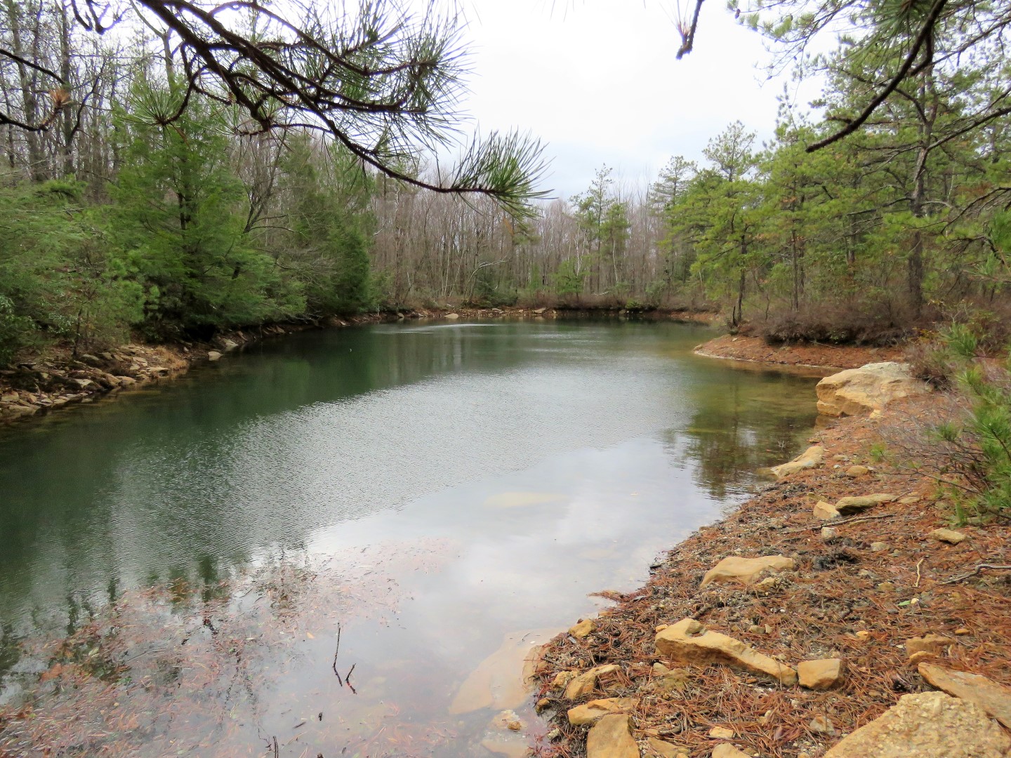
| Kline's Reservoir |
 |
| Some ruins on the left. |
 |
| After this hairpin turn the trail descends much more steeply. |
 |
| It was a huge risk ignoring that closure sign. I was worried I would get to the bottom to find a mammoth muddy trench that we could not get across and would have to climb all the way back up and road walk anyway. |
 |
| But fortunately that never happened. It was all clear with no evidence of construction other than blue marking flags and posts with blue and white ribbon ... |
 |
| ... and at the bottom a few these blue things ... |
 |
| ... that were easy enough to step over. |
 |
| And this comes out at the Roaring Creek Trail where we turned right. So, construction completed? Not yet started? Definitely call first and ask if you plan to do this hike. We might have just been very lucky. |
 |
| The Roaring Creek Trail which is the most popular trail and from what I understand can get quite busy. For us it was just a .5 mile walk back to the parking lot. |
 |
| Some side trails along the way to picnic tables at Kine's Reservoir. |
 |
| Back at the parking lot. |


No comments:
Post a Comment