... turn right and go up the hill a short distance to the spur trail on the left.
A short distance ahead, keep right on the Lake Hopatcong Trail.
Passing by the Civic Center Field on the right.
Coming up on the Middle School.
At the fence the trail turns right ...
... for a short distance through a rocky area ...
... then comes out in front of the Middle School where I could find no trail markers.
It's a left turn to the end of the block, then a right for a little bit of road walking.
Right at the stop sign where there will be a sidewalk on the left side.
Then left through the break in the fence.
The trail goes along the edge of Vetran's Field for a short distance ...
... then leaves to the left through a power cut.
Balloon #36
The woods road becomes flooded out by the swamp on the right but the trail has been diverted to the left on higher ground.
Meeting up with the Highlands Trail where we turned right. This is a reroute of the Highlands Trail which removed a long portion off of busy Route 605. We followed this to the right to meet up with where Shawnee and I had left off in 2012 where the old road walk part started.
Watch the rocks right before the swamp outlet crossing.
I went down like I had stepped on a sheet of ice busting up my thumb and pulling some muscles in my wrist. Fortnuately (again) nothing broken.
All of the rocks were slippery and now I was afraid to step on them so I went right up to the outlet where that white pipe is and cross there.
Safely on the other side.
Balloon #37
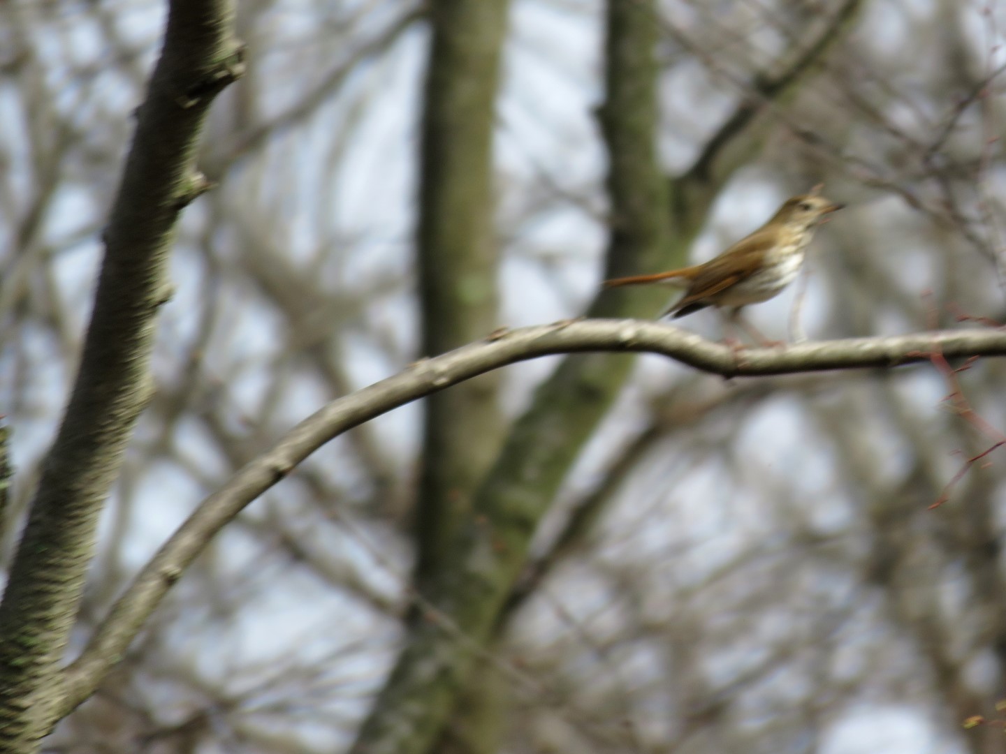
An out of focus wood thrush back from his migration in Central America. Now go and eat some of those annoying gnats that have come out of hibernation.
Finally some sunshine. It had poured all night and into the morning but the trails were amazingly dry.
A yellow triangle trail joins in from where the former Highlands Trail followed the road walk. This yellow trail comes from the Byram Trails to the left.
Now following up over Route 605. I could have turned back where yellow joined in since that was where Shawnee and I had left off but we went a little farther....
... and came across waterfalls that I did not remember seeing previously. Maybe they were dry at the time since it was late summer.
The trail crosses over at the top of the falls. We actually did it and went a bit farther but we had to cross more upstream since that water was deep and raging.
Now heading back.
Just for old time's sake, followed the old route of the Highlands Trail down to Route 605 where the road walk used to begin. Yellow still goes that way.
Back on the Highlands Trail reroute.
We took a break smack in the middle of the trail because there was nobody else out there. We had the entire hike all to ourselves.
Another wood thrush.
Crossing back over the swamp outlet we made it across the rocks which were drier and not as slippery now.
I wanted to hike the rest of the Highlands Trail reroute so when the Lake Hopatcong Trail turned left, we stayed right on the Highlands Trail/Lake Hopatcong Spur Trail.
Cowboy Creek to the right.
Balloon #38
The Lake Hopatcong Spur Trail turns left, we turned right on the Highlands Trail.
The Highlands Trail turns left on Route 605 for a very short road walk to around the bend where I had left off on this hike of the Byram Trails. This was our turn around point,
Back at where the spur trail left the Highlands Trail, I had a feeling this would lead back to where we needed to be
on the Lake Hopatcong Trail because I had seen a spur for Cowboy Creek
which is not shown on the map. But I had promised to let someone's dog out and didn't have time to
investigate to we continued to retrace.
Right where the Highlands Trail leaves to the left.
This is the Cowboy Creek spur that thought might connect to that other spur trail but without it being on the map, no way to know for sure.
Back at the Middle School where there are no markers, around the bend on the paved path to ...
... that path on the right where a short distance in the markers resume.
I was almost running the last couple of miles of this hike because I was behind schedule to let that dog out and it was hot (80 degrees) in full sun with no leaves on the trees yet and the last thing I wanted to do was go waaaaay off the trail up a steeeeeeep hill to retrieve two more balloons. Seriously, I need an intervention. Welcome balloons #39 and #40.
I was there yesterday as well. Although I mostly wander around off trail in the woods. The trail is almost always empty except during deer season when there are tons of hunters.
Slippery rocks are my nemesis having had two serious accidents & several other painful incidents. I hope your finger & wrist are feeling better today. BTW: I hear there is are Balloon Rehab Centers you might consider. But their withdrawal program is rather harsh. It involves clowns. That alone would be enough to scare the hot air out of me!
Ha ha ha! At least my balloon obsession is constructive. My wrist is much better today, thanks. The second I stepped on that rock I thought to myself, "Self, don't you think you should test that rock firs.... SPLAT!" Darn if hiking isn't hazardous!
Thank you for this great descriptive. Now I know to NOT attempt it with my mt. bike. (I had hoped the trail would improve or become more accessible since it's ribbon cutting.) And THANK YOU for picking up those nasty balloons. Love how your dog seemed to be your guide!
I don't know about mountain biking but the trail is definitely good for hiking! Yes, my dog *thinks* he knows where he is going and is always up front and center so that is why he is in all the pictures. He has also learned what "NOT THAT WAY" means, LOL.


I was there yesterday as well. Although I mostly wander around off trail in the woods. The trail is almost always empty except during deer season when there are tons of hunters.
ReplyDeleteOh, so we weren't completely alone, LOL.
DeleteSlippery rocks are my nemesis having had two serious accidents & several other painful incidents. I hope your finger & wrist are feeling better today. BTW: I hear there is are Balloon Rehab Centers you might consider. But their withdrawal program is rather harsh. It involves clowns. That alone would be enough to scare the hot air out of me!
ReplyDeleteLinda
Ha ha ha! At least my balloon obsession is constructive. My wrist is much better today, thanks. The second I stepped on that rock I thought to myself, "Self, don't you think you should test that rock firs.... SPLAT!" Darn if hiking isn't hazardous!
DeleteThank you for this great descriptive. Now I know to NOT attempt it with my mt. bike. (I had hoped the trail would improve or become more accessible since it's ribbon cutting.) And THANK YOU for picking up those nasty balloons. Love how your dog seemed to be your guide!
ReplyDeleteI don't know about mountain biking but the trail is definitely good for hiking! Yes, my dog *thinks* he knows where he is going and is always up front and center so that is why he is in all the pictures. He has also learned what "NOT THAT WAY" means, LOL.
DeleteThe tails on these birds seem reddish to me, so perhaps these were Hermit Thrushes?
ReplyDeleteCould be. They are very similar.
Delete