ABOUT THE PARK:
Highlands Trail - NYNJ Trail Conference (scroll down to the second description paragraph that begins with "Turn left onto Stonetown Road..."
Norvin Green State Forest - NJ DEP
DIRECTIONS:
GPS Coordinates 41.071488, -74.306835
 |
| Parking pullout on West Brook Road - not the one indicated on the map (more on that later) but this spot worked. I had planned on parking at the New Weis Center but there were signs plastered everywhere that parking is not allowed until after 9 AM and it was 7AM. |
TRAIL MAPS:
North Jersey Trails Map #115 - NY/NJ Trail Conference
HIKE DISTANCE: 7.1 miles
THE HIKE:
 |
| From the pullout parking we walked on the grassy side of the guardrail to the downed trees a short distance ahead. |
 |
| Just the other side of those downed trees, a teal Highlands Trail blaze. |
 |
| Over those trees and right on the Highlands Trail. |
 |
| This section runs parallel to West Brook Road until .... |
 |
| ,,, this construction area which is where the parking on the map appears to be but it did not look right to me which is why I parked at the other pullout. There is a gate that might be blocked when parking here. Not to mention a ton of trash. |
 |
| Just a short walk on West Brook Road then left on Townsend Road. |
 |
| Townsend Road |
 |
| Gargoyles guarding a drive on the right. |
 |
| Soon after the Highlands Trail leaves Townsend Road to the right. |
 |
| Passing the orange trail which would be our return route. |
 |
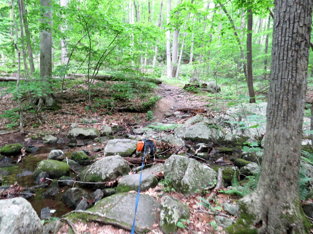
| The terrain alternates between rocky and smooth, uphill/downhill/flat. |
 |
| Blueberries with some time left until ripe. |
 |
| This poor little guy, minding his own business, tried to hop off the trail as we approached and Brodie grabbed him in his mouth. He promptly dropped the toad (who hopped on off the trail and seemed to be unharmed) then proceeded to spit, shake his head and foam at the mouth. Do you think that would stop him from doing it again? Of course not. There was a repeat performance a few hours later and that toad tasted just as bad. All toads secrete a substance through their skin that is foul tasting to other animals. Fortunately we don't have any toxic toads here so I wasn't worried. Brodie is fine. If he would just consider this a lesson learned. |
 |
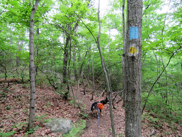
| Red and yellow join in just before a bridge. |
 |
| Bridge over Blue Mine Brook |
 |
| Ruins on the right. |
 |
| Yellow leaves to the right, we stayed left on teal/red. |
 |
| Starting the climb up to Wyanokie High Point. |
 |
| Some early views before reaching the top. |
 |
| New York City skyline in the distance on a drizzly, cloudy day. |
 |
| The views get better the closer we get to the top. |
 |
| Gorgeous mountain laurel in full bloom everywhere. |
 |
| Indigo Bunting |
 |
| Another Indigo Bunting singing back and forth with the one from before. |
 |
| Views from the top of Wyanokie High Point. |
 |
| Heading down the other side which is much shorter but steeper. |
 |
| The mountain laurel was really pink on this side. |
 |
| At the bottom, looking back at the way we came down, leaving the Highlands Trail and taking blue towards Weis. |
 |
| Leaving blue to left on white. |
 |
| At the end of white, right on green. |
 |
| Green starts out as a woods road ... |
 |
| ... but soon leaves to the left on a more rugged route. |
 |
| As soon as green rejoins the woods road, going right a short distance leads to old automotive ruins. |
 |
| Heading back the other way to continue on green. |
 |
| Brodie has not noticed the efts yet, probably because they move so slow they go right under his speedy fast critter radar. |
 |
| A rock hop over Blue Mine Brook at an old stone bridge abutment then ... |
 |
| ... leaving green on blue/yellow at the kiosk on the right. |
 |
| Staying left on yellow when blue continues straight ahead. |
 |
| Left on orange. |
 |
| A look at the water cascading down Blue Mind Brook before rock hopping over. |
 |
| Staying on orange when red starts to the right. |
 |
| Mine tailings just before ... |
 |
| ... Roomy Mine. This is the only picture I was able to get. There are arched opening up above but kids where climbing everywhere and were in the arched openings so it's wasn't an opportune time to photograph. Not to mention all of the questions and petting requests for Brodie which kept me busy. |
 |
| Continuing on orange to the top of the mine where things were more quiet. |
 |
| Yellow joins in on the way up. |
 |
| Another mine opening at the top. Brodie was curious but was not making a move to actually go in there. |
 |
| We needed to stay right on orange here but followed yellow left a short distance ... |
 |
| ... to the views at Ball Mountain. |
 |
| Heading back to orange. |
 |
| Orange ends at the teal Highlands Trail where we turned left. |
 |
| Left on Townsend Road. |
 |
| Right on West Brook Road past the construction/garbage area but instead of staying on the Highlands Trail for that short stretch parallel to West Brook Road ... |
 |
| ... we just continued on the the grass back to our car up ahead. |


I was just researching this hike, so your timing is perfect! Thank you for sharing :)
ReplyDeleteExcellent! Get there early because Wyanokie High Point gets crowded. I had it all to myself for a bit but then heard a loud group of people approaching so that is when I moved on. Also, it looked to me like there was a pullout for one car to park just beyond where you leave Townsend Road into the woods. I did not see any signs saying you could not park there so that might be worth checking out.
DeleteGorgeous pictures of the Mountain Laurels. Looked like a nice hike. Thanks for sharing! Joanne from NJ
ReplyDeleteThanks. I happened to hit it at just the right time for mountain laurel to be in full bloom.
DeleteI wonder if the first bird in your pictures could be a Chipping Sparrow?
ReplyDeleteThat's the only thing I could come up with. The picture was very dark so I had to lighten it considerably to make out anything but I remembered the bird being bigger than a chipping sparrow. But then maybe I just remembered wrong. Have also never seen one in the woods like that but nothing else has a black eyeline and it does look like he has rust on the top of his head so I suppose that is what it is.
DeleteEnjoyable as always!
ReplyDelete