ABOUT THE PARK:
Appalachian Trail Pennsylvania - The Appalachian Trail Conservancy
DIRECTIONS:
This is a point-to-point hike with a car spotted at either end.
We left one car at Smith Gap, GPS coordinates 40.82558, -75.41452
 |
| Room for 2-3 cars on Smith Gap Terrace just off of Smith Gap Road. |
We then shuttled to Lehigh Gap in the other car, GPS coordinates 40.78306, -75.60402
 |
| Large parking lot on the eastern side of Lehigh Gap. |
TRAIL MAP:
Appalachian Trail in Pennsylvania Sections 1-6 - Appalachian Trail Conservancy
HIKE DISTANCE: 12.2 miles
THE HIKE:
This was a point-to-point hike done with Lynn, Glen and their dog Trek from
Agile Trekker so we could spot a car at either end and hike through 12 miles without having to retrace. We all agreed this hike is best done south to north because of the grueling climb at the beginning. See Lynn's pictures and write-up
here.
 |
| The Appalachian Trail goes right through the parking lot. |
 |
| Turning right towards that ominous ascent up to the right. Straight is a blue-blazed bypass trail call the Winter Trail. There is no second chance to get to the bypass it until AFTER the worst part of the ascent so here is where you need to decide if you are feeling lucky. |
 |
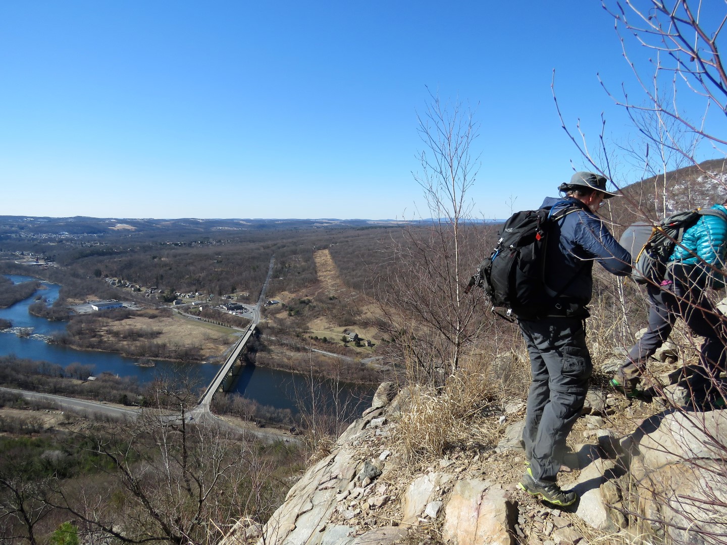
| A little bit of a view as we get higher. |
 |
| We had both researched this hike. How bad could it really be? |
 |
| Lehigh Gap |
 |
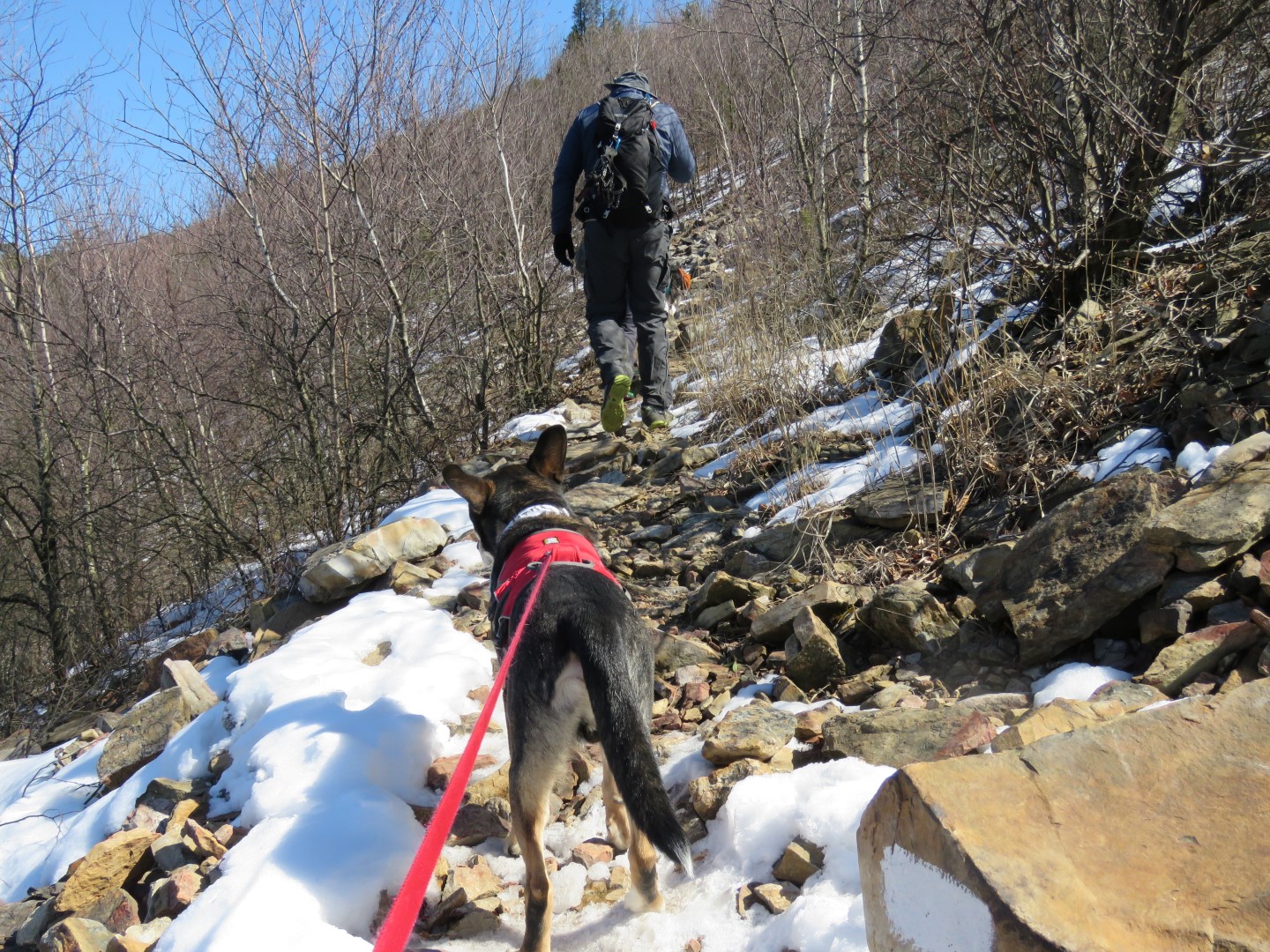
| Yes, it is actually as straight up as it looks in the picture. |
 |
| And yes, a lot of those rocks are wobbly. |
 |
| Brodie was no longer amused and wanted to go back. Trek was no longer amused either. But it was too late. We could not even imagine going back down. Dogs had to be lifted by their harnesses, passed on and hoisted up. |
 |
| Trek and Brodie (photo by Lynn) |
 |
| Me almost at the top. (photo by Lynn) |
 |
| We all survived and made it to the top. That was a very difficult section of trail. |
 |
| There had been no snow until almost at the top and it would just be a little snow here and there, right? We DID research that also and it appeared snow would be spotty on the northern slopes and in the shade. |
 |
| This is more along the lines of what we expected based on snow reports. |
 |
| The other end of blue-blazed Winter Trail, well beyond the most difficult section of the AT. |
 |
| Happy dogs safely at the top. (And they had serious doubts about making it.) |
 |
| Where did all of this snow come from? At least it is a nice, smooth woods road. |
 |
| Seems like there is way more uphill than downhill on this hike. |
 |
| Leaving the woods road on a foot path. |
 |
| Coming up on a power cut and the snow continued on for most of the rest of the hike which made going even more difficult. |
 |
| Little Gap ... |
 |
| ... where you can clean the mud (or snow?) off of your shoes. |
 |
| Crossing Little Gap Road about 5 miles into the hike. |
 |
| There is another steep climb up ahead, but it was nothing like the beginning of the hike. |
 |
| Glen and I used microspikes for this part. It was pretty slippery. Lynn made it without. |
 |
| A view from the top. |
 |
| Back up on the ridge and no more steep climbing for the rest of the hike. |
 |
| A rare and all too short, blissfully snow-and-rock -free section of trail. |
 |
| Ski lifts of the Blue Mountain Ski Area off to the left. |
 |
| Passing the Delps Trail with ... |
 |
| ... almost 10 miles down and 2.5 more to go. |
 |
| After a very rocky section of trail (which is what I had read the last 2.5 miles would be)... |
 |
| ... the rocks ended after just a short distance and then the trail became the easiest it had been for the last couple of miles. |
 |
| We all made it back to the car just as the sun was setting. |
 |
| Brodie snuggling up with Lynn on the ride to take them back to their car. |
It was so nice meeting Lynn, Glen and their awesome trail dog, Trek.


Thanks for hiking with us!
ReplyDeleteIt was my pleasure and thanks again for helping Brodie up the Wall of Death!
Delete