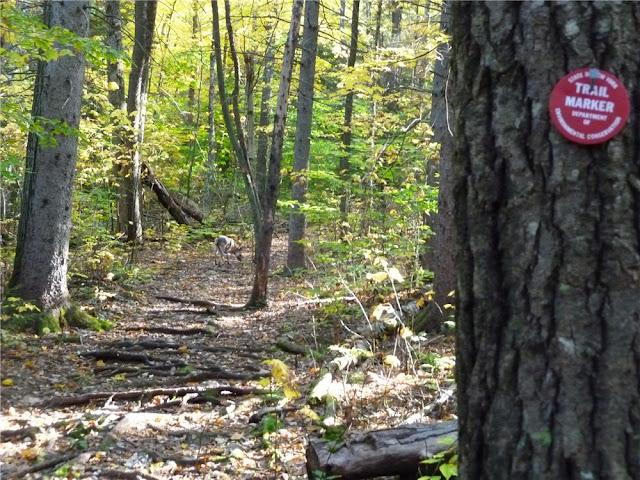
Catskill Forest Preserve - New York State Department of Environmental Conservation
DIRECTIONS:
GPS Coordinates 42.288765, -74.114545
View Larger Map
 |
| Parking lot almost at the end of Big Hollow Road. |
TRAIL MAP:
Northeastern Catskill Trails Map #141 - NY/NJ Trail Conference
HIKE DISTANCES:
Windham High Peak - Burnt Knob - Acra Point Lollipop: 10.5 miles
Shorter versions with NY/NJ Trail Conference links:
Windham High Peak via Burnt Knob Out and Back: 7.3 miles
Acra Point Loop: 5.2 miles
PEAK BAGGING:
Windham High Peak - Peakery.com
Burnt Knob - Peakery.com
Acra Point - Peakery.com
THE HIKE:
When driving in, make note of a trailhead on the left shortly before the parking lot. This is where the hike starts.
 |
| Immediately cross a brand new bridge (replacing one destroyed by Hurricane Irene) and sign the trail register at the other side of the bridge. |
 |
| Foot bridge crosses over Batavia Kill. |
 |
| Red-blazed Black Dome Range Trail |
 |
| Blue-blazed Escarpment Trail |
 |
| While ascending the blue-blazed Escarpment Trail, turn around to see Acra Point. |
 |
| Fall foliage on the Escarpment Trail. |
 |
| The Blackhead Range from Burnt Knob side trail overlook. |
 |
| Windham High Peak from Burnt Knob Overlook |
 |
| The Hudson Valley from Burnt Knob Overlook |
 |
| Panorama of Burnt Knob Overlook |
 |
| View of the Black Dome Valley from the other side of Burnt Knob heading towards Windham High Peak. |
 |
| 3500 ft elevation sign just before the summit of Windham High Peak. |
 |
| Hudson Valley view from Windham High Peak |
 |
| Fall Foliage in the Hudson Valley from Windham High Peak |
 |
| Historical graffiti on Windham High Peak. |
 |
| Continue on briefly to the other side of the WIndham High Peak summit for a view of the Blackhead Range before heading back. |
 |
| Heading back towards Acra Point. |
 |
| Returning to the trail junction, turn right to return to car, straight for Acra Point loop. |
 |
| Burnt Knob (left) and Windham High Peak (right behind tree) from Escarpment Trail ascending Acra Point |
 |
| Hudson Valley view from Acra Point |
 |
| Continuing on from Acra Point, the trail goes through a very attractive fairytale-like spruce forest. |
 |
| At the next trail junction, turn right on the yellow-blazed Batavia Kill Trail. |
 |
| Batavia Kill Shelter |
 |
| The trail follows along the Batavia Kill. |
 |
| A footbridge that barely survived Hurricane Irene. |
 |
| Another brand new bridge on the red-blazed Black Dome Range Trail just before the parking lot. |
HIKE SUMMARY:
[ 0.00] Walk back the way you drove in briefly, then turn right on the red-blazed trail; cross footbridge and sign trail register
[ 1.00] Left on blue-blazed Escarpment Trail towards Burnt Knob
*** turn right on blue trail for 5.2 mile Acra Point Loop ***
[ 1.40] Side trail on left to overlook of Blackhead Range
[ 1.85] Side trail on right to overlook of Hudson Valley
[ 2.20] Side trail on left to overlook; a little farther along another overlook on left
[ 3.40] 3500 feet elevation sign
[ 3.45] Windham High Peak view to the right of Hudson Valley
[ 3.55] Windham High Peak view to the left of Blackhead Range; retrace
[ 6.30] At intersection keep straight on blue when red goes right
*** turn right on red back to parking lot for 7.3 mile hike ***
[ 6.65] Side trail to right to view of Burnt Knob and Windham High Peak
[ 7.00] Acra High Point view to left at rock outcrop as trail turns sharply right
[ 8.95] Turn right on yellow when blue goes straight
[ 9.15] Batavia Kill shelter on right
[ 9.85] Cross Batavia Kill, yellow trail ends, turn right on red trail towards Big Hollow Road
[ 9.95] Cross damaged bridge (stable enough for crossing)
[10.35] Cross new bridge; sign out at trail register
[10.50] Back at parking lot


I'm impressed they have those bridges replaced already. Would take a miracle in Virginia state government to get a bridge redone that quickly. Looks like a great fall color year.
ReplyDeleteI agree, I was VERY impressed. I believe it is the NY State DEC that is responsible for the bridges. I would think that by hikers signing trail registers it shows how many people use the trails and how important they are so repairs get prompt attention. These bridges were very nicely built, very stable and sturdy. Thanks and nice job NY State DEC!
ReplyDeleteGreat pictures. My sense is that DEC, NYNJTC etc are working to repair the most heavily traveled trails first. For example Diamond Notch trail bridge was washed away and still not repaired. Suprisingly the Diamond Falls bridge is still out.
ReplyDeleteThis is a beautiful area. The pictures you displayed depicts the location in the very light that I view it. Incredible.
ReplyDeleteWas wondering if there was a trail to the site of the Kaaterskill Hotel? We have an idea where the hotel was, just wondered if there was a way to get there. Thanks
ReplyDeleteI did this hike today. Thanks very much! BTW, the broken footbridge has been replaced.
ReplyDeleteOutstanding! And thanks for the info on the bridge. I am sure it wasn't priority at the time I hiked there since it was usable and other bridges had been completely demolished by Irene. Nice that DEC got to the point of fixing the more minor damage. I am sure they were busy with Irene repairs for a long time.
DeleteDaniela
How is this trail with dogs?
ReplyDeleteDo you mean are they allowed? Yes
DeleteIf you are referring to the difficulty, my shepherd did fine on the trails. There was nothing she was not able to navigate on her own.
Daniela
Sharp Shepherd!
ReplyDelete