ABOUT THE PARK: Slide Mountain Wilderness - New York State DEC
TRAIL MAP: NY/NJ Trail Conference Southern Catskills Trails Map 143
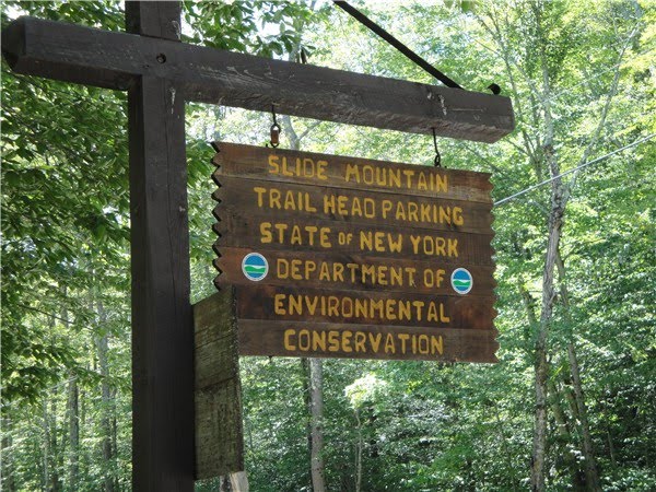
DIRECTIONS: NY State Thruway I-87 to exit 19 (Kingston). West on Route 28 for about 30 miles, left on County Road 47. At the hairpin turn make note of the parking area for Giant Ledge on the right if you want to hike that afterwards. About 2 miles beyond the hairpin turn, the Slide Mountain Parking area is on the left. Porta potties are in both lots. The drive was about 2 1/2 hours from Central New Jersey.
HIKE DISTANCES:
Slide Mountain (highest peak in the Catskills at 4,180 feet): 6.8 miles
Giant Ledge: 3.2 miles
HIKE DIRECTIONS: For the Slide Mountain hike, followed the NY/NJ Trail Conference directions which I highly recommend. It is longer than the direct route but much more interesting and pretty. The direct route, which the rest of the world takes (so you will run into more people), is pretty boring. It's OK for the return trip but going out, I would go as follows:
Start on the yellow trail from the parking lot:


At .7 miles at the intersection which says to take the red trail to Slide Mountain, keep straight on the yellow trail. (You will be coming back on the red trail - that is the more heavily traveled, more boring trail.)

At the next intersection at 1.5 miles, turn left on the blue trail: (This is the reverse side of the sign, not what you see in the direction you would be heading.)

At the beginning of the trail you will see a monument to the left which commemorates Bill Curtis and Allen Ormsbee, hikers who died on Mount Washington, NH in an ice storm in 1900. The blue trail is named after them.

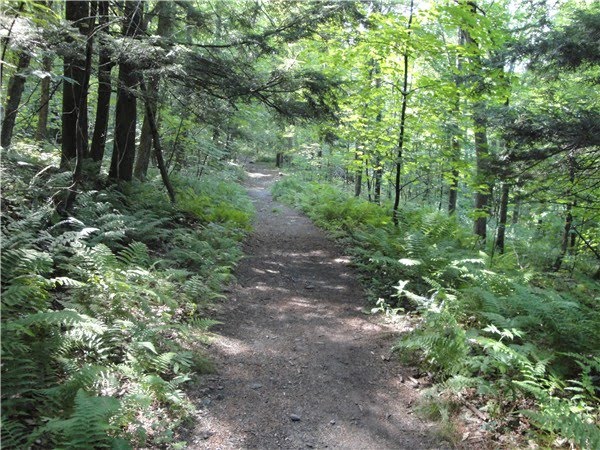
There will be some rock scrambles but nothing overly difficult.

And you will go through fragrant and cool spruce-fir forests.

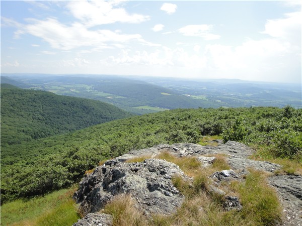
Just before the 3,500 foot elevation sign, there will be a scenic overlook to the left.


A little farther up the trail on the right are more views but they seem to be more obstructed by foliage in the summer:

Just after 3 miles there is a fork in the trail. Keep left; the right trail goes to a camping spot. Shortly thereafter at the intersection, turn right on the red trail. This intersection was not clearly marked like the others and I did not notice any red markers all the way to the summit although I did see some on the return trip going the other way.
At about 4 miles you will come to a scenic overlook on the left. I found this to be the best place for views along the entire route. Views at the summit at not that good.


A short distance ahead is an old fire tower footing which is supposed to be the summit although it looks like there are some higher areas around it.

A little farther ahead is a huge rock with views at the top. Follow the trail around to the right of the large rock to find the plaque in memory of John Burroughs.

Here is a picture of John Burroughs at that rock in 1900 compared to my picture in 2010:


I continued on out the red trail for a bit and caught a glimpse of Ashokan Reservoir through the trees:

After that point I turned around and headed back as the trail starts to decline very steeply and I was afraid my dog would not be able to get back up. So going back it's the red trail all the way to the yellow trail, right on the yellow trail back to the parking lot. We then hopped in the car and drove the two miles over to the Giant Ledge parking area. The trail starts on the other side of the road to the right of the porta potty.

You simply follow the signs up, yellow trail to left on blue trail. It's a long, steep, rocky climb up but very worth it for the views.

Once you get to the views at the top, the trail flattens out and you can go on about another 1/4 of a mile to various view points to the right before turning around and heading back.