Showing posts sorted by relevance for query Beech Trail. Sort by date Show all posts

Monday, January 3, 2011

Harriman State Park, NY - Lake Skannatati/Lake Askoti/Hansenclever Mine/Old Cemetery


ABOUT THE PARK:  Harriman State Park

DIRECTIONS:
GPS 41.242389,-74.102401

View Larger Map

TRAIL MAP:  NY/NJ Trail Conference Norther Harriman Bear Mountain Trails Map 119

HIKE DISTANCE:  6.2 miles

HIKE DESCRIPTION:
I had intended to follow the 8.4 mile Red Cross/Beech Trail and Long Path Loop from Lake Skannatati as described on the NY/NJ Trail Conference site but had to reroute to avoid following bear tracks in the snow, cutting off a little over 2 miles of the loop.

From the parking lot start steeply uphill on the inverted red triangle trail.
Near the top of the climb watch for the red cross trailhead and make note of where it is as you will be backtracking to that trail soon.  Continue straight ahead to a view of Lake Skannatati.
Backtrack a very short distance and turn left on the red cross trail.
Cross over Seven Lakes Drive then past Lake Askoti on the right.
Cross the inlet stream to Lake Askoti:
At 2.3 miles reach an intersection with the Hansenclever Road (woods road).  The water filled pit is what remains of the main opening of the Hansenclever Mine.
At this point to follow the NY/NJ Trail Conference directions you would turn left to continue on the red cross trail.  The only prints in the snow going in that direction, however, were these...
Seems all of the human footprints turned around and headed back at this point.  Not wanting to follow behind a bear I turned right on the unmarked Hansenclever Road instead.  This cut off a little over 2 miles of the loop.  At 3.05 miles I met up with the blue-blazed Beech Trail as it crossed over Hansenclever Road.  A right turn on the blue trail put me where I needed to be to continue following the NY/NJ Trail Conference directions.
At 3.45 miles arrive at an old cemetery with tombstones dated in the 1800's.
At 5.05 miles turn right on the aqua-blazed Long Path.
At 6.10 miles cross over Seven Lakes Drive and walk along Lake Skannatati back to the parking lot.


HIKE SUMMARY:
[  0.00]  Take inverted red triangle trail (to the right of the aqua Long Path) from parking lot
[  0.30]  Arrive at scenic overlook; backtrack short distance to red cross trail
[  0.35]  Left on red cross trail
[  0.85]  Cross over Seven Lakes Drive
[  1.60]  Cross power cut
[  2.05]  Cross over wooden foot bridge
[  2.10]  Left on red cross trail where unmarked trail comes in from the right
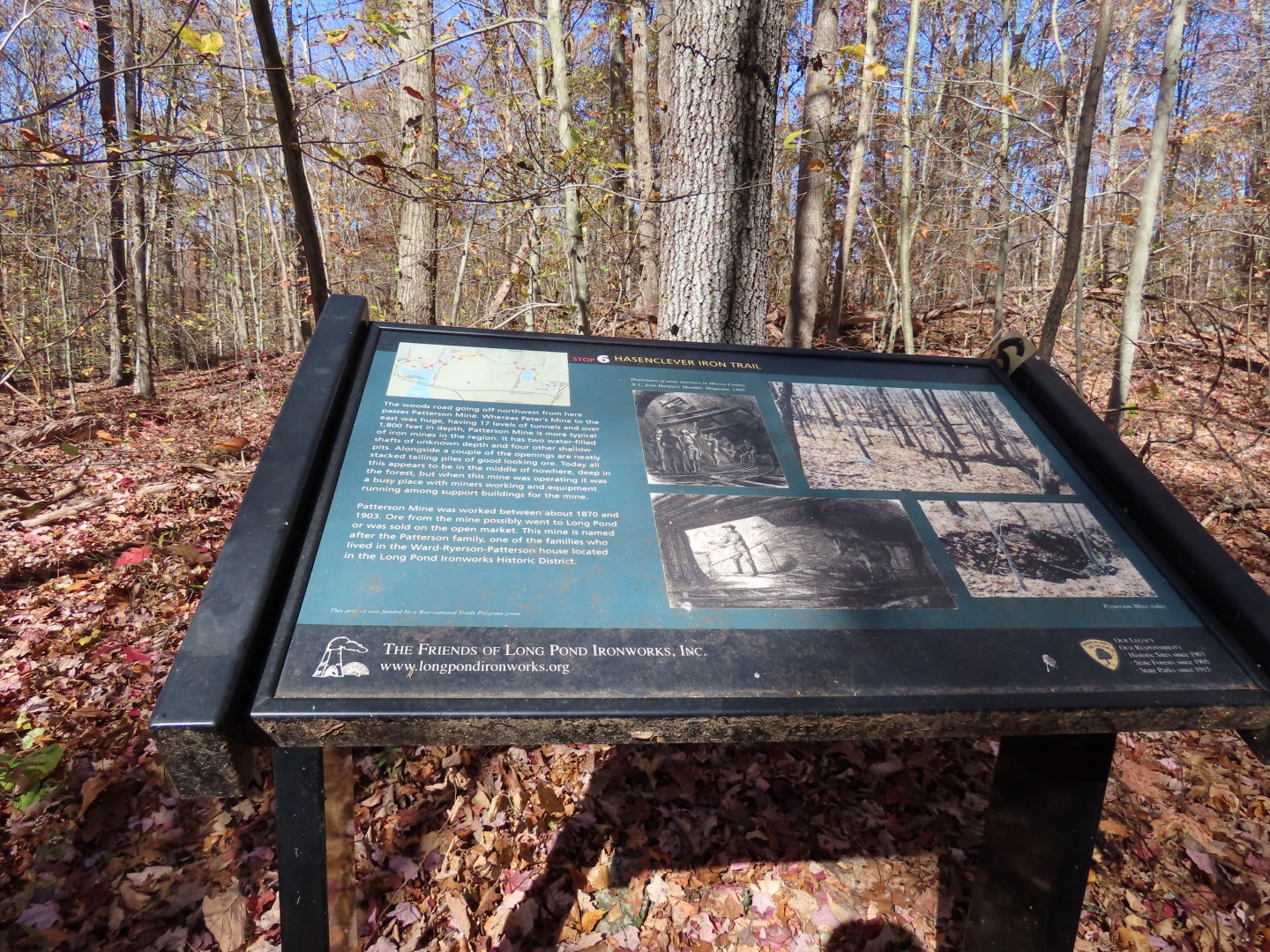
[  2.35]  Hansenclever mine; turn right on Hansenclever Road (woods road)
[  3.05]  Right on blue-blazed Beech Trail
[  3.45]  Old cemetary on right
[  4.40]  Blue trail leaves woods road on foot path to the left
[  4.50]  Cross over Route 106
[  5.05]  Blue trail terminates; turn right on aqua-blazed Long Path
[  5.65]  Right on Route 106 for 250 ft then continue on aqua-blazed Long Path to the left
[  5.90]  Cross power cut
[  6.10]  Cross over Seven Lakes Drive
[  6.20]  Arrive back at parking lot

Saturday, May 12, 2012

Fairy Stone State Park, VA - Little Mountain Loop


ABOUT THE PARK:
Fairy Stone State Park - Virginia Department of Conservation and Recreation

DIRECTIONS:
GPS Coordinates 36.797030, -80.112268

View Larger Map
Large parking lot on opposite side of road from trails.  Trails are walking distance from the cabins.

ACCOMMODATIONS:
Cabins at this park are pet-friendly.  I stayed in Cabin 12.  These cabins are older, built in the 1930's by the CCC.  Click here for more information on cabin rentals.
Out the back door of the cabin, Fairy Stone Lake was just a few steps away.
Fairy Stone Lake early in the morning.
Fairy Stone Lake at sunset.

TRAIL MAP:
Fairy Stone State Park Trail Guide - Virginia State Parks 

HIKE DISTANCE:
Hikes from base camp at Fairy Stone State Park: 

PEAK BAGGING:
Little Mountain - Peakery.com

THE HIKE:
To start hiking, cross the street from the parking lot, ascend the stone steps and keep straight on the white-blazed Beach Trail.
The blue-blazed Turkey Ridge Trail.
Fairy Stone Lake from the Lakeshore Trail.
The Lakeshore Trail continues across the dam between Fairy Stone Lake and Philpott Lake before it ends.
Spotted Sandpipers at the dam.
Fairy Stone Lake from the dam.
Mallards in Fairy Stone Lake.
Orange-blazed Little Mountain Falls Trail.
Little Mountain Falls
Blue Ridge Mountain view from the Little Mountain Falls Trail.
A harmless Eastern Milk Snake on the Little Mountain Falls Trail.

HIKE SUMMARY:
[0.00]    From parking lot cross road and go up 3 stone steps to trail head at the kiosk; continue straight on white-blazed Beach Trail
[0.10]    Left on yellow-blazed Lakeshore Trail
[0.25]    At intersection post turn right, go few steps turn right at next post, turn right at next post on blue-blazed Turkey Ridge Trail when the yellow-blazed Lakeshore Trail goes left
[0.50]    Keep left on blue-blazed Turkey Ridge Trail when orange-blazed Little Mountain Falls Trail goes right
[0.55]    Keep left on blue-blazed Turkey Ridge Trail when blue-blazed Turkey Ridge also goes right
[0.80]    Keep right as yellow-blazed Lakeshore Trail joins in from left; left on yellow Lakeshore Trail when blue Turkey Ridge leaves to the right
[1.10]    Bench with lake view on left, few steps later keep straight when blue-blazed Turkey Ridge Trail comes in from the right (now blazed both blue and yellow)
[1.30]    Keep straight on yellow-blazed Lakeshore Trail when Turkey Ridge Trail leaves to the right
[1.50]    End of dam with lake views; retrace
[1.70]    Turn left on blue-blazed Turkey Ridge Trail when yellow-blazed Lakeshore Trail goes straight
[2.50]    Make sharp left turn at intersection on blue Turkey Ridge Trail when Turkey Ridge Trail also goes straight
[2.55]    Make sharp left turn on orange-blazed Little Mountain Falls Trail when blue Turkey Ridge Trail goes right
[2.65]    Turn left on orange-blazed Little Mountain Falls Trail when orange goes right also
[3.15]    Keep left on orange trail with staff access trail comes in from right
[3.50]    Short side trail on left to waterfalls; retrace and continue right on orange trail
[4.15]    Blue Mountain Vista at bench
[4.50]    Turn right on orange trail when paved Mountain View Trail passes on left
[5.40]    Keep straight on orange at a clearing where staff access is to the right and Mountain View Trail is to the left
[5.65]    Turn right at sign post towards trailhead still on orange
[5.75]    Make sharp left turn on orange when orange also goes right (completion of Little Mountain Falls Trail loop)
[5.80]    Keep straight on blue-blazed Turkey Ridge when blue-blazed Turkey Ridge goes right also
[6.05]    Turn left on yellow-blazed Lakeshore Trail towards trailhead; few steps later left on yellow Lakeshore Trail
[6.15]    Turn right on white-blazed Beech Trail when left goes to campground
[6.25]    Cross paved road back to parking lot

Saturday, January 6, 2024

Harriman State Park, NY - Long Path Loop from St. John's

ABOUT THE PARK:
Harriman State Park - New York State Parks

DIRECTIONS:
GPS Coordinates 41.22523, -74.09120
Hiker parking off of St. John's Road.

TRAIL MAP:
Southern Harriman Bear Mountain Trails Map #118 - New York New Jersey Trail Conference


HIKE DISTANCE:  7.9 miles

THE HIKE: 
There was a random section of Long Path through Harriman State Park that I had not hiked yet which was easily accessed by the hiker parking lot off of St. John's Road.  
Walking out of the hiker parking lot to St. John's Road where we turned right.
Looking back at the parking lot entrance road.
St. John's Road
Passing St. John's In-the-Wilderness church on the right.
St. John's Road ends at Lake Welch Drive where it is closed to the right for the winter season.
On the left just before Lake Welch Drive, left on the Long Path.
Where the Long Path turned left, I continued on a short distance to turn right on Cranberry Mountain Trail which is a paved road, currently closed to traffic.
Right on Old Turnpike ...
... to the end at Lake Welch Drive.
Gated Old Turnpike at Lake Welch Drive.
Road walking back to St. John's Road on Lake Welch Road.  This part is open to traffic but there isn't much since it is gated for the winter up ahead.
St. John's Road on the right that says "road closed" but is accessible to the parking lot.  I think it means closed to through traffic but it doesn't stop those using it to cut over to route 106.
Across from St. John's Road on the left, picking up the Long Path again.
Cellar ruins.
An old growth tree on what looks to be an old homestead.
At the blue Beech Trail I completed my missing section of Long Path and continued left on the Long Path.
The Long Path turns right briefly on Route 106 where there was a fair amount of traffic going well in excess of the 30 mph speed limit.
The Long Path continues to Lake Askoti.
At Lake Askoti where the Long Path turns left, we turned right.
Lake Askoti
This turns into a gravel path in a power cut.
Leaving the power cut to the right on an unmarked trail.
This trail was mostly clear and easy to follow ...
... with a few overgrown sections ...
... and some blow downs.  No maintenance on this old trail but it is apparently still used since it exists.
Pileated Woodpecker
The trail ends at a woods road where we turned right.
At a cairn we turned right on a trail ...
... that still has old red markers from when it was the Rockhouse Mountain Trail.  Another currently unmaintained trail that is still being used.
Right on the blue Beech Trail.
The Beech Trail crosses over Route 106 but we turned left for a short road walk ...
... to Lake Welch Drive up ahead.  
To get up to Lake Welch Drive, cross over to the right ...
... and follow a path steeply uphill.
This part of Lake Welch Drive is closed to traffic from December to April ...
... so you can hopscotch right down the middle with no fear of traffic.
At the end of this guardrail, it's a left back to the parking lot but I wanted to see if I could find Barnes Mine on the right first.
There were so many herd paths through the field that I tried to follow but ended up on Pole Brook Mountain and had to bushwhack back down a bit.  
St. John's In-the-Wilderness Church from up above.
Balloon #1 of 2024
Barnes Mine
Just beyond Barnes Mine I saw red markers and followed those for a bit.
This would lead back to the Long Path where I had been earlier but I retraced because I had seen the old access road to Barnes Mine and wanted to follow that back to see where it came out in that field full of herd paths.  Note that the red markers only exist heading to the Long Path.  Heading back in the direction of the mine there are no markers so the trail would be hard to find in that direction.
Having just passed Barnes Mine on the left, on the old access road.
Coming out at that field ...
... where I grabbed balloon #2 of 2024.
Looking back from Lake Welch Drive, the access road to the mine is to the left around the back of that boulder.
Crossing over Lake Welch Drive to the trail back to the parking lot.
Back at the parking lot opposite from where we started the hike.