

ABOUT THE PARK:
Farny State Park - NY/NJ Trail Conference Description
Splitrock Reservoir - Wikipedia
From the Rockaway Township Web Site:
Splitrock Reservoir – The reservoir and surrounding land is owned by the City of Jersey City and the public may access the water body for fishing and kayaking only from the public access parking area located near the dam. Only Car top watercraft is permitted providing it is launched from the access located at the parking area. Gas powered motors are not permitted. Shoreline fishing is not permitted. Hiking is allowed only on the specific marked trails – other access will be considered trespass and violators will be subject to fine.TRAIL MAP:
NY/NJ Trail Conference Online Map (north, south and middle sections of the Four Birds Trail)
South and middle maps merged to fit this hike on one page:

DIRECTIONS:
I-287 to exit 43 to north on Fanny Road to Powerville Road, left on Valley Road, eight on Rockaway Valley Road, left on Split Rock Road which turns to gravel, parking lot on right at Reservoir.

The parking lot holds about 25 cars and I got the last spot at 7:15 am on a Saturday so get there early, mostly people there for fishing and kayaking. Do not park along the road. At the end of the hike every single car I passed that was parked along Split Rock Road had been ticketed and the area was being actively patrolled.

HIKE DISTANCE: 10.5 miles if you can manage to follow the trail - my hike ended up being 9 hours and 14 miles due to backtracking because of poorly marked trails.
HIKE DIRECTIONS:
From the parking lot, turn left and walk along Split Rock Road for about .3 miles. At the second power cut, start looking for the blue blaze on a tree to the left going into the woods. The trail is somewhat obstructed by weeds so you will probably miss it if you aren't looking for the blaze on the tree.

For the first couple of miles the blazing is pretty good. Then it gets spotty. You will find clearly marked blazes in two different shades of blue:


Faded out blazes which are very hard to see:


Blazes which have fallen to the ground or no blazes at all:

Another problem was a blaze indicating a turn but no discernible trail to turn on to. After the 4th time of backtracking, going in circles and not being able to find the continuation of the trail, in sheer frustration I cut through the woods towards the reservoir and continued north on Charlottsburg Road which is a dirt road closed to traffic, mostly running along the reservoir.

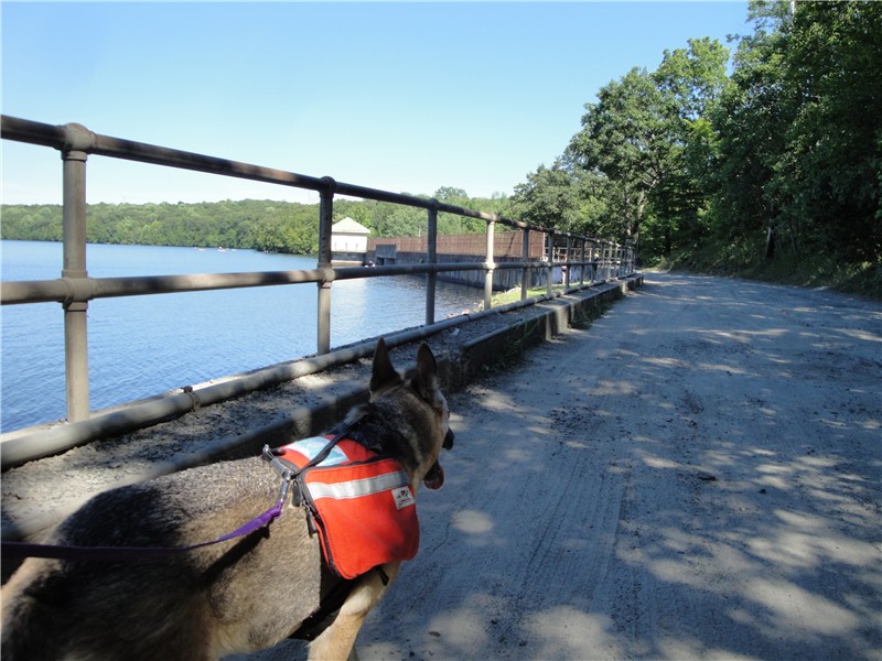
Along this stretch there were some nice views of the reservoir but you had to overlook the broken glass and empty beer cans all along the shore.


I tried to pick up the blue-blazed trail again when it met up with Charlottsburg Road where the McMansions start appearing to the right only to end up in somebody's back yard so I went back and stayed on Charlottsburg Road. There were some faint white blazes and although it was not the right place to run into the white-blazed Four Birds Trail, I followed them only to find the trail terminated at the reservoir.

Continued north along Charlottsburg Road where it becomes a dumping ground for tires, car seats, floor tiles and other assorted garbage until I started noticing orange diamond blazes to the left. I have not seen this trail on maps but really not wanting to hook back up with the blue-blazed trail, I followed to find this trail to be very well-blazed.

The orange-blazed trail terminates right at the white-blazed Four Birds Trail where you turn left.

The white-blazed trail is much better marked than the blue trail. There are a few questionable spots but not near as bad. Others I ran into who hike/run there frequently say they avoid the blue-blazed trail on the east side of the reservoir because it is so difficult to follow. This trail follows along the reservoir for 1 1/2 miles.

Follow the white-blazed trail until it goes downhill steeply to Split Rock Road.

Turn left on Split Rock Road.

Cross the bridge at the dam back to the parking lot on the left just beyond the dam.

To do this hike my recommendation would be to start on the blue-blazed trail but as soon as you start having problems, head on over towards the reservoir to Charlottsburg Road. Don't keep trying and get frustrated like I did - that takes all of the fun out of hiking.
I just stumbled across your blog. We are looking to go to Split Rock for something different, as we have hiked in many places nearer to us in southern Morris County.
ReplyDeleteThis is a real nice explanation. I have heard that the Four Birds Trail (is that the white blaze?) is also nice.
Again, thanks for the post!
I did this last weekend and found this post very helpful. Without this, I would very likely have used up most of my energy on the blue trail and not completed the loop. And I would certainly not have realized that I could take the very well marked orange trail to get to the Four Birds Trail.
ReplyDeleteOne comment -- towards the end of the loop, its possible to bypass the steep descents of the white trail by taking the bypass lumber roads. If tired at that point, just get off the trail and take the road away from the reservoir. You will join Splitrock road in a few minutes a short distance up the road from where you would emerge using the white trail.
The town barricaded the parking lot yesterday -
ReplyDeletehttp://www.dailyrecord.com/article/20100727/COMMUNITIES/100726106/Rockaway-Twp-barricades-Split-Rock-Reservoir-over-safety-concerns-litter
The parking lot has been reopend as of 8-2-2010 at 6:30pm to hikers, boaters, and fishermen. Swimmers, cliff jumpers, and illegal parkers are strictly prohibited.
ReplyDeleteI wanted to go hiking around the reservoir today starting from the gate on Charlottesburg Rd. but I could not find the white blazed trail. I did see new blue signs that were put up by the water company and I spoke to a local that i saw on the road. He indicated to me that the lands around the reservoir were closed to hiking due to the problems with the ATVs. I couldn't find anything online about the land being restricted and I saw no signs notifying the public that the trails had been closed. Has anyone heard of this.
ReplyDeleteI haven't heard anything but he might have been referring to Charlottsburg Road which runs along the east side of the reservoir. The white trail is on the west side of the reservoir and starts steeply uphill.
ReplyDeleteBoth the Four Birds Trail (white) and Split Rock Loop Trail (blue) have been clearly marked and are easy to follow.
ReplyDeleteI did hear that the trails have been reblazed since I hiked there and there is also a better map available now so definitely a hike worth revisiting!
ReplyDeletehttp://www.nynjtc.org/product/jersey-highlands-central-north-region-trail-map
Daniela
Did almost the exact same hike today. The blue blazes were great but the orange blazes were very faded and had to look around for them several times. The white trail was alright but they need a few more in a few spots. Had to backtrack twice and cut through the woods once, and that was with a good map and GPS.
ReplyDeleteI hiked those trails last year and except for the orange trail, the blazing was great. Farny was closed for a long time after Sandy so I would guess trail maintenance suffered, too. I bet a lot of trees with white blazes were lost and that is probably what threw you off. I know how frustrating that hike is when the blazes aren't good.
DeleteDaniela
Do you have to wade through water at any section on the reservoir loop if I hike up White blaze followed by blue?
DeleteNot that I recall but this was hiked almost 7 years ago and I have done hundreds of other hikes since then so don't go by my memory.
Deletethe first time I tried this hike I got so caught up exploring the unmarked trails around Double D on the east that I bailed out right before the blue disappears (coincidentally, Im sure, in the Smoke Rise dumping/partying/playground) and took just followed the shoreline back to the lot. The second time I went White first and had no problem whatsoever even getting to Indian Cliffs. This past fall I set out to do the blue first (mind you I have the NYNJTC maps) and everything was easy (from experience I knew the blue only matters when it turns east toward double d) until that same point, which is a blur of pink ties, blue, and nothingness ending when i desperately sought a mailman in that certain place where the people responsible for the abuse of that trail, which would be one of the best trails in new jersey, seemingly terrified for my life, pointed out that i was a mile north of misty pond! looking for the blue to just go straight down C-Burg to the lot, another blur of reds, whites, and blues ensued until, after deciding to give it one last try, I stumbled upon a boy scout troop campsite Camp Winnebago on the wrong side of the reservoir from where i wanted to be Just as it got dark. God bless that Raritan Troop, and their Saint of a leader. He called the manager of Winnebago, who, also a Saint, drove me to my car. He referenced the mess of trails at the north end, but more importantly: as part of some war between Smoke Rise (who utterly abuse and sabotage the blue so as to treat it like their playground, then hide back behind their city walls) vs. everybody else, he kicks Smoke Rise residents off of his property, the boundaries of which are marked with BLUE PAINT! those foot tall swaths of blue that you may convince yourself to follow actually DO lead you to the right spot if you come from the white, but you end up like me the other way around. Also of note: in Hiking the Jersey Highlands the author mentions the blue once went up to an excellent view of the reservoir i believe right where that very underwhelming house stands...a cheap house built fast steal a swath of land from the public overnight. that is how the blue can lead right into backyards.
ReplyDeleteTHAT SAID
with the current construction and the end to splitrock as we know it, and to put an end to this ridiculousness, yesterday I hiked about 13 miles from the Wildcat Ridge beaver pond lot on upper hibernia rd and fully completed the loop Blue first with a GPS receiver, waypointing EVERY single troublesome spot. I literally hugged the Blue right turn marker at the base of indian cliffs, for it had been so long since I'd last seen one of them. More importantly, i have the coordinates in UTM (NYNJTC trail maps format) as well as my entire trip (followed the reservoir all the way up the east side this time, but i do have the blue tracked from earlier) and if you or anyone would like to have the data i will happily oblige.
on a side note, while at the hawkwatch in WCR in november, where the hawk counters were stationed (we saw two Golden Eagles!) i brought up a positively mystical expeerience i had with an unidentified bird on the shore of Splitrock in april '13 that made them go silent. ...turns out a Northern Goshawk performed its "skydance" for me. the hawkwatch counts show, with the exception of 2004, ZERO recorded sightings. Yesterday (364 days later) i didnt see one but I heard that unforgettable call all day. I hope the people who know, as I now do, that they are nesting at Splitrock are just keeping it secret, because this must be taken into consideration concerning the coming development (it wont)
I know this was long, but Splitrock is a special place. Relative to new jersey, its the island from Lost.